What Is Drone Photogrammetry? A Complete Guide to Aerial 3D Mapping
What Is Drone Photogrammetry Complete Guide
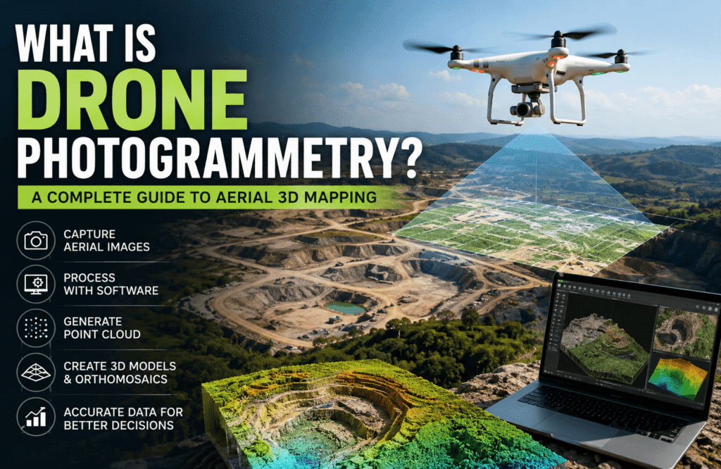
Drone photogrammetry is a way of using aerial photographs to create detailed spatial data. With the right equipment and software, a drone can capture overlapping images of an area and turn them into useful outputs such as orthomosaics, point clouds, elevation models, and 3D models.
It is quite different from simply taking aerial photos. Instead of producing images that are mainly used for viewing, photogrammetry turns those images into measurable digital information. This makes it useful for surveying, drone mapping, construction, engineering, archaeology, land assessment, and many other applications.
The quality of the final results depends on several things, including how the flight is planned, how much the images overlap, the camera being used, positioning accuracy, ground control, weather, and the way the data is processed.
In this guide, we’ll look at how drone photogrammetry works, what it can produce, where it is used, how accurate it can be, and when it may be the right choice for a project.
Quick Answer:
Drone photogrammetry is a mapping technique that uses overlapping photographs captured by a UAV-mounted camera. Specialized software processes those images to reconstruct spatial information and create outputs such as point clouds, orthomosaics, 3D models, and elevation data.
What Is Drone Photogrammetry?
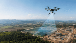
Drone photogrammetry brings together a drone, an imaging sensor, positioning technology, and photogrammetry software to create a digital representation of a physical area. This process is closely related to modern drone mapping methods, where aerial imagery is converted into useful spatial information.
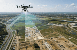
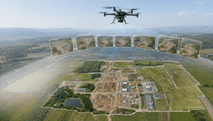
During a survey, the drone follows a planned flight path and takes a series of photographs with enough overlap between them. The software then looks for common features in different images. By comparing those features from multiple viewpoints, it can work out the position of the camera and reconstruct the shape of the surfaces shown in the photographs.
The basic process looks like this:
Drone → Aerial Images → Photogrammetry Processing → Point Cloud → 3D Model → GIS/CAD Data
Traditional aerial photography is mainly focused on capturing what an area looks like. Drone photogrammetry goes a step further by adding spatial information that can be used for measurements, mapping, and 3D reconstruction. If you’re comparing these two approaches, our guide on drone mapping vs drone photography provides a useful comparison.
For example, a construction company might use an orthomosaic to keep track of site conditions and a point cloud to examine the site’s three-dimensional surfaces. A survey team could use the same collection of images to create terrain information or other mapping products.
Why Is Drone Photogrammetry Useful?
One of the biggest advantages of drone photogrammetry is that a single well-planned aerial survey can produce several different types of spatial data.
It can be used for:
- Mapping large outdoor areas
- Documenting construction sites
- Creating topographic datasets
- Tracking construction progress
- Measuring stockpiles
- Supporting engineering projects
- Documenting archaeological sites
- Creating 3D visualizations
- Comparing changes in a site over time
To understand why all of this is possible, it helps to look at what happens between the initial drone flight and the final dataset.
How Does Drone Photogrammetry Work?
A professional drone photogrammetry project involves more than simply sending a drone into the air and taking pictures. The process usually includes planning, image capture, positioning, data processing, and quality checks.
Each part of the workflow can affect the quality of the final results.
1. Project Planning
Everything starts with understanding what the project actually needs.
Before the flight, the survey team normally determines the:
- Area that needs to be surveyed
- Required coverage
- Desired image resolution
- Accuracy requirements
- Coordinate system
- Final deliverables
- Site restrictions
The desired result plays an important role in planning the survey. A project that needs a highly detailed 3D model may require a different flight approach than one that only needs a basic orthomosaic.
2. Flight Planning
Once the project requirements are clear, the flight can be planned.
Some of the main factors include:
- Flight altitude
- Flight lines
- Image overlap
- Ground Sampling Distance
- Survey boundaries
- Terrain
- Obstacles
- Weather
- Applicable aviation requirements
Image overlap is particularly important. Photogrammetry software needs to see the same features in several photographs so it can compare them and reconstruct their position in three-dimensional space.
If there isn’t enough overlap, the software may struggle to match images correctly and parts of the final dataset may be incomplete.
3. Data Capture
After the flight is planned, the drone captures the required aerial photographs while following the designated route.
Most image-based photogrammetry projects use RGB cameras. These cameras capture details that can later be used to identify features such as buildings, roads, terrain, equipment, and other visible objects.
Consistent and clear imagery gives the processing software a better chance of finding matching points between photographs.
4. Positioning and Ground Control
Positioning information helps place the final dataset in the correct geographic location.
Depending on the project, the workflow may include:
- GNSS
- RTK
- PPK
- Ground Control Points
- Check points
The right method depends on the accuracy and georeferencing requirements of the project.
Ground Control Points, for example, are physical locations with known coordinates. They can help connect the aerial dataset to a known coordinate system and can also be used to check the accuracy of the finished data.
5. Data Processing
Once the images have been collected, they are processed using photogrammetry software.
A typical workflow may look like this:
Image Alignment → Feature Matching → Camera Position Estimation → Point-Cloud Generation → Surface Reconstruction → Final Data Products
The software examines the photographs and identifies common features between them. It then uses those relationships to reconstruct the surveyed environment.
Depending on the project, the processed data can become an orthomosaic, point cloud, digital elevation model, 3D mesh, or another type of spatial product.
6. Quality Control
The final step is making sure the processed data is actually suitable for its intended purpose.
A quality-control process may check:
- Image coverage
- Image alignment
- Positioning
- Ground control
- Point-cloud completeness
- Surface reconstruction
- Accuracy
- Final deliverables
This step is important because a model can look impressive visually while still not being accurate enough for a particular professional application.
What Technology Does Drone Photogrammetry Use?
Drone photogrammetry is not based on the drone alone. Several different technologies work together to produce the final dataset.
RGB Cameras
RGB cameras capture visible-light photographs, which form the foundation of most image-based photogrammetry projects.
Camera resolution, lens characteristics, exposure, and overall image quality can all influence the quality of the final reconstruction.
GNSS
GNSS provides geographic positioning information and helps determine where the drone was when each photograph was captured.
This positioning information can be used during the processing and georeferencing stages.
RTK and PPK
RTK and PPK are positioning methods that can improve the geographic control of drone imagery.
RTK applies positioning corrections while the survey is taking place. PPK, on the other hand, applies corrections during post-processing.
The choice between them depends on the project setup and the level of positioning accuracy required.
Ground Control Points
Ground Control Points, often called GCPs, are physical points on the ground with known coordinates.
Survey teams can use them to improve georeferencing and independently check the accuracy of the processed dataset.
Photogrammetry Software
Photogrammetry software takes the overlapping photographs and turns them into spatial data.
Depending on the software and project requirements, it can produce:
- Point clouds
- 3D meshes
- Orthomosaics
- Digital elevation products
- 3D models
GIS and CAD
GIS and CAD platforms are often used after the photogrammetry processing is complete.
GIS software can help with spatial analysis and mapping, while CAD platforms are commonly used in engineering, design, and planning workflows.
The drone data needs to be provided in a suitable format and coordinate system for these workflows to work properly.
How Does Photogrammetry Create a 3D Model?
Photogrammetry creates a 3D model by comparing the same features across multiple overlapping photographs.
Imagine taking three aerial photographs of a building. A roof corner, window, or another recognizable feature may appear in all three images, but from slightly different camera positions.
The software identifies that common feature and compares its location in each photograph. By combining this information with the position and angle of the camera, it can estimate where the feature exists in three-dimensional space.
The process can be simplified to:
Multiple Photographs → Feature Matching → Camera Positions → 3D Reconstruction → Point Cloud → 3D Model
This works because the same physical feature is visible from different viewpoints.
However, photogrammetry mainly reconstructs surfaces that the camera can actually see. Things such as dense vegetation, reflective materials, moving objects, poor lighting, and surfaces with very little texture can make the reconstruction more difficult.
What Can Drone Photogrammetry Produce?
A single drone photogrammetry survey can produce several different types of spatial data.
| Data Product | What It Represents | Common Uses |
|---|---|---|
| Orthomosaic | Geometrically corrected aerial imagery | Mapping and documentation |
| Point Cloud | Three-dimensional spatial points | Measurement and analysis |
| 3D Model | Three-dimensional representation | Visualization and planning |
| 3D Mesh | Connected surface geometry | Detailed modeling |
| DEM | Digital elevation representation | Terrain analysis |
| DSM | Digital surface representation | Site and infrastructure analysis |
| GIS Data | Spatial information | Mapping and analysis |
| CAD Data | Digital geometry | Engineering and design |
The right deliverable depends on what the project is trying to accomplish.
For example, a construction team may mainly need an orthomosaic and progress documentation, while an engineering team may need a point cloud or CAD-compatible data for further design work.
Where Is Drone Photogrammetry Used?
Drone photogrammetry is used across a wide range of industries. Its ability to cover large outdoor areas while creating reusable spatial data makes it particularly useful for projects where both aerial imagery and measurements are important.
Construction
Construction companies can use drone photogrammetry for:
- Site documentation
- Progress monitoring
- Existing-condition mapping
- Earthwork analysis
- Aerial visualization
- As-built documentation
Regular drone surveys can also be useful for tracking how a site changes throughout the different stages of construction.
By comparing datasets from different dates, project teams can get a clearer picture of what has changed and how work is progressing.
Land Surveying
Drone photogrammetry can support several surveying tasks, including:
- Topographic mapping
- Terrain modeling
- Orthomosaic production
- Point-cloud generation
- Elevation analysis
- Site documentation
It can complement traditional surveying methods when aerial coverage provides an efficient way to collect the required information.
Mining and Quarries
Mining and quarry operations can use drone photogrammetry for:
- Stockpile measurements
- Volume calculations
- Terrain mapping
- Site documentation
- Progress monitoring
Instead of relying entirely on workers to cover large or difficult areas on foot, aerial imagery can provide a repeatable record of the site.
Archaeology
Archaeologists can use photogrammetry to document excavation areas, ruins, monuments, visible structures, terrain, and heritage sites.
Aerial surveys can also be repeated over time, creating digital records that make it easier to compare changes to a site.
Engineering and Infrastructure
Engineers can use aerial 3D datasets to understand existing site conditions and support projects involving:
- Roads
- Industrial sites
- Infrastructure
- Utilities
- Large structures
- Design workflows
Having a detailed digital record of existing conditions can be useful during planning and design.
Environmental Mapping
Environmental projects can also benefit from aerial spatial data.
Photogrammetry can support terrain analysis, land assessment, site documentation, and monitoring of changes over time.
What Are the Benefits of Drone Photogrammetry?
When the workflow is properly planned, drone photogrammetry can provide several practical advantages.
Large-Area Coverage
A drone can collect aerial imagery over a relatively large area without requiring survey teams to physically walk through every part of the site.
This can be particularly useful when the area is difficult to access or covers a large amount of land.
Repeatable Data Collection
Drone flights can be repeated using similar mission plans. This makes it possible to collect comparable datasets at different points in time.
For projects such as construction monitoring, this repeatability can be especially valuable.
3D Visualization
Photogrammetry can turn ordinary aerial photographs into three-dimensional representations of visible surfaces.
These models can make it easier for professionals to understand the shape and spatial relationships of a site compared with looking at individual photographs.
Multiple Deliverables
Another major benefit is that one survey can produce several useful outputs.
The same collection of images may be used to create an orthomosaic, point cloud, 3D model, and elevation products, depending on the project requirements.
Difficult Terrain
Aerial data collection can provide perspectives that may be difficult, unsafe, or time-consuming to obtain from the ground.
Progress Documentation
Construction and infrastructure teams can repeat aerial surveys and compare site conditions from one project stage to another.
The benefits, however, depend heavily on proper planning, suitable equipment, positioning, processing, and quality control.
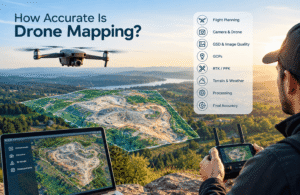
How Accurate Is Drone Photogrammetry?
There is no single accuracy figure that applies to every drone photogrammetry project.
The final accuracy depends on the entire survey workflow. Camera quality, Ground Sampling Distance, image overlap, GNSS positioning, RTK or PPK, Ground Control Points, terrain, weather, lighting, processing, and quality assurance can all make a difference.
What Factors Affect Photogrammetry Accuracy?
Camera quality: A good-quality camera can capture more detail, which can help with image matching and reconstruction.
Ground Sampling Distance: GSD affects the spatial resolution represented by the imagery. A lower GSD generally means more detail is captured per pixel.
Image overlap: Sufficient overlap gives the software more common information to work with when reconstructing the site.
RTK/PPK: These positioning methods can improve the geographic accuracy of the aerial imagery.
Ground Control Points: Known ground coordinates can provide additional spatial control and can be used to check the accuracy of the final dataset.
Terrain: Changes in elevation can influence flight planning and image geometry.
Lighting: Shadows and rapidly changing lighting conditions can affect image consistency and feature matching.
Weather: Wind, rain, fog, and other weather conditions can affect both the flight and image quality.
Processing: Software settings and processing methods can influence the final outputs.
Quality control: Accuracy checks help determine whether the finished dataset actually meets the project’s requirements.
Expert Note: The accuracy of drone photogrammetry should always be judged according to the specific project, survey conditions, positioning method, and required deliverables. There is no single accuracy number that applies to every drone survey.
What Are the Limitations of Drone Photogrammetry?
Although drone photogrammetry is useful for many applications, it does have limitations.
It works best when the camera has a clear view of the surfaces being mapped and can capture enough overlapping detail.
Dense Vegetation
Leaves and branches can block the camera’s view of the ground. As a result, it can be difficult to reconstruct the terrain beneath dense vegetation using standard image-based photogrammetry.
Poor Lighting
Low light, strong shadows, or constantly changing lighting can make photographs less consistent and may make image matching more difficult.
Reflective Surfaces
Materials such as glass, water, and polished metal can cause reflections that make it harder for photogrammetry software to identify matching features.
Moving Objects
Vehicles, people, moving vegetation, and other objects that change position between photographs can create inconsistencies in the dataset.
Low-Texture Surfaces
Large surfaces with very little visible detail give the software fewer features to match between images.
Weather
Rain, strong winds, fog, and poor visibility can affect both drone operations and image quality.
Airspace Restrictions
Drone flights must comply with the aviation rules and restrictions that apply to the area where the survey is being carried out.
These limitations do not mean that photogrammetry cannot be used. They simply highlight why proper planning is an important part of the process.
Drone Photogrammetry vs Traditional Surveying
Drone photogrammetry is not necessarily a replacement for traditional surveying. In many cases, the two methods work well together. For a more detailed comparison of aerial mapping and traditional surveying approaches, see our guide on drone mapping vs land surveying.
| Factor | Drone Photogrammetry | Traditional Surveying |
|---|---|---|
| Coverage | Broad aerial coverage | Targeted ground measurements |
| Perspective | Aerial | Ground-based |
| 3D Data | Generated from imagery | Depends on equipment and workflow |
| Repeat Surveys | Efficient for aerial capture | May require more field effort |
| Difficult Terrain | Can improve site access | May require physical access |
| Visual Documentation | Strong | Depends on equipment |
| Detailed Measurements | Possible after processing | Strong with appropriate instruments |
The best approach depends on the project’s required accuracy, site conditions, accessibility, deliverables, and overall scope.
For example, a drone survey can provide a broad view of an entire site, while ground-based instruments can be used where highly detailed measurements are needed.
For many professional projects, combining both approaches can provide a more complete dataset.
How Does Drone Photogrammetry Support GIS and CAD?
The value of drone photogrammetry goes beyond producing a visually detailed 3D model.
Once processed, drone data can be incorporated into professional GIS and CAD workflows.
The overall process can be thought of as:
Drone Data → Processing → GIS/CAD → Spatial Analysis → Measurement → Planning
GIS professionals can use drone-derived information to study spatial relationships, elevation, land features, and changes across a site.
Engineering teams can also use compatible point clouds, models, and other geometry in design and planning workflows.
However, the data needs to meet the requirements of the intended system. Coordinate systems, file formats, accuracy, and project specifications all need to be considered before the data is delivered.
How Can New Jersey Drones Support Photogrammetry Projects?
For projects that require professional aerial imagery, mapping, or 3D spatial documentation, New Jersey Drones can build a photogrammetry workflow around the specific needs of the site.
A typical project may include:
- Mission planning
- Aerial image capture
- GNSS positioning
- RTK or PPK workflows
- Ground control
- Photogrammetric processing
- Point-cloud generation
- 3D reconstruction
- GIS or CAD-ready deliverables
The important thing is to start with the project’s requirements and then choose the appropriate technology and workflow.
Instead of selecting equipment first and trying to fit the project around it, the better approach is to determine what the final data needs to accomplish and build the survey around those requirements.
When Should You Use Drone Photogrammetry?
Drone photogrammetry can be a good option when a project needs broad aerial coverage and spatial information about visible surfaces.
It may be worth considering when:
- The survey area is large.
- Aerial mapping is required.
- A 3D model would be useful.
- Repeat site documentation is needed.
- Access to parts of the terrain is difficult.
- An orthomosaic is required.
- Point-cloud data is useful.
- The project team needs a digital record of the site.
There are also situations where another method, or a combination of methods, may be more appropriate.
For example:
- Extremely detailed indoor scanning is required.
- Dense vegetation prevents reliable surface capture.
- Specialized ground measurements are needed.
- Drone operations are not possible at the site.
- Legal or professional requirements call for another survey method.
In many cases, drone photogrammetry works best as part of a larger geospatial workflow rather than as a standalone solution.
FAQs
What is Drone Photogrammetry?
Drone photogrammetry uses overlapping photographs captured by a UAV to reconstruct spatial information. Specialized software can turn those photographs into point clouds, orthomosaics, 3D models, and elevation products.
How does Drone Photogrammetry work?
A drone captures overlapping photographs across a planned survey area. Photogrammetry software then identifies common features between the images, estimates camera positions, and uses the information to create three-dimensional spatial data.
Can drones create 3D models?
Yes. When enough suitable overlapping imagery is available, photogrammetry software can turn drone photographs into point clouds, meshes, and 3D models of visible surfaces.
What sensors are used for Drone Photogrammetry?
RGB cameras are the most common sensors used for image-based drone photogrammetry. Positioning technologies such as GNSS, RTK, and PPK can also be used alongside the camera system.
Is Drone Photogrammetry accurate?
Drone photogrammetry can produce highly useful and accurate spatial datasets when the survey is properly planned and uses suitable equipment, image overlap, positioning, ground control, and quality checks.
The actual accuracy depends on the individual project and should always be evaluated against its requirements.
Can Drone Photogrammetry be used for surveying?
Yes. Drone photogrammetry can support topographic mapping, orthomosaic creation, point-cloud generation, terrain modeling, and other surveying workflows when the survey methodology is appropriate for the project.
What industries use Drone Photogrammetry?
A wide range of industries use drone photogrammetry, including construction, surveying, mining, engineering, archaeology, infrastructure, and environmental projects.
It can be used for mapping, documentation, visualization, measurement, and spatial analysis.
What is an orthomosaic?
An orthomosaic is a collection of aerial photographs that have been processed and geometrically corrected to create one map-like image.
Unlike a normal aerial photograph, an orthomosaic is designed to provide a more consistent spatial representation of the surveyed area.
What is the difference between photogrammetry and LiDAR?
Photogrammetry uses overlapping photographs to reconstruct spatial information, while LiDAR measures distances using laser pulses.
Photogrammetry can provide detailed visual information and is useful for many mapping applications. LiDAR can have advantages in situations where terrain needs to be measured through or around vegetation or where laser-based measurements are more suitable.
Final Takeaway
Drone photogrammetry combines aerial photography with digital spatial reconstruction. A planned drone flight captures overlapping images, and specialized software processes those images into useful products such as point clouds, orthomosaics, 3D models, and elevation data.
The drone itself is only one part of the process. Flight planning, camera selection, image overlap, positioning, ground control, weather, processing, and quality control all contribute to the quality of the final dataset.
For organizations that need aerial mapping, site documentation, or 3D spatial data, drone photogrammetry can be a practical and flexible solution when the workflow is designed around the project’s actual requirements.
For professional aerial mapping and 3D documentation projects, New Jersey Drones can develop a workflow based on the site, required accuracy, and final deliverables.