Types of Drone Mapping: Photogrammetry, LiDAR & More
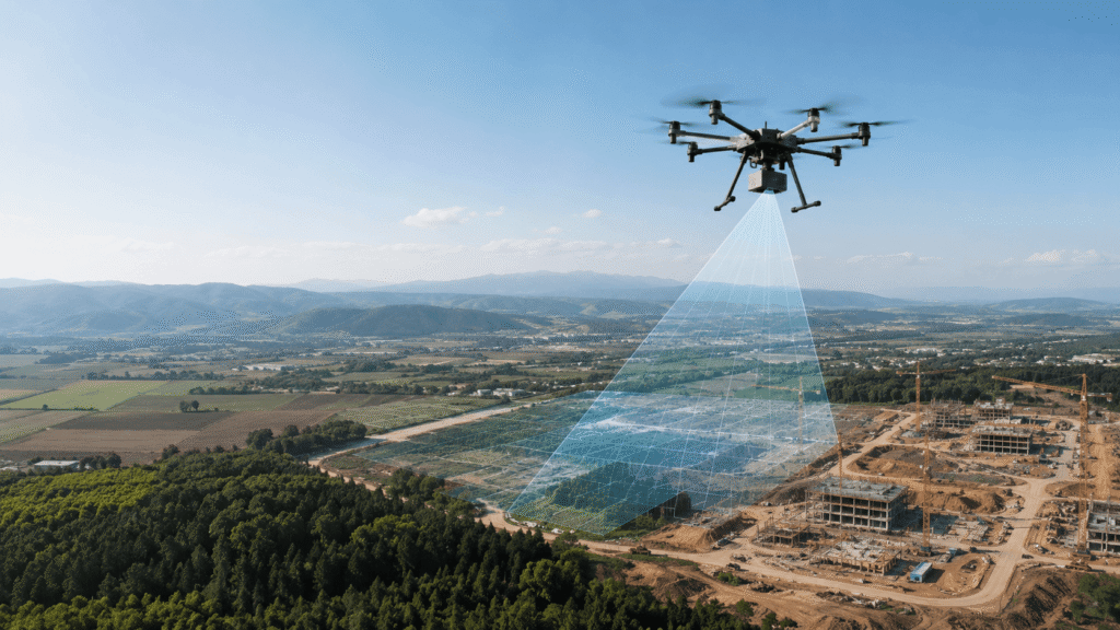
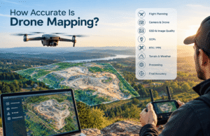
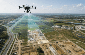
A drone captures aerial data for different mapping applications, including photogrammetry, LiDAR, terrain mapping, and site documentation
Drone mapping uses aerial data to create maps, measurements, models, and visual records of an area. Different mapping methods collect different types of information, which makes some methods better suited to certain projects than others.
The most common approaches include photogrammetry, LiDAR, thermal mapping, multispectral mapping, orthomosaic mapping, 3D mapping, and topographic mapping.
For a beginner, the choice can seem complicated. You may wonder whether you need a standard camera, LiDAR, thermal imaging, or another type of sensor. The answer depends on what you need to learn about the site.
If you need a detailed aerial map, photogrammetry may be a practical option. If terrain and vegetation matter, LiDAR may be more suitable. Thermal mapping focuses on heat differences, while multispectral mapping can help assess crops and vegetation.
This guide explains each type in simple terms and helps you choose the right approach for your project.
What Are the Main Types of Drone Mapping?
The main types of drone mapping include:
- Photogrammetry: Uses overlapping aerial photographs to create maps and models.
- LiDAR mapping: Uses laser measurements to collect distance and terrain information.
- Thermal mapping: Uses a thermal camera to detect differences in heat.
- Multispectral mapping: Captures information from different parts of light for applications such as agriculture.
- Orthomosaic mapping: Combines aerial photographs into a single detailed map.
- 3D mapping: Creates a three-dimensional representation of a site or object.
- Topographic mapping: Shows land shape, elevation, and terrain changes.
These approaches can also work together. A construction project, for example, might use aerial photography to create an orthomosaic and 3D model while using elevation data to understand changes across the site.
For a broader overview of the mapping process, see our Drone Mapping Guide.
Quick Comparison of Drone Mapping Types
| Mapping type | Main data | Common uses | Beginner-friendly? |
|---|---|---|---|
| Photogrammetry | Aerial photographs | Construction, land, property, surveying | Yes |
| LiDAR | Laser measurements | Terrain, vegetation, infrastructure | Moderate |
| Thermal mapping | Heat information | Inspections and energy-related work | Moderate |
| Multispectral mapping | Different parts of light | Agriculture and vegetation | Moderate |
| Orthomosaic mapping | Combined aerial photographs | Site mapping and planning | Yes |
| 3D mapping | Overlapping imagery and other data | Buildings, sites, terrain | Moderate |
| Topographic mapping | Elevation and terrain information | Construction and land development | Moderate |
This comparison shows why there is no single best drone mapping method. Your project determines which type of data matters most.
What Is Drone Photogrammetry?
Drone photogrammetry uses overlapping aerial photographs to create maps, measurements, and 3D models.
It is a common approach for general drone mapping because photographs provide visual information that is easy to understand and can support many different projects.
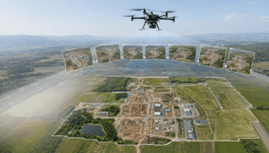
During a drone photogrammetry mission, the drone follows a planned flight path and captures photographs across the target area. The photographs overlap with one another. Mapping software then compares the images and uses the shared visual information to build a map or model.
How Does Drone Photogrammetry Work?
A typical photogrammetry workflow follows these steps:
- Plan the flight. Define the area that needs coverage.
- Set the flight path. Establish the route and required image coverage.
- Capture photographs. The drone collects overlapping images.
- Process the images. Mapping software analyzes the photographs.
- Create the output. The software produces a map, model, or other data product.
- Review the results. Check the final output before using it for measurements or decisions.
Good results depend on the quality of the images, flight planning, site conditions, and data processing.
What Can Drone Photogrammetry Create?
Photogrammetry can produce several useful outputs, including:
- Orthomosaic maps
- 3D models
- Surface models
- Site measurements
- Aerial documentation
An orthomosaic can show an entire site as one detailed aerial map. A 3D model can show the shape and depth of buildings, terrain, stockpiles, and other objects.
Where Is Photogrammetry Used?
Photogrammetry can support many industries, including:
- Construction
- Land surveying
- Real estate
- Agriculture
- Mining
- Infrastructure
- Property documentation
- Stockpile measurement
For many general mapping tasks, photogrammetry provides a practical balance between visual detail, equipment requirements, and project flexibility.
What Are the Advantages of Photogrammetry?
Photogrammetry offers several benefits:
- Provides visual detail: Aerial photographs show the appearance of the mapped area.
- Supports multiple outputs: The same imagery can support maps and 3D models.
- Works across industries: Construction, agriculture, property, and land projects can use it.
- Uses camera-based data: Many mapping workflows start with suitable aerial photography.
What Are the Limitations?
Photogrammetry also has limitations. Poor lighting can affect photographs, while dense vegetation can make it difficult to capture the ground surface clearly. The drone also needs adequate image coverage for the mapping software to produce useful results.
The next major mapping method takes a different approach by using laser measurements instead of photographs.
What Is LiDAR Drone Mapping?
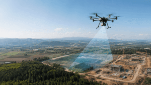
LiDAR drone mapping uses laser pulses to measure distances between the sensor and objects or surfaces.
The basic difference between LiDAR and photogrammetry is simple:
Photogrammetry uses photographs. LiDAR uses laser measurements.
LiDAR can be particularly useful for terrain-related projects and areas where vegetation makes ground information difficult to capture with normal aerial photographs.
When Is LiDAR Useful?
LiDAR can support mapping projects involving:
- Forested areas
- Terrain
- Construction sites
- Infrastructure
- Large land areas
- Areas with substantial vegetation
For example, vegetation can obscure the ground in an aerial photograph. LiDAR can provide information that helps users analyze terrain in these environments.
What Are the Advantages of LiDAR?
LiDAR can:
- Collect distance measurements.
- Support terrain mapping.
- Provide useful elevation information.
- Help with projects involving vegetation.
- Support infrastructure and land-related work.
What Are the Limitations?
LiDAR systems generally require specialized equipment and can involve higher project costs than simpler camera-based workflows. Processing and interpreting LiDAR data can also require additional expertise.
That makes LiDAR unnecessary for some straightforward mapping jobs. If you only need a visual site map, a suitable camera-based workflow may be enough.
Is LiDAR Better Than Photogrammetry?
Neither LiDAR nor photogrammetry is always better. The right choice depends on the project.
Photogrammetry can work well when you need visual site information and general mapping. LiDAR can be useful when terrain, vegetation, or other site conditions make laser-based measurements a better fit.
Your project requirements should guide the decision rather than the assumption that one technology is always superior.
What Is Thermal Drone Mapping?
Thermal drone mapping uses a thermal camera to identify differences in heat across a site, building, structure, or piece of equipment.
A standard camera records visible images. A thermal camera records information related to infrared radiation and temperature differences.
This makes thermal mapping useful when heat patterns matter.
What Is Thermal Drone Mapping Used For?
Common applications include:
- Building inspections
- Heat-loss investigations
- Solar panel inspections
- Electrical equipment inspections
- Industrial inspections
- Certain agricultural applications
- Fire and emergency assessment
For example, an inspection team can use thermal imagery to identify areas with unusual heat patterns that require closer investigation.
What Are the Advantages of Thermal Mapping?
Thermal imagery can reveal heat differences that may not be visible in a normal photograph. A drone can also cover large or difficult-to-access areas without requiring an inspector to physically reach every location.
What Are the Limitations?
Weather and environmental conditions can influence thermal readings. The resulting images also require proper interpretation.
A thermal image can show a temperature difference, but the image alone does not always explain why that difference exists. Users may need additional inspection or information to identify the cause.
Thermal mapping therefore works best when you have a clear inspection goal and understand how to interpret the data.
What Is Multispectral Drone Mapping?
Multispectral drone mapping captures information from different parts of light to identify variations that ordinary photographs may not show clearly.
This method has important applications in agriculture, forestry, and environmental monitoring.
A multispectral camera can capture information from selected parts of the electromagnetic spectrum. For beginners, the important point is that the resulting data can reveal differences in vegetation that are difficult to identify from a standard aerial photograph alone.
What Is Multispectral Mapping Used For?
Common applications include:
- Crop monitoring
- Plant health assessment
- Irrigation management
- Identifying areas of crop stress
- Forestry
- Environmental monitoring
A farmer can use aerial data to identify areas of a field that differ from surrounding areas. Those locations can then receive closer attention.
Why Do Farmers Use Multispectral Mapping?
Large fields can contain significant variation. Multispectral imagery can help identify those differences across an entire field.
This information can support crop-management decisions and help users determine where additional inspection may be useful.
Multispectral mapping does not replace agronomic knowledge. It provides additional information that can support the assessment of crops and vegetation.
What Are the Limitations?
Multispectral mapping requires compatible equipment and appropriate processing. Environmental conditions can also influence the collected data.
It may be unnecessary for a basic property map. If your goal is simply to document the layout of a site, standard aerial photography may provide the information you need.
What Is an Orthomosaic Map?
An orthomosaic map combines multiple aerial photographs into one detailed aerial image that can support mapping, planning, and measurement.
An orthomosaic is best understood as a mapping product created from aerial imagery, rather than a completely separate sensor type.
The mapping software processes multiple photographs and combines them into one continuous map. The resulting image provides a consistent view of the mapped area.
What Is an Orthomosaic Used For?
Orthomosaic maps can support:
- Construction progress monitoring
- Land documentation
- Agriculture
- Property mapping
- Surveying
- Site planning
For a construction site, an orthomosaic can provide a current aerial view of the entire project area. Teams can use that record to review site conditions and compare changes over time.
Why Is an Orthomosaic Useful?
An orthomosaic makes large amounts of aerial imagery easier to review. Instead of opening individual photographs one by one, you can examine the mapped area as a single image.
It can also support measurements and planning when the mapping workflow meets the requirements of the project.
What Is Drone 3D Mapping and 3D Modeling?
Drone 3D mapping creates a three-dimensional digital representation of a site, structure, object, or terrain.
A common workflow uses overlapping drone photographs. Processing software analyzes the images and creates a model that represents the shape and depth of the mapped subject.
What Can You Map in 3D?
3D drone mapping can support projects involving:
- Buildings
- Construction sites
- Quarries
- Mines
- Roads
- Structures
- Terrain
What Is the Difference Between 2D and 3D Drone Mapping?
A 2D map shows an area from above. An orthomosaic is a common example.
A 3D model represents height, shape, and depth.
For example, a construction team might use a 2D orthomosaic to review the overall site and a 3D model to examine the shape of structures or terrain.
Where Is 3D Drone Mapping Used?
Common applications include:
- Construction planning
- Site documentation
- Architecture
- Real estate
- Mining
- Infrastructure
- Project progress monitoring
3D models can make complex sites easier to visualize. They can also provide a digital record that teams can compare as a project develops.
What Is Topographic Drone Mapping?
Topographic drone mapping shows the shape and elevation of land.
Instead of focusing only on the appearance of a site, topographic mapping focuses on changes in terrain. It can show slopes, elevation differences, high and low areas, and other surface features.
What Information Can Topographic Mapping Provide?
Topographic mapping can provide information about:
- Elevation changes
- Slopes
- High and low areas
- Terrain shape
- Surface features
Where Is Topographic Mapping Used?
Topographic mapping can support:
- Construction
- Road planning
- Land development
- Drainage planning
- Mining
- Engineering projects
Photogrammetry and LiDAR can both support topographic mapping. The suitable method depends on the terrain, vegetation, project requirements, equipment, and budget.
For an open site, aerial photography may provide useful terrain information. Dense vegetation can create different requirements and may make LiDAR more attractive.
Which Type of Drone Mapping Should You Choose?
Choose the mapping method based on the information you need, not simply on the most advanced equipment available.
Use photogrammetry when you need general aerial mapping, site documentation, measurements, or visual models.
Consider LiDAR when terrain information matters and vegetation or site conditions make photography-based mapping less suitable.
Use thermal mapping when your project requires information about heat differences.
Consider multispectral mapping when you need information about crops, plants, or vegetation.
Use orthomosaic mapping when you need a detailed aerial map for documentation, planning, or comparison.
Use 3D mapping when you need a three-dimensional representation of a building, site, structure, or terrain.
Use topographic mapping when elevation and land shape are important.
Can You Combine Different Mapping Methods?
Yes. A project can use more than one method when each provides different useful information.
For example:
- Construction: Photogrammetry + 3D modeling
- Agriculture: Multispectral imagery + standard aerial imagery
- Forested terrain: LiDAR + aerial imagery
- Property documentation: Photogrammetry + orthomosaic mapping
- Terrain projects: Photogrammetry or LiDAR + topographic mapping
Combining methods can provide a more complete view of a site when one type of data cannot answer every project question.
Photogrammetry vs LiDAR vs Thermal vs Multispectral
These four methods collect different types of information.
| Method | Main information | Best suited to |
|---|---|---|
| Photogrammetry | Visual aerial information | General mapping and site documentation |
| LiDAR | Laser-based distance information | Terrain and suitable vegetation-related projects |
| Thermal | Heat differences | Inspections and heat-related applications |
| Multispectral | Information from selected parts of light | Agriculture and vegetation |
Photogrammetry focuses on what the camera can capture visually. LiDAR measures distance with laser pulses. Thermal imaging focuses on heat patterns. Multispectral imaging captures selected parts of light that can provide additional information about vegetation.
The right method depends on the question your project needs to answer.
What Should You Consider Before Choosing a Drone Mapping Method?
Before selecting a mapping method, review these factors.
1. Define the Project Purpose
Start by deciding what you need to learn about the site. A construction map requires different information from a crop-monitoring project or thermal inspection.
2. Consider the Area Size
The size of the project affects flight planning, data collection, processing, and project time. A small property may need a simpler workflow than a large agricultural or mining site.
3. Identify the Required Detail
Determine how detailed the final map or model needs to be. The required level of detail can influence the equipment and workflow.
4. Check the Terrain
Open land, steep terrain, buildings, forests, and complex structures can create different mapping challenges.
5. Consider Vegetation
Dense vegetation can hide the ground from a camera. This factor can influence whether photogrammetry or LiDAR better fits the project.
6. Check Weather and Lighting
Weather and lighting can affect aerial imagery. Environmental conditions can also influence thermal and multispectral data.
7. Review Your Equipment
The drone and camera must match the mapping task. A standard camera cannot provide the same type of information as a thermal or multispectral sensor.
8. Set a Budget
Consider the cost of equipment, software, data processing, and the time required to complete the project.
9. Consider the Software
The drone collects the data, but mapping software turns that data into usable outputs. Make sure your planned workflow supports the map or model you need.
10. Decide How You Will Use the Data
A map created for visual documentation may have different requirements from data used for detailed surveying, engineering, or land-development work.
Once these factors are clear, the equipment decision becomes much easier.
What Mistakes Do Beginners Make With Drone Mapping?
Beginners often choose a drone before defining the mapping task. Starting with the project goal can prevent unnecessary equipment costs and poor results.
Common mistakes include:
- Choosing equipment first: Define the required data before selecting equipment.
- Skipping flight planning: Plan the coverage and flight path before collecting imagery.
- Capturing insufficient imagery: Make sure the site receives adequate image coverage.
- Ignoring weather: Check conditions before collecting aerial data.
- Expecting every drone to produce mapping results: Drone and camera capabilities affect the final output.
- Choosing the wrong mapping method: Match the method to the information you need.
- Relying entirely on automatic processing: Review the final data instead of assuming the software handled every issue.
- Ignoring local drone rules: Check the aviation requirements that apply to your location.
- Failing to review the output: Inspect the final map or model before using it for important decisions.
A reliable workflow starts with a clear objective, suitable equipment, planned data collection, appropriate processing, and a review of the final result.
FAQs
What are the main types of drone mapping?
The main types include photogrammetry, LiDAR, thermal mapping, multispectral mapping, orthomosaic mapping, 3D mapping, and topographic mapping. Each approach provides different information or mapping outputs.
Is photogrammetry or LiDAR better for drone mapping?
Neither is always better. Photogrammetry suits many general mapping projects, while LiDAR can be useful for terrain and projects where vegetation makes photography-based mapping more difficult.
What type of drone mapping is best for beginners?
Photogrammetry can be a practical starting point for many beginners because aerial photographs are easy to understand and support a wide range of mapping tasks. Your project requirements should guide the final choice.
What is drone photogrammetry used for?
Drone photogrammetry is used to create aerial maps, 3D models, measurements, construction documentation, land records, property documentation, and other visual mapping products.
When should you use LiDAR instead of photogrammetry?
Consider LiDAR when terrain information is important and vegetation or site conditions make it difficult to capture the ground clearly with aerial photographs. Equipment, budget, and project requirements also matter.
What is thermal drone mapping used for?
Thermal drone mapping is used for applications involving heat differences, including building inspections, solar panel checks, electrical inspections, industrial work, and certain emergency applications.
What is multispectral drone mapping used for?
Multispectral mapping is mainly used to examine variations in crops and vegetation. Agriculture, forestry, and environmental monitoring can benefit from this type of aerial information.
Can one drone be used for different types of mapping?
Yes. A drone platform can support different mapping tasks when it is compatible with the required cameras or sensors. Standard, thermal, and multispectral cameras collect different types of information.
How do I choose the right drone mapping method?
Start with the information you need. Choose photogrammetry for many general mapping tasks, consider LiDAR for suitable terrain applications, use thermal mapping for heat-related work, and consider multispectral mapping for vegetation-focused projects.
Choosing the Right Drone Mapping Method
Different drone mapping methods solve different problems. Photogrammetry provides a practical option for many general mapping projects. LiDAR can support terrain work where vegetation creates challenges. Thermal mapping focuses on heat, while multispectral mapping provides information useful for crops and vegetation.
Orthomosaics and 3D models turn aerial data into practical visual products. Topographic mapping focuses on land shape and elevation.
The best approach starts with one question: What information do you need from your project?
Once you know the answer, you can choose the mapping method, drone, camera, and software that fit the task.
If you want to understand the complete process from planning a flight to creating useful mapping outputs, continue with our Drone Mapping Guide.