Complete Guide to Drone Mapping, Software, Workflow, Accuracy, Applications & Best Practices (2026)
Complete Guide to Drone Mapping, Software, Workflow, Accuracy, Applications & Best Practices (2026)
Quick Answer
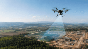
Drone mapping is the process of using drones equipped with high-resolution cameras or advanced sensors to capture aerial images and geospatial data. That information is processed using technologies like photogrammetry or LiDAR to create accurate 2D maps, realistic 3D models, and detailed terrain data.
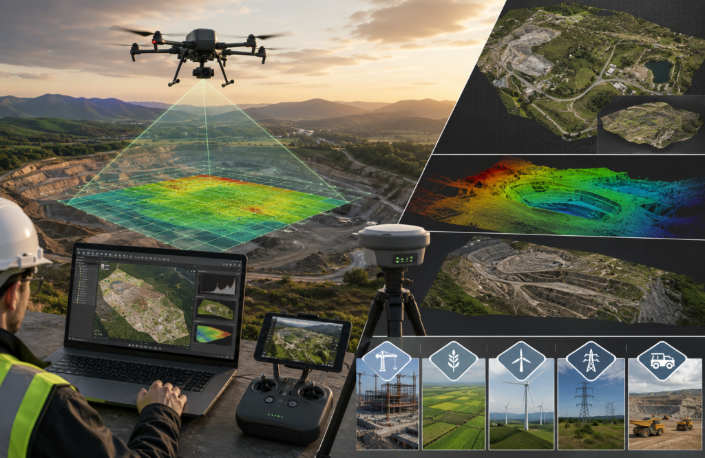
During a mapping mission, the drone follows a pre-planned flight path and captures hundreds of overlapping images. Specialized software then combines those images into a single, highly accurate digital map. Compared to traditional surveying methods, drone mapping is faster, safer, and often more cost-effective, making it a popular choice across industries such as construction, agriculture, mining, utilities, and government.
Key Takeaways
- Drone mapping uses UAVs (unmanned aerial vehicles) to capture aerial imagery and spatial data that can be turned into accurate maps, 3D models, and terrain information.
- The workflow typically includes project planning, site assessment, automated flight, data processing, and quality checks before the final deliverables are produced.
- Essential equipment includes multirotor or fixed-wing drones, RGB or LiDAR sensors, RTK/PPK GNSS systems, and Ground Control Points (GCPs) for improved accuracy.
- Popular mapping software such as Pix4D, DroneDeploy,Dronesasaservice, and similar platforms process captured data into orthomosaics, elevation models, and 3D reconstructions.
- High-end drone mapping systems can achieve accuracy within 1–5 centimeters when RTK/PPK technology and properly surveyed GCPs are used.
- Common applications include construction progress tracking, crop monitoring, stockpile volume calculations, infrastructure inspections, land surveying, and environmental monitoring.
- Key benefits include faster data collection, lower operating costs, improved worker safety, and better decision-making through accurate, up-to-date information.
- Looking ahead, advances in AI, smarter sensors, automation, and cloud-based processing are expected to make drone mapping even more powerful in 2026 and beyond.
Introduction
Surveying has long been an essential part of construction, engineering, agriculture, mining, and land management. Traditionally, it involved teams working on the ground with total stations, GPS equipment, and measuring tools to collect site data. While these methods are highly accurate, they can be time-consuming, labor-intensive, and challenging on large or difficult terrain.
Drone technology has transformed that process.
Today, organizations can collect detailed aerial data in a fraction of the time by using drones equipped with high-resolution cameras or advanced sensors. Instead of spending days walking a site, a drone can capture hundreds or even thousands of images in a single flight. That data is then processed into accurate orthomosaic maps, 3D models, digital elevation models (DEMs), contour maps, and volume calculations.
As a result, drone mapping has become an essential tool across many industries. Construction companies use it to monitor project progress, mining operations rely on it for stockpile measurements, farmers use it to assess crop health, and utility providers inspect power lines, pipelines, and other infrastructure more safely than ever before. Environmental organizations also use drone mapping to monitor changes in forests, coastlines, and natural landscapes over time.
This comprehensive guide explains everything you need to know about drone mapping in 2026. You’ll learn how it works, the technology behind it, the equipment and software required, practical applications across different industries, and the best practices for achieving professional results.
Whether you’re new to drone mapping or looking to improve your existing workflow, this guide will give you a solid understanding of the process and help you make informed decisions for your projects.
What Is Drone Mapping?
Drone mapping is the process of capturing georeferenced aerial images or sensor data with an unmanned aerial vehicle (UAV) and processing that data into accurate geospatial products such as orthomosaic maps, 3D models, digital elevation models (DEMs), digital surface models (DSMs), digital terrain models (DTMs), contour maps, and dense point clouds. It combines drone technology, positioning systems, remote sensing, and photogrammetry or LiDAR processing to produce survey-grade spatial data for mapping, measurement, analysis, and decision-making.
Unlike traditional land surveying, which collects measurements from the ground, drone mapping captures spatial information from above using autonomous flight missions. During a mission, the drone follows a predefined flight path while recording hundreds or thousands of overlapping images or LiDAR measurements. Each image or scan is geotagged with geographic coordinates using GNSS technology, allowing mapping software to reconstruct the surveyed area into highly accurate digital representations.
Drone mapping supports both visualization and measurement. Depending on the project objectives, the processed data can be used to calculate distances, surface areas, elevations, stockpile volumes, terrain profiles, infrastructure conditions, vegetation health, or construction progress. The resulting datasets integrate directly with Geographic Information Systems (GIS), Computer-Aided Design (CAD), and Building Information Modeling (BIM) platforms for engineering, planning, and asset management
Understanding what drone mapping produces is only part of the picture. The next step is learning how the technology converts aerial imagery into accurate maps and 3D models through a structured mapping workflow.
What Is Drone Mapping Workflow?
Drone mapping follows a structured workflow that transforms aerial images or sensor data into accurate geospatial products such as orthomosaic maps, digital elevation models (DEMs), digital surface models (DSMs), digital terrain models (DTMs), point clouds, contour maps, and textured 3D models. The workflow includes project planning, site assessment, flight planning, data acquisition, image processing, quality assurance, and final data delivery.
Unlike conventional aerial photography, every stage of the workflow directly influences mapping accuracy, spatial resolution, and data quality. Factors such as flight altitude, image overlap, camera calibration, GNSS positioning, Ground Control Points (GCPs), RTK or PPK corrections, and photogrammetric processing work together to produce reliable mapping outputs.
What Are the Main Steps in a Drone Mapping Workflow?
A professional drone mapping workflow consists of seven interconnected stages. Each stage prepares the data for the next process while improving the accuracy and reliability of the final deliverables.
- Project Planning
- Site Assessment
- Flight Planning
- Data Acquisition
- Data Processing
- Quality Assurance
- Data Export and Delivery
What Happens During Project Planning?
Project planning defines the mapping objective, required accuracy, survey area, deliverables, flight permissions, and equipment before the drone leaves the ground. A clearly defined objective determines the flight parameters, sensor selection, processing workflow, and final output format.
Typical project objectives include:
- Construction progress monitoring
- Land surveying
- Topographic mapping
- Stockpile volume calculation
- Infrastructure inspection
- Precision agriculture
- Environmental monitoring
- Corridor mapping
During planning, operators also determine:
- Required accuracy
- Coordinate reference system (CRS)
- Projection
- Expected Ground Sampling Distance (GSD)
- Required overlap
- Flight altitude
- Sensor type
- Deliverables
Why Is Site Assessment Important Before Drone Mapping?
Site assessment identifies environmental, operational, and regulatory conditions that may affect flight safety or mapping accuracy.
Before flying, the survey area is inspected for:
- Trees
- Buildings
- Power lines
- Towers
- Moving vehicles
- Restricted airspace
- Weather conditions
- Wind speed
- Sun angle
- Magnetic interference
- GNSS signal obstruction
The assessment also determines suitable locations for Ground Control Points (GCPs), checkpoints, and the drone takeoff and landing area.
How Is a Drone Mapping Flight Planned?
Flight planning creates an automated mission that captures complete aerial coverage with consistent image overlap and spatial accuracy.
Mission planning software calculates the flight path based on:
- Survey boundary
- Flight altitude
- Camera specifications
- Ground Sampling Distance (GSD)
- Front overlap
- Side overlap
- Flight speed
- Camera angle
- Flight direction
Common mission types include:
- Grid Mission
- Double Grid Mission
- Corridor Mission
- Cross Hatch Mission
- Oblique Mission
These flight patterns ensure sufficient image redundancy for accurate photogrammetric reconstruction.
How Is Mapping Data Captured?
Data acquisition records overlapping aerial images or LiDAR measurements while the drone follows the planned flight path autonomously.
Every captured image contains:
- Geographic coordinates
- Camera position
- Camera orientation
- Timestamp
- Sensor metadata
Modern mapping drones use:
- RGB cameras
- LiDAR scanners
- Thermal cameras
- Multispectral sensors
Together with GNSS, RTK, or PPK positioning, these sensors produce highly accurate geospatial datasets.
How Are Drone Images Processed Into Maps?
Photogrammetry software converts overlapping aerial images into accurate digital mapping products through a sequence of computer vision algorithms.
The processing workflow typically includes:
Image Alignment
↓
Feature Detection
↓
Feature Matching
↓
Tie Point Generation
↓
Bundle Adjustment
↓
Sparse Point Cloud
↓
Dense Point Cloud
↓
Mesh Reconstruction
↓
Texture Generation
↓
Orthomosaic Creation
↓
Elevation Model Generation
↓
Export
The final products may include:
- Orthomosaic
- Point Cloud
- DEM
- DSM
- DTM
- Contour Map
- 3D Model
- Volume Report
How Is Drone Mapping Accuracy Verified?
Quality assurance validates that the processed data meets the required positional accuracy before delivery.
Quality checks typically include:
- Checkpoint verification
- RMSE calculation
- Horizontal accuracy assessment
- Vertical accuracy assessment
- GCP residual analysis
- Image overlap inspection
- Missing image detection
- Distortion analysis
- Coordinate verification
Professional survey workflows often compare processed data against independently surveyed checkpoints to confirm survey-grade accuracy.
What Deliverables Are Produced After Drone Mapping?
Drone mapping generates multiple geospatial products that support surveying, engineering, construction, agriculture, mining, utilities, and GIS analysis.
Common deliverables include:
- Orthomosaic Maps
- Digital Elevation Models (DEM)
- Digital Surface Models (DSM)
- Digital Terrain Models (DTM)
- Dense Point Clouds
- Textured 3D Models
- Contour Maps
- Volume Calculations
- Cut-and-Fill Reports
- Inspection Reports
The datasets can be exported in industry-standard formats such as GeoTIFF, LAS, LAZ, DXF, SHP, OBJ, FBX, GeoJSON, KML, and CSV for integration with GIS, CAD, BIM, and project management software.
Understanding the workflow explains how drone mapping produces geospatial data. The next step is understanding which hardware, sensors, and positioning technologies make accurate drone mapping possible, and how each component contributes to the quality of the final results.
What Equipment Is Required for Drone Mapping?
Direct Answer
Drone mapping requires a combination of aerial platforms, positioning systems, imaging sensors, surveying equipment, and mapping software to capture, process, and deliver accurate geospatial data. Every component contributes to mapping accuracy, spatial resolution, coverage efficiency, and the quality of the final mapping products.
The equipment requirements vary depending on the project scope, terrain, accuracy requirements, and deliverables. A basic photogrammetry project may only require an RGB camera drone, while engineering-grade surveys often combine RTK or PPK positioning, Ground Control Points (GCPs), LiDAR sensors, and professional photogrammetry software.
What Are the Main Components of a Drone Mapping System?
A professional drone mapping system consists of several interconnected components that collect, position, process, and validate geospatial information.
The primary components include:
- Drone Platform
- Camera or Mapping Sensor
- GNSS Positioning System
- RTK or PPK Module
- Ground Control Points (GCPs)
- Checkpoints
- Flight Planning Software
- Photogrammetry Software
- GIS or CAD Software
Each component contributes to the overall accuracy, reliability, and usability of the final mapping outputs.
What Types of Drones Are Used for Drone Mapping?
Drone mapping primarily uses multirotor drones and fixed-wing drones, with each platform designed for different survey requirements.
Multirotor Drones
Multirotor drones provide excellent maneuverability, hovering capability, and high image density, making them ideal for detailed surveys over small to medium-sized areas.
Common applications include:
- Construction
- Building inspection
- Mining
- Infrastructure
- Land surveying
- Stockpile measurement
- Typical attributes
- Vertical Takeoff and Landing (VTOL)
- Hover capability
- High positional stability
- Shorter flight time
- Higher image density
Fixed-Wing Drones
Fixed-wing drones cover significantly larger areas during a single flight because they remain airborne using aerodynamic lift instead of continuously generating lift with propellers.
Common applications include
- Agriculture
- Forestry
- Large mining sites
- Pipeline mapping
- Powerline inspection
- Environmental monitoring
- Typical attributes
- Long flight endurance
- Large coverage area
- Higher cruising speed
- Longer operational range
- Lower image density per hectare
Which Sensors Are Used in Drone Mapping?
Drone mapping uses different sensors depending on the information being collected.
RGB Camera
RGB cameras capture visible-light photographs for photogrammetry.
Applications
- Orthomosaic maps
- 3D models
- Surface measurements
- Construction monitoring
Attributes
- Resolution
- Sensor size
- Global shutter
- Rolling shutter
- Dynamic range
- Lens quality
LiDAR Sensor
LiDAR sensors emit laser pulses that measure distances between the drone and surrounding objects to generate dense three-dimensional point clouds.
Applications
- Forestry
- Dense vegetation
- Utility corridors
- Terrain mapping
- Flood modelling
Attributes
- Pulse rate
- Point density
- Scan angle
- Range accuracy
- Vertical accuracy
Multispectral Sensor
Multispectral cameras capture specific wavelength bands beyond visible light to evaluate vegetation conditions.
Applications
- Precision agriculture
- Crop monitoring
- Forestry
- Environmental assessment
Attributes
- Spectral bands
- NDVI capability
- Reflectance accuracy
- Radiometric calibration
Thermal Camera
Thermal sensors detect infrared radiation to identify temperature variations.
Applications
- Solar inspection
- Roof inspection
- Powerline inspection
- Search and rescue
- Wildlife monitoring
Attributes
- Thermal sensitivity
- Resolution
- Temperature range
- Accuracy
Why Are RTK and PPK Important in Drone Mapping?
RTK (Real-Time Kinematic) and PPK (Post-Processed Kinematic) improve GNSS positioning accuracy by correcting satellite positioning errors, enabling centimeter-level georeferencing for drone mapping.
RTK applies corrections during the flight, while PPK applies corrections after the flight using recorded satellite observations.
Benefits include:
- Higher positional accuracy
- Fewer Ground Control Points
- Faster fieldwork
- Better repeatability
- Improved survey reliability
What Are Ground Control Points (GCPs)?
Ground Control Points (GCPs) are accurately surveyed reference markers placed across the mapping area to improve georeferencing accuracy during photogrammetric processing.
GCPs reduce positional errors by aligning aerial imagery with real-world coordinates.
- Well-distributed GCPs improve
- Horizontal accuracy
- Vertical accuracy
- Scale consistency
- Model alignment
- Orthomosaic accuracy
What Are Checkpoints in Drone Mapping?
Checkpoints are independently surveyed reference points used to verify mapping accuracy rather than control image alignment.
Unlike GCPs, checkpoints remain excluded from photogrammetric adjustment and provide an unbiased assessment of the final positional accuracy.
- Checkpoints support
- RMSE calculation
- Accuracy validation
- Quality assurance
- Survey certification
What Software Is Used for Drone Mapping?
Drone mapping software automates mission planning, image processing, geospatial analysis, and data visualization.
Professional workflows often combine multiple software platforms.
Flight Planning Software
- DJI Pilot 2
- DJI GS Pro
- DroneDeploy Flight
- Pix4D Capture
- UgCS
Functions
- Mission planning
- Flight automation
- \Waypoint generation
- Image overlap configuration
Photogrammetry Software
- Pix4Dmapper
- Agisoft Metashape
- DJI Terra
- RealityCapture
- WebODM
Functions
- Image alignment
- Point cloud generation
- Orthomosaic creation
- DEM generation
- 3D reconstruction
GIS and CAD Software
- ArcGIS Pro
- QGIS
- AutoCAD Civil 3D
- Bentley Context Capture
- Global Mapper
Functions
- Spatial analysis
- Engineering design
- Asset management
- Infrastructure planning
- Terrain modelling
Selecting the right equipment is only one part of producing accurate mapping results. The next section explains how drone mapping technologies such as photogrammetry, LiDAR, RTK, and PPK work together to transform raw aerial data into precise geospatial products.
How Does Drone Mapping Work?
Direct Answer
Drone mapping works by capturing overlapping aerial images or LiDAR measurements with a drone, assigning precise geographic coordinates to each dataset, and processing the collected information through photogrammetry or LiDAR software to generate accurate geospatial products such as orthomosaic maps, 3D models, point clouds, digital elevation models (DEMs), digital surface models (DSMs), and digital terrain models (DTMs).
The complete process combines autonomous flight planning, image acquisition, GNSS positioning, computer vision, and geospatial processing to reconstruct the real-world environment with survey-grade accuracy.
What Happens During a Drone Mapping Flight?
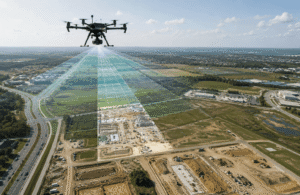
A drone mapping mission follows a predefined flight path while automatically capturing hundreds or thousands of overlapping images or sensor measurements.
Unlike conventional aerial photography, drone mapping collects data with consistent image overlap, camera orientation, flight altitude, and geospatial positioning to support accurate three-dimensional reconstruction.
During the flight, the drone continuously records:
- High-resolution aerial images
- Geographic coordinates
- Camera orientation
- Flight altitude
- Timestamp
- Sensor metadata
- RTK or PPK positioning information
This information forms the foundation for accurate photogrammetric processing.
How Does Photogrammetry Create Maps From Drone Images?
Photogrammetry converts overlapping aerial photographs into measurable geospatial data by identifying common features across multiple images and calculating their three-dimensional positions.
Instead of analyzing each photograph independently, photogrammetry compares thousands of shared image features to reconstruct the surveyed environment.
The photogrammetry workflow typically includes:
- Image Alignment
- Feature Detection
- Feature Matching
- Tie Point Generation
- Bundle Adjustment
- Sparse Point Cloud Creation
- Dense Point Cloud Generation
- Mesh Reconstruction
- Texture Mapping
- Orthomosaic Generation
- DEM, DSM, and DTM Creation
Every stage improves the geometric accuracy and completeness of the final mapping products.
What Is Image Overlap in Drone Mapping?
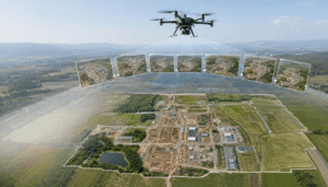
Image overlap is the percentage of shared ground coverage between consecutive aerial photographs captured during a mapping mission.
Photogrammetry software relies on overlapping images to identify common features, calculate camera positions, and reconstruct accurate three-dimensional geometry.
Most professional mapping missions use:
- Front Overlap: 75–85%
- Side Overlap: 70–80%
Projects involving forests, complex terrain, or tall structures often require even higher overlap to improve reconstruction quality.
How Does GNSS Improve Drone Mapping Accuracy?
Global Navigation Satellite Systems (GNSS) determine the precise geographic position of the drone and every captured image.
Each image receives geographic coordinates that allow mapping software to accurately position aerial data within a real-world coordinate system.
Professional mapping drones commonly support:
- GPS
- GLONASS
- Galileo
- BeiDou
Modern GNSS receivers often work with RTK and PPK correction technologies to achieve centimeter-level positioning accuracy.
What Role Do RTK and PPK Play During Data Collection?
RTK and PPK reduce satellite positioning errors by applying correction data to GNSS measurements.
RTK calculates corrections during the flight, allowing the drone to geotag images with highly accurate coordinates in real time.
PPK records raw satellite observations during the flight and applies positioning corrections after data collection.
Both technologies reduce dependence on Ground Control Points (GCPs) while improving the positional accuracy of orthomosaics, elevation models, and 3D reconstructions.
How Does LiDAR Mapping Work?
LiDAR mapping measures distances by emitting laser pulses toward the ground and recording the time required for each pulse to return to the sensor.
Instead of relying on overlapping photographs, LiDAR directly captures millions of three-dimensional measurement points.
Each laser pulse generates:
- X Coordinate
- Y Coordinate
- Z Elevation
- Return Intensity
- Classification Information
LiDAR performs exceptionally well in forests and densely vegetated areas because laser pulses can penetrate gaps in vegetation and capture the terrain beneath the canopy.
What Mapping Products Are Created After Processing?
Drone mapping software transforms raw aerial imagery into multiple geospatial products for surveying, engineering, construction, mining, agriculture, and GIS analysis.
The most common outputs include:
- Orthomosaic Maps
- Point Clouds
- Textured 3D Models
- Digital Surface Models (DSM)
- Digital Terrain Models (DTM)
- Digital Elevation Models (DEM)
- Contour Maps
- Slope Maps
- Volume Reports
- Cut-and-Fill Analysis
These deliverables support measurement, visualization, planning, inspection, and spatial analysis across numerous industries.
How Does Drone Mapping Convert Images Into 3D Models?
Drone mapping converts two-dimensional aerial photographs into three-dimensional models by combining camera geometry, feature matching, triangulation, and bundle adjustment.
Photogrammetry software estimates the position of every camera, reconstructs millions of spatial points, generates a dense surface mesh, and applies high-resolution textures to produce a realistic digital representation of the surveyed environment.
The resulting 3D models allow professionals to:
- Measure distances
- Calculate volumes
- Analyze terrain
- Inspect structures
- Visualize projects
- Plan construction activities
Understanding how drone mapping works makes it easier to evaluate the accuracy of the collected data. The next section explains the factors that influence drone mapping accuracy, how professionals measure accuracy, and how RTK, PPK, Ground Control Points (GCPs), and checkpoints improve the reliability of mapping results.
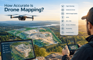
How Accurate Is Drone Mapping?
Direct Answer
Drone mapping can achieve 1–3 cm horizontal accuracy and 2–5 cm vertical accuracy under optimal conditions when using RTK or PPK positioning, properly surveyed Ground Control Points (GCPs), calibrated cameras, adequate image overlap, and professional photogrammetry workflows. The final accuracy depends on flight planning, sensor quality, GNSS positioning, environmental conditions, and data processing techniques.
Professional mapping projects evaluate accuracy using independent checkpoints and Root Mean Square Error (RMSE) calculations instead of relying solely on drone specifications.
What Determines Drone Mapping Accuracy?
Drone mapping accuracy depends on multiple technical and environmental factors that influence image quality, positioning precision, and photogrammetric reconstruction.
The most important factors include:
- GNSS signal quality
- RTK or PPK corrections
- Ground Control Points (GCPs)
- Checkpoints
- Camera calibration
- Camera shutter type
- Ground Sampling Distance (GSD)
- Flight altitude
- Image overlap
- Flight speed
- Lighting conditions
- Wind speed
- Terrain complexity
- Sensor quality
- Photogrammetry software
- Processing settings
Each factor contributes to the positional accuracy and geometric reliability of the final mapping products.
What Is Horizontal and Vertical Accuracy?
Horizontal accuracy measures how closely mapped features match their true position on the X and Y coordinates.
Vertical accuracy measures how closely elevation values represent the actual height of terrain or objects along the Z axis.
Both measurements determine whether drone mapping data satisfies engineering, surveying, construction, or GIS requirements.
Typical professional accuracy levels are:
- Accuracy Type
- Typical Range
- Horizontal Accuracy
- 1–3 cm
- Vertical Accuracy
- 2–5 cm
Actual results vary depending on project conditions and quality assurance procedures.
What Is Ground Sampling Distance (GSD)?
Ground Sampling Distance (GSD) represents the real-world distance covered by a single image pixel on the ground and determines the spatial resolution of aerial imagery.
A smaller GSD captures finer surface details and improves measurement precision, while a larger GSD covers more area but reduces image detail.
GSD depends on:
- Flight altitudeCamera resolution
- Sensor size
- Focal length
Lower flight altitudes generally produce smaller GSD values and higher-resolution mapping outputs.
How Do RTK and PPK Improve Accuracy?
RTK (Real-Time Kinematic) and PPK (Post-Processed Kinematic) improve positioning accuracy by correcting GNSS satellite errors.
RTK applies corrections during the flight through a real-time communication link, while PPK applies corrections after the flight using recorded satellite observations.
These correction methods reduce positional errors, improve image geotagging, and minimize the number of Ground Control Points required for survey-grade mapping.
Why Are Ground Control Points (GCPs) Important?
Ground Control Points (GCPs) provide accurately surveyed reference locations that align aerial imagery with real-world coordinates during photogrammetric processing.
Well-distributed GCPs improve:
- Orthomosaic accuracy
- DEM accuracy
- DSM accuracy
- DTM accuracy
- Scale consistency
- Model alignment
- Georeferencing quality
Although RTK and PPK reduce dependence on GCPs, engineering-grade surveys still use GCPs to maximize positional accuracy.
What Are Checkpoints in Drone Mapping?
Checkpoints are independently surveyed reference locations used to validate mapping accuracy after processing.
Unlike Ground Control Points, checkpoints do not influence photogrammetric adjustment. Instead, they verify whether the processed dataset meets the required positional accuracy.
Professional surveyors use checkpoints to:
- Calculate RMSE
- Verify horizontal accuracy
- Verify vertical accuracy
- survey quality
- Validate project deliverables
What Is RMSE in Drone Mapping?
Root Mean Square Error (RMSE) is a statistical measurement that quantifies the difference between mapped coordinates and independently surveyed checkpoint coordinates.
RMSE provides an objective measure of mapping accuracy by calculating the average positional error across multiple checkpoints.
Lower RMSE values indicate higher positional accuracy and better overall survey quality.
RMSE is widely used to validate drone mapping projects against professional surveying standards.
What Environmental Factors Reduce Drone Mapping Accuracy?
Several environmental conditions can reduce mapping accuracy by affecting image quality, GNSS positioning, or photogrammetric processing.
Common factors include:
- Strong winds
- Poor lighting
- Motion blur
- Dense vegetation
- Water reflections
- Snow-covered surfaces
- Fog
- Rain
- Shadow variations
- Satellite obstruction
- Multipath GNSS errors
- Tall buildings
- Tree canopies
Professional flight planning minimizes these issues before data collection begins.
What Industry Standards Are Used to Verify Accuracy?
Professional drone mapping projects compare measured accuracy against recognized surveying standards.
Common standards include:
- ASPRS Positional Accuracy Standards
- NSSDA (National Standard for Spatial Data Accuracy)
- ISO geospatial standards
- Local cadastral surveying regulations
Following recognized standards ensures that drone mapping data satisfies engineering, construction, and surveying requirements.
How Can Drone Mapping Accuracy Be Improved?
Drone mapping accuracy improves through careful planning, high-quality equipment, precise positioning, and rigorous quality assurance.
Best practices include:
- Use RTK or PPK-enabled drones.
- Survey Ground Control Points accurately.
- Validate results with independent checkpoints.
- Maintain 75–85% front overlap and 70–80% side overlap.
- Fly at an altitude that achieves the target GSD.
- Use a calibrated global shutter camera.
- Avoid high winds and poor lighting.
- Verify GNSS satellite availability before flying.
- Follow consistent flight speed and mission parameters.
- Review RMSE and checkpoint residuals before delivering results.
Following these practices consistently produces more reliable and repeatable mapping outputs.
Accurate data becomes valuable only when it supports real-world decisions. The next section explores the practical applications of drone mapping across construction, surveying, agriculture, mining, utilities, infrastructure, environmental monitoring, and many other industries, demonstrating how organizations use geospatial data to improve efficiency, safety, and decision-making.
What Are the Applications of Drone Mapping?
Direct Answer
Drone mapping supports surveying, construction, agriculture, mining, infrastructure, utilities, environmental management, public safety, and many other industries by producing accurate geospatial data for measurement, planning, inspection, monitoring, and decision-making. Organizations use drone mapping to reduce fieldwork, improve safety, accelerate data collection, and create highly accurate digital representations of real-world environments.
The same mapping workflow can produce different outputs depending on project objectives, sensor type, accuracy requirements, and industry needs.
Which Industries Use Drone Mapping?
Drone mapping is widely adopted across industries that require accurate spatial information, repeatable measurements, terrain analysis, infrastructure documentation, or asset monitoring.
Major industries include:
- Land Surveying
- Construction
- Mining
- Agriculture
- Utilities
- Oil and Gas
- Renewable Energy
- Transportation
- Forestry
- Environmental Management
- Telecommunications
- Urban Planning
- Real Estate
- Insurance
- Archaeology
- Disaster Management
Each industry uses different mapping outputs, sensors, and software to solve specific operational challenges.
How Is Drone Mapping Used in Land Surveying?
Land surveyors use drone mapping to collect high-resolution geospatial data for topographic surveys, boundary planning, terrain modeling, contour generation, and site documentation.
Common deliverables include:
Orthomosaic Maps
- DEM
- DTM
- Contour Maps
- Point Clouds
- Surface Models
Typical equipment:
- RTK Drone
- PPK Drone
Ground Control Points
- GNSS Rover
- Primary benefits:
- Faster surveys
- Reduced field time
- Improved safety
- Better terrain visualization
- Repeatable measurements
How Is Drone Mapping Used in Construction?
Construction companies use drone mapping to monitor project progress, calculate earthwork volumes, compare planned and actual site conditions, document construction activities, and improve project management.
Common applications include:
- Progress Monitoring
- Earthwork Measurement
- Cut-and-Fill Analysis
- Site Planning
- Quantity Verification
- As-Built Documentation
Common outputs:
- Orthomosaic
- 3D Model
- Volume Report
- DEM
Business benefits:
- Better scheduling
- Cost control
- Reduced rework
- Improved stakeholder reporting
How Is Drone Mapping Used in Mining?
Mining companies use drone mapping to measure stockpile volumes, monitor excavation progress, analyze haul roads, inspect pit walls, and optimize mine planning.
Common deliverables:
- Stockpile Volume Reports
- Digital Terrain Models
- Contour Maps
- High-Resolution Orthomosaics
Benefits:
- Accurate inventory
- Safer inspections
- Faster reporting
- Improved operational planning
How Is Drone Mapping Used in Agriculture?
Farmers and agronomists use drone mapping to monitor crop health, evaluate irrigation performance, identify plant stress, and support precision agriculture.
Common sensors:
- RGB Camera
- Multispectral Camera
- Thermal Camera
- Common outputs:
- NDVI Maps
- Vegetation Index Maps
- Crop Health Maps
- Field Orthomosaics
Benefits:
- Early disease detection
- Optimized irrigation
- Better fertilizer management
- Higher crop productivity
How Is Drone Mapping Used in Utilities?
Utility companies use drone mapping to inspect power lines, substations, pipelines, transmission corridors, and communication infrastructure.
Typical outputs:
- Corridor Maps
- Inspection Models
- Asset Documentation
- Vegetation Encroachment Maps
Benefits:
- Reduced inspection risk
- Faster maintenance planning
- Improved asset management
How Is Drone Mapping Used in Oil and Gas?
Oil and gas companies use drone mapping to inspect pipelines, monitor construction projects, document facilities, detect environmental changes, and improve operational safety.
Typical applications:
- Pipeline Monitoring
- Facility Inspection
- Right-of-Way Mapping
- Environmental Compliance
How Is Drone Mapping Used in Renewable Energy?
Renewable energy operators use drone mapping to inspect solar farms, wind turbines, substations, and transmission infrastructure.
Common sensors:
- RGB
- Thermal
- LiDAR
Typical applications:
- Solar Panel Inspection
- Wind Turbine Inspection
- Vegetation Management
- Asset Monitoring
How Is Drone Mapping Used in Forestry?
Forestry professionals use drone mapping to estimate timber volume, monitor forest health, assess wildfire damage, classify vegetation, and create canopy models.
Typical outputs:
- Canopy Height Model
- Tree Inventory
- Vegetation Classification
- LiDAR Point Cloud
How Is Drone Mapping Used in Environmental Monitoring?
Environmental organizations use drone mapping to observe ecosystem changes, monitor wetlands, assess coastal erosion, document flood impacts, and support conservation projects.
Applications include:
- Wetland Mapping
- Flood Assessment
- Coastal Monitoring
- Habitat Analysis
- River Monitoring
- Glacier Monitoring
How Is Drone Mapping Used in Urban Planning?
Urban planners use drone mapping to analyze land development, transportation networks, zoning projects, infrastructure expansion, and smart city initiatives.
Common outputs:
- Digital Twins
- 3D City Models
- Land Use Maps
- Infrastructure Models
How Is Drone Mapping Used in Disaster Management?
Emergency responders use drone mapping to assess disaster damage, locate blocked roads, document affected infrastructure, and improve rescue coordination.
Applications include:
- Earthquake Assessment
- Flood Mapping
- Wildfire Documentation
- Landslide Analysis
- Hurricane Damage Assessment
Benefits:
- Faster response
- Better situational awareness
- Safer field operations
What Business Benefits Does Drone Mapping Provide?
Drone mapping improves operational efficiency by reducing survey time, increasing measurement accuracy, minimizing field risks, and providing up-to-date geospatial information for planning and decision-making.
Organizations benefit from:
- Faster data collection
- Lower operational costs
- Improved worker safety
- Better collaboration
- Higher measurement accuracy
- Digital documentation
- Repeatable monitoring
- Better project visibility
- Data-driven decision making
Understanding where drone mapping is used explains its business value. The next section explores the different types of drone mapping, including orthomosaic mapping, 3D mapping, LiDAR mapping, thermal mapping, multispectral mapping, corridor mapping, and volumetric mapping, helping readers choose the right approach for specific project requirements.
What Are the Different Types of Drone Mapping?
Direct Answer
Drone mapping includes multiple mapping techniques designed to capture different types of geospatial information. Each mapping type uses specific sensors, flight methods, and processing workflows to produce outputs such as orthomosaic maps, elevation models, point clouds, 3D models, vegetation maps, thermal images, and terrain models.
The appropriate mapping method depends on the project objective, required accuracy, terrain conditions, vegetation density, and the information that needs to be measured or analyzed.
What Is Orthomosaic Mapping?
Orthomosaic mapping creates a geometrically corrected aerial map by stitching hundreds or thousands of overlapping drone images into a single high-resolution image with uniform scale and geographic accuracy.
Unlike a standard aerial photograph, an orthomosaic removes image distortion caused by camera tilt, terrain variation, and lens characteristics, allowing users to measure distances, areas, and coordinates accurately.
Common Uses
- Land surveying
- Construction monitoring
- Site planning
- Agriculture
- Urban planning
- Property documentation
Primary Outputs
- Orthomosaic Map
- GeoTIFF
- High-resolution aerial imagery
What Is 3D Drone Mapping?
3D drone mapping reconstructs real-world objects and terrain into three-dimensional digital models using overlapping aerial photographs or LiDAR data.
Photogrammetry software calculates the position of millions of image features to generate textured 3D meshes and dense point clouds that accurately represent buildings, infrastructure, terrain, and landscapes.
Common Uses
- Construction
- Architecture
- BIM
- Mining
- Heritage preservation
- Urban planning
Primary Outputs
- Textured 3D Model
- Mesh
- Point Cloud
- OBJ
- FBX
What Is LiDAR Drone Mapping?
LiDAR drone mapping measures ground elevation and object geometry by emitting laser pulses and calculating the time required for each pulse to return to the sensor.
Unlike photogrammetry, LiDAR captures accurate elevation data even in densely vegetated environments where traditional aerial imagery cannot clearly observe the ground surface.
Common Uses
- Forestry
- Powerline inspection
- Corridor mapping
- Flood modeling
- Topographic surveying
- Utility mapping
Primary Outputs
- Classified Point Cloud
- Bare Earth Model
- DTM
- DEM
- LAS
- LAZ
What Is Photogrammetry Mapping?
Photogrammetry mapping creates accurate geospatial models by processing overlapping aerial images captured from multiple viewpoints.
Computer vision algorithms identify common image features, reconstruct camera positions, and calculate three-dimensional coordinates to generate mapping products.
Common Uses
- Surveying
- Construction
- Mining
- Agriculture
- Real estate
- Infrastructure inspection
Primary Outputs
- Orthomosaic
- DEM
- DSM
- DTM
- Point Cloud
- 3D Model
What Is Thermal Drone Mapping?
Thermal drone mapping captures infrared radiation to visualize surface temperature differences across structures, equipment, vegetation, and landscapes.
Temperature variations reveal hidden issues that are not visible in standard RGB imagery.
Common Uses
- Solar inspection
- Building inspection
- Powerline inspection
- Search and rescue
- Wildlife monitoring
Primary Outputs
- Thermal Maps
- Temperature Analysis
- Heat Distribution Models
What Is Multispectral Drone Mapping?
Multispectral drone mapping captures multiple wavelength bands beyond visible light to evaluate vegetation health, crop performance, and environmental conditions.
Specialized cameras calculate vegetation indices that support precision agriculture and environmental analysis.
Common Uses
- Precision agriculture
- Crop scouting
- Forestry
- Environmental monitoring
- Land management
Primary Outputs
- NDVI Map
- NDRE Map
- Vegetation Health Map
- Crop Stress Analysis
What Is Corridor Mapping?
Corridor mapping captures long, narrow infrastructure routes using optimized flight paths that maintain consistent coverage along linear assets.
Common Uses
- Roads
- Railways
- Pipelines
- Transmission lines
- Fiber optic networks
- Rivers
- Canals
Primary Outputs
- Corridor Orthomosaic
- Linear Point Cloud
- Elevation Profile
- Inspection Reports
What Is Topographic Mapping?
Topographic mapping measures terrain elevation, slopes, contours, and landforms to create accurate surface representations.
Surveyors use topographic mapping to analyze site conditions before construction, mining, transportation, or infrastructure projects.
Common Uses
- Engineering
- Land development
- Mining
- Highway design
- Environmental assessment
Primary Outputs
- Contour Map
- DEM
- DTM
- Slope Map
- Aspect Map
What Is Volumetric Mapping?
Volumetric mapping calculates the volume of stockpiles, excavations, landfills, and construction materials by analyzing three-dimensional terrain models.
Professional software compares existing terrain with reference surfaces to determine material quantities accurately.
Common Uses
- Mining
- Construction
- Aggregate management
- Waste management
- Earthworks
Primary Outputs
- Volume Report
- Cut-and-Fill Analysis
- Stockpile Measurements
What Is Inspection Mapping?
Inspection mapping combines high-resolution imagery, thermal sensors, zoom cameras, or LiDAR to evaluate the condition of buildings, infrastructure, utilities, and industrial assets.
Common Uses
- Bridges
- Buildings
- Towers
- Wind turbines
- Solar farms
- Transmission lines
- Oil and gas facilities
Primary Outputs
- Inspection Reports
- Defect Documentation
- Asset Models
- Maintenance Records
Which Type of Drone Mapping Is Best?
The best type of drone mapping depends on the project objective, required deliverables, terrain characteristics, vegetation density, sensor requirements, and accuracy expectations.
General recommendations include:
Orthomosaic Mapping — Accurate aerial maps and site documentation.
Photogrammetry Mapping — 3D models and surface reconstruction.
LiDAR Mapping — Dense vegetation and high-accuracy terrain mapping.
Thermal Mapping — Heat analysis and equipment inspection.
Multispectral Mapping — Crop and vegetation monitoring.
Volumetric Mapping — Stockpile and earthwork calculations.
Topographic Mapping — Terrain analysis and engineering design.
Inspection Mapping — Infrastructure and asset management.
Selecting the appropriate mapping type ensures that collected data aligns with project goals and industry requirements.
Understanding the different types of drone mapping helps you choose the right workflow and deliverables for each project. The next section explains the best drone mapping software, comparing flight planning, photogrammetry, GIS, and CAD platforms used to process, analyze, and manage drone mapping data.
| Mapping Type | Primary Sensor | Main Output | Best For |
| Orthomosaic | RGB Camera | GeoTIFF | Surveying, Construction |
| Photogrammetry | RGB Camera | 3D Model | Surveying, Mining |
| LiDAR | LiDAR Scanner | Point Cloud | Forestry, Utilities |
| Thermal | Thermal Camera | Thermal Map | Inspection |
| Multispectral | Multispectral Camera | NDVI | Agriculture |
| Volumetric | RGB/LiDAR | Volume Report | Mining |
| Topographic | RGB/LiDAR | DEM/DTM | Engineering |
What Software Is Used for Drone Mapping?
Drone mapping software plans autonomous flights, processes aerial imagery or LiDAR data, reconstructs geospatial models, analyzes spatial information, and exports mapping deliverables for surveying, engineering, construction, agriculture, mining, and GIS applications. Professional drone mapping workflows typically combine flight planning software, photogrammetry software, GIS platforms, CAD software, and cloud collaboration tools to transform raw drone data into actionable geospatial intelligence.
Each software category performs a different function within the mapping workflow, from mission planning and image processing to spatial analysis and engineering design.
What Types of Drone Mapping Software Are Available?
Drone mapping software falls into five primary categories.
- Flight Planning Software
- Photogrammetry Software
- LiDAR Processing Software
- GIS Software
- CAD and Engineering Software
Together, these applications support the complete drone mapping lifecycle from mission planning to final project delivery.
What Is Flight Planning Software?
Flight planning software creates automated drone missions by defining flight paths, image overlap, altitude, speed, camera settings, and survey boundaries before data collection begins.
Professional mission planning ensures complete coverage, consistent image quality, and sufficient overlap for accurate photogrammetric reconstruction.
Common Flight Planning Software
- DJI Pilot 2
- DJI GS Pro
- Pix4Dcapture
- DroneDeploy Flight
- UgCS
- Map Pilot Pro
Primary Functions
- Mission planning
- Waypoint generation
- Grid missions
- Corridor missions
- Terrain following
- Flight simulation
- Camera trigger control
- Battery estimation
What Is Photogrammetry Software?
Photogrammetry software converts overlapping aerial images into accurate geospatial products by applying computer vision algorithms, camera calibration, feature matching, and three-dimensional reconstruction techniques.
These platforms transform raw drone imagery into engineering-ready deliverables.
Popular Photogrammetry Software
Pix4Dmapper
Best for
- Surveying
- Construction
- Mining
Key capabilities
- Orthomosaic generation
- Point cloud creation
- DEM
- DSM
- Volume calculation
- Accuracy reports
Agisoft Metashape
Best for
- Surveying
- Archaeology
- Heritage documentation
- Research
Key capabilities
- High-detail 3D reconstruction
- Mesh generation
- Texture mapping
- Dense point clouds
DJI Terra
Best for
- DJI Enterprise drones
- Construction
- Public safety
Key capabilities
- Rapid image processing
- LiDAR processing
- 2D mapping
- 3D reconstruction
Reality Capture
Best for
- Large 3D projects
- Infrastructure
- Digital twins
Key capabilities
- Ultra-fast reconstruction
- High-detail meshes
- Large-scale modeling
Web ODM
Best for
- Open-source workflows
- Education
- Small businesses
Key capabilities
- Orthomosaic generation
- DEM
- Point clouds
- Cloud deployment
What Software Processes LiDAR Data?
LiDAR processing software classifies laser returns, removes noise, generates terrain models, and produces high-density point clouds for surveying and engineering projects.
Popular software includes
- TerraScan
- LP360
- DJI Terra
- Global Mapper Pro
- ArcGIS Pro
- CloudCompare
Common outputs
- LAS
- LAZ
- Classified Point Cloud
- Bare Earth Model
- DTM
What Is GIS Software Used for?
Geographic Information System (GIS) software stores, analyzes, visualizes, and manages geospatial datasets produced during drone mapping projects.
GIS platforms combine drone data with satellite imagery, engineering drawings, utility networks, environmental datasets, and cadastral information.
Popular GIS software
- ArcGIS Pro
- ArcGIS Online
- QGIS
- Global Mapper
Primary capabilities
- Spatial analysis
- Buffer analysis
- Terrain analysis
- Overlay analysis
- Asset management
- Network analysis
- Spatial visualization
What Is CAD Software Used for After Drone Mapping?
CAD software converts drone mapping deliverables into engineering drawings, infrastructure models, grading plans, and construction documentation.
Common CAD platforms include
- AutoCAD Civil 3D
- Bentley OpenRoads
- Bentley MicroStation
- Autodesk ReCap Pro
- Carlson Civil
Primary applications
- Site design
- Corridor design
- Earthwork planning
- Road design
- Utility design
- Construction documentation
What File Formats Do Drone Mapping Software Export?
Professional drone mapping software exports multiple geospatial formats for interoperability across GIS, CAD, BIM, and engineering platforms.
Common export formats include
Raster
- GeoTIFF
- JPEG
- PNG
Point Cloud
- LAS
- LAZ
- E57
- CAD
- DXF
- DWG
- DGN
3D Models
- OBJ
- FBX
- PLY
- STL
- GIS
- SHP
GeoJSON
- KML
- KMZ
- GPKG
Tabular Data
- CSV
- XLSX
Which Drone Mapping Software Is Best?
The best drone mapping software depends on project requirements, sensor type, workflow complexity, collaboration needs, and budget.
General recommendations include:
| Project Requirement | Recommended Software |
| Surveying | Pix4Dmapper |
| Construction | DJI Terra, Pix4Dmapper |
| Mining | Pix4Dmapper, Global Mapper |
| Agriculture | DroneDeploy, Pix4Dfields |
| Forestry | LP360, TerraScan |
| GIS Analysis | ArcGIS Pro, QGIS |
| Engineering | Civil 3D, Bentley OpenRoads |
| Open Source | WebODM |
Many organizations combine multiple software platforms to create an efficient end-to-end mapping workflow.
How Does Drone Mapping Software Fit Into the Complete Workflow?
Drone mapping software supports every stage of the mapping process.
Workflow
Project Planning
↓
Mission Planning Software
↓
Drone Flight
↓
Image Collection
↓
Photogrammetry / LiDAR Software
↓
Quality Control
↓
GIS Analysis
↓
CAD / BIM
↓
Reports
↓
Decision Making
Each software category contributes to transforming raw aerial data into reliable geospatial information for operational and engineering decisions.
Powerful software alone cannot guarantee accurate mapping results. The next section explains the best practices for drone mapping, including mission planning, image overlap, sensor selection, weather assessment, quality assurance, and data management, to help produce reliable and repeatable geospatial data.
| Software | Primary Use | Best For | Key Output |
| Pix4Dmapper | Photogrammetry | Surveying | Orthomosaic, DEM |
| Agisoft Metashape | 3D Reconstruction | Heritage, Research | Mesh, Point Cloud |
| DJI Terra | DJI Workflow | Construction | 2D/3D Maps |
| RealityCapture | Large Models | Infrastructure | Digital Twins |
| ArcGIS Pro | GIS | Spatial Analysis | GIS Layers |
| AutoCAD Civil 3D | CAD | Engineering | Design Drawings |
| WebODM | Open Source | Education | Orthomosaic |
What Are the Best Practices for Drone Mapping?
Drone mapping delivers the most accurate and reliable results when flight planning, sensor selection, GNSS positioning, image quality, photogrammetric processing, and quality assurance follow established surveying best practices. Consistent workflows reduce positional errors, improve data quality, and produce repeatable geospatial datasets suitable for engineering, surveying, construction, agriculture, mining, and infrastructure projects.
Professional operators optimize every stage of the workflow, from mission planning to final data validation, to achieve survey-grade accuracy.
How Should You Plan a Drone Mapping Mission?
A successful drone mapping project begins with careful mission planning that aligns flight parameters with the required deliverables, site conditions, and accuracy objectives.
Before every flight, define:
- Project objective
- Survey boundary
- Required deliverables
- Required accuracy
- Coordinate Reference System (CRS)
- Sensor type
- Flight altitude
- Ground Sampling Distance (GSD)
- Image overlap
- Flight speed
- Battery requirements
Proper planning minimizes field errors and reduces the need for repeat flights.
Why Is Flight Altitude Important?
Flight altitude directly affects Ground Sampling Distance (GSD), image resolution, mapping accuracy, and survey efficiency.
Lower flight altitudes produce:
- Higher image resolution
- Smaller GSD
- Better feature detection
- Improved measurement precision
Higher flight altitudes provide:
- Larger coverage area
- Fewer images
- Faster data collection
Selecting the correct altitude balances accuracy, processing time, and operational efficiency.
What Image Overlap Produces the Best Results?
Image overlap determines how effectively photogrammetry software reconstructs three-dimensional geometry.
Recommended overlap values include:
- Front Overlap: 75–85%
- Side Overlap: 70–80%
Increase overlap when mapping:
- Dense vegetation
- Tall buildings
- Steep terrain
- Complex infrastructure
- Forest canopies
Higher overlap improves feature matching, bundle adjustment, and point cloud quality while reducing reconstruction errors.
Why Should You Use RTK, PPK, and Ground Control Points?
RTK, PPK, and Ground Control Points improve georeferencing accuracy by reducing GNSS positioning errors and aligning aerial imagery with real-world coordinates.
Best practices include:
- Use RTK or PPK whenever possible.
- Survey Ground Control Points accurately.
- Distribute GCPs evenly across the project area.
- Validate results using independent checkpoints.
- Review RMSE before delivering final datasets.
These practices improve positional accuracy and increase confidence in engineering-grade deliverables.
How Do Weather Conditions Affect Drone Mapping?
Weather conditions influence image quality, flight stability, GNSS reception, and photogrammetric processing.
Avoid flying during:
- Heavy rain
- Fog
- Snow
- Strong winds
- Rapid cloud movement
- Poor visibility
Ideal mapping conditions include:
- Light winds
- Stable lighting
- Good satellite visibility
- Minimal shadows
- Dry weather
Consistent environmental conditions improve image consistency and reconstruction quality.
Why Is Camera Calibration Important?
Camera calibration corrects lens distortion and improves the geometric accuracy of aerial imagery before photogrammetric reconstruction.
Proper calibration enhances:
- Image alignment
- Point cloud quality
- Orthomosaic accuracy
- DEM accuracy
- 3D reconstruction
Professional mapping workflows verify calibration regularly to maintain consistent measurement quality.
How Can You Improve Drone Mapping Accuracy?
Drone mapping accuracy improves through disciplined operational procedures and rigorous quality assurance.
Recommended practices include:
- Use RTK or PPK-enabled drones.
- Fly with consistent speed.
- Maintain recommended image overlap.
- Use a global shutter camera when possible.
- Achieve the target Ground Sampling Distance (GSD).
- Avoid motion blur.
- Verify camera focus before takeoff.
- Check GNSS satellite availability.
- Review image quality immediately after landing.
- Process imagery using professional photogrammetry software.
Small improvements at each stage often produce significant gains in final positional accuracy.
How Should Drone Mapping Data Be Managed?
Effective data management protects project integrity, simplifies collaboration, and supports long-term geospatial analysis.
Recommended practices include:
- Organize projects using consistent folder structures.
- Preserve original imagery.
- Backup raw flight data.
- Store GNSS observation files.
- Document flight metadata.
- Maintain processing reports.
- Archive final deliverables.
- Record coordinate reference systems and processing settings.
Well-managed datasets improve repeatability and simplify future updates.
What Common Mistakes Reduce Drone Mapping Quality?
Several operational mistakes reduce mapping accuracy and increase processing errors.
Common mistakes include:
- Flying too fast
- Insufficient image overlap
- Incorrect flight altitude
- Poor camera focus
- Ignoring weather conditions
- Weak GNSS reception
- Uneven GCP placement
- Using uncalibrated cameras
- Skipping checkpoint validation
- Delivering data without quality assurance
Avoiding these issues improves both positional accuracy and project reliability.
What Checklist Should You Complete Before Every Drone Mapping Mission?
A pre-flight checklist reduces operational risks and helps maintain consistent data quality.
Mission Planning
- Define project objectives.
- Confirm survey boundary.
- Select the coordinate reference system.
- Calculate the required GSD.
- Configure flight altitude and overlap.
Equipment Inspection
- Charge drone and controller batteries.
- Inspect propellers and motors.
- Clean the camera lens.
- Verify sensor operation.
- Confirm RTK or PPK functionality.
Site Assessment
- Review weather conditions.
- Check wind speed.
- Identify obstacles.
- Verify satellite visibility.
- Confirm airspace authorization.
Quality Assurance
- Verify image quality.
- Review GNSS positioning.
- Inspect image overlap.
- Validate checkpoints.
- Calculate RMSE before project delivery.
Following best practices helps produce reliable mapping results, but many professionals still have practical questions about equipment, costs, regulations, software, accuracy, and project planning. The next section answers the most frequently asked questions about drone mapping to help beginners and experienced operators make informed decisions.
How Much Does Drone Mapping Cost?
Drone mapping costs vary based on the project area, survey complexity, required accuracy, sensor type, deliverables, flight time, data processing requirements, and the experience of the service provider. Small mapping projects may cost a few hundred dollars, while large engineering, mining, or infrastructure surveys can cost several thousand dollars due to advanced equipment, fieldwork, and processing requirements.
Professional drone mapping projects typically price the entire workflow rather than only the drone flight because planning, data processing, quality assurance, and report generation contribute significantly to the final deliverables.
What Factors Affect Drone Mapping Costs?
Several technical and operational factors determine the total cost of a drone mapping project.
The most common pricing factors include:
- Survey area size
- Terrain complexity
- Required accuracy
- RTK or PPK requirements
- Ground Control Points (GCPs)
- Checkpoints
- Flight duration
- Number of flights
- Sensor type
- Weather conditions
- Data processing time
- Required deliverables
- Software licensing
- Travel expenses
- Regulatory approvals
Projects requiring engineering-grade accuracy generally cost more because they involve additional surveying, validation, and quality control.
How Does Project Size Affect Pricing?
Project size directly influences flight duration, image volume, processing time, and reporting requirements.
Typical project categories include:
Small Projects
Examples:
- Residential property
- Small construction site
- Roof inspection
- Small farm
Characteristics:
- Short flight time
- Fewer images
- Faster processing
Medium Projects
Examples:
- Commercial developments
- Industrial facilities
- Large farms
- Road sections
Characteristics:
Multiple flight missions
Larger datasets
More processing
Large Projects
Examples:
- Mines
- Highways
- Railways
- Utility corridors
- Large infrastructure projects
Characteristics:
- Multiple survey days
- High image volumes
- Advanced processing
- Larger project teams
Why Do Different Sensors Affect Project Costs?
Different sensors collect different types of geospatial information, and specialized sensors increase equipment costs, processing complexity, and project value.
RGB Camera
Best for:
- Orthomosaic mapping
- Construction
- Surveying
Lower equipment costs and faster processing make RGB cameras suitable for most standard mapping projects.
LiDAR
Best for:
- Forestry
- Dense vegetation
- Utility corridors
- Topographic surveys
LiDAR systems generally cost more because they capture millions of laser measurements and require specialized processing software.
Multispectral Camera
Best for:
- Precision agriculture
- Crop health analysis
- Environmental monitoring
Multispectral projects include additional radiometric calibration and vegetation analysis.
Thermal Camera
Best for:
- Infrastructure inspection
- Solar farms
- Electrical inspections
Thermal mapping requires specialized infrared sensors and interpretation.
Do RTK, PPK, and Ground Control Points Increase Project Costs?
RTK, PPK, and Ground Control Points improve positional accuracy but may increase project costs because they require additional surveying equipment, field measurements, and quality assurance procedures.
These technologies become essential for:
- Engineering surveys
- Construction
- Mining
- Utility mapping
- Infrastructure development
- High-precision GIS projects
The additional investment often reduces costly measurement errors and improves confidence in the final deliverables.
Which Deliverables Influence Pricing?
The number and complexity of deliverables significantly affect processing time and project costs.
Common deliverables include:
Orthomosaic Maps
- DEM
- DSM
- DTM
- Point Clouds
- 3D Models
- Contour Maps
- Volume Reports
- Cut-and-Fill Reports
- Inspection Reports
- GIS Layers
- CAD Files
Projects requiring multiple outputs typically involve longer processing workflows and additional quality control.
Is Drone Mapping More Cost-Effective Than Traditional Surveying?
Drone mapping often reduces fieldwork, improves safety, and accelerates data collection compared to conventional surveying methods, particularly for large or difficult-to-access sites.
Advantages include:
- Faster site coverage
- Reduced labor requirements
- Lower safety risks
- Frequent project updates
- Richer geospatial datasets
- Digital documentation
- Repeatable monitoring
Traditional surveying remains essential for legal boundary surveys, cadastral work, and projects requiring direct field measurements or regulatory certification.
How Can You Reduce Drone Mapping Costs?
Organizations can optimize project costs through efficient planning and well-defined project requirements.
Cost-saving strategies include:
- Define project objectives clearly.
- Survey only the required area.
- Select the appropriate sensor.
- Use RTK-enabled drones when practical.
- Combine multiple deliverables into one survey.
- Schedule flights during suitable weather.
- Provide existing control data when available.
- Standardize file formats and reporting requirements.
Efficient planning reduces repeat flights, processing time, and project delays.
How Should You Choose a Drone Mapping Service Provider?
Selecting the right service provider improves data quality, project reliability, and long-term value.
Evaluate providers based on:
- Industry experience
- Certified drone pilots
- Surveying expertise
- RTK and PPK capability
- Quality assurance process
- Software expertise
- Deliverable quality
- Previous project portfolio
- Regulatory compliance
- Data security practices
A qualified provider should explain the workflow, expected accuracy, processing methods, and deliverables before the project begins.
Understanding project costs helps organizations plan drone mapping investments more effectively. Before choosing equipment, software, or a service provider, many readers still have practical questions about regulations, accuracy, licensing, equipment, and workflows. The next section answers the most frequently asked questions about drone mapping to address those remaining concerns.
FAQs
What is drone mapping?
Drone mapping is the process of collecting aerial images or sensor data with an unmanned aerial vehicle (UAV) and processing that information into accurate geospatial products such as orthomosaic maps, digital elevation models (DEMs), digital surface models (DSMs), digital terrain models (DTMs), point clouds, contour maps, and 3D models. Drone mapping supports surveying, engineering, agriculture, construction, mining, and infrastructure management.
How does drone mapping work?
Drone mapping works by capturing overlapping aerial images or LiDAR measurements during an autonomous flight and processing them through photogrammetry or LiDAR software. The software reconstructs the surveyed area into measurable geospatial datasets with accurate geographic coordinates.
What is the difference between drone mapping and drone surveying?
Drone mapping focuses on collecting and processing aerial geospatial data, while drone surveying combines drone mapping with surveying principles, coordinate systems, Ground Control Points (GCPs), checkpoints, and accuracy validation to produce survey-grade deliverables.
How accurate is drone mapping?
Drone mapping can achieve horizontal accuracy of approximately 1–3 cm and vertical accuracy of 2–5 cm under optimal conditions using RTK or PPK positioning, properly surveyed Ground Control Points, high-quality imagery, and professional processing workflows.
What is the difference between drone mapping and photogrammetry?
Drone mapping is the complete workflow of planning, capturing, processing, and delivering geospatial data. Photogrammetry is one processing method within that workflow that converts overlapping aerial photographs into measurable maps and 3D models.
What is the difference between photogrammetry and LiDAR?
Photogrammetry reconstructs terrain from overlapping images using computer vision, while LiDAR measures distances with laser pulses to generate highly accurate point clouds. Photogrammetry is generally more cost-effective for visible surfaces, whereas LiDAR performs better in dense vegetation and complex terrain.
What is an orthomosaic map?
An orthomosaic map is a geometrically corrected aerial image created by stitching multiple overlapping photographs into one seamless map. Unlike a standard aerial photograph, an orthomosaic has a uniform scale that supports accurate measurements of distance, area, and location.
What is a Digital Elevation Model (DEM)?
A Digital Elevation Model (DEM) is a raster dataset that represents ground elevation values. Engineers, surveyors, and planners use DEMs for terrain analysis, drainage studies, slope calculations, and infrastructure design.
What is the difference between a DEM, DSM, and DTM?
A DEM represents elevation data, a DSM includes the elevation of buildings, vegetation, and other surface features, while a DTM represents the bare-earth terrain after removing above-ground objects.
What is Ground Sampling Distance (GSD)?
Ground Sampling Distance (GSD) is the real-world distance represented by one image pixel. Smaller GSD values produce higher-resolution imagery and improve measurement precision.
What are Ground Control Points (GCPs)?
Ground Control Points are accurately surveyed reference markers placed throughout a project area to improve georeferencing accuracy during photogrammetric processing. Properly distributed GCPs increase the positional accuracy of orthomosaics, elevation models, and 3D reconstructions.
What are checkpoints in drone mapping?
Checkpoints are independently surveyed reference points used to verify mapping accuracy after processing. Unlike Ground Control Points, checkpoints are not used to adjust the model and instead provide an objective measure of accuracy.
What is RTK in drone mapping?
Real-Time Kinematic (RTK) is a GNSS correction technology that applies positioning corrections during flight to achieve centimeter-level image geotagging and improve mapping accuracy.
What is PPK in drone mapping?
Post-Processed Kinematic (PPK) is a positioning method that records GNSS observations during the flight and applies corrections afterward. PPK offers high positional accuracy without requiring a continuous real-time correction link.
Which industries use drone mapping?
Drone mapping is widely used in surveying, construction, mining, agriculture, forestry, utilities, oil and gas, renewable energy, transportation, environmental monitoring, public safety, telecommunications, and urban planning.
What sensors are used for drone mapping?
Drone mapping commonly uses RGB cameras, LiDAR sensors, multispectral cameras, thermal cameras, and hyperspectral sensors. Sensor selection depends on the project objectives and the required deliverables.
Which drone is best for mapping?
The best mapping drone depends on project requirements, survey size, required accuracy, sensor compatibility, flight endurance, and regulatory requirements. Multirotor drones are preferred for detailed site surveys, while fixed-wing drones cover larger areas more efficiently.
What software is used for drone mapping?
Professional drone mapping workflows commonly use flight planning software, photogrammetry software, LiDAR processing platforms, GIS software, and CAD applications. Popular examples include Pix4Dmapper, Agisoft Metashape, DJI Terra, ArcGIS Pro, QGIS, and AutoCAD Civil 3D.
How long does drone mapping take?
The total project duration depends on the survey area, flight time, processing requirements, weather conditions, and the number of deliverables. Small projects may be completed within a few hours, while large infrastructure or mining projects can require several days.
What file formats does drone mapping produce?
Drone mapping software exports GeoTIFF, LAS, LAZ, SHP, GeoJSON, DXF, DWG, OBJ, FBX, KML, KMZ, CSV, and other formats compatible with GIS, CAD, and BIM platforms.
Can drone mapping replace traditional surveying?
Drone mapping complements traditional surveying by collecting large volumes of geospatial data quickly and safely. Traditional surveying remains essential for legal boundary surveys, cadastral work, and projects that require certified field measurements.
Is drone mapping suitable for small projects?
Drone mapping is suitable for both small and large projects. Residential properties, construction sites, farms, roof inspections, and infrastructure inspections all benefit from accurate aerial data and efficient documentation.
How do weather conditions affect drone mapping?
Wind, rain, fog, lighting conditions, and GNSS satellite visibility affect image quality, flight stability, and positional accuracy. Stable weather conditions generally produce more reliable mapping results.
Is drone mapping safe?
Drone mapping is safe when operators follow aviation regulations, complete pre-flight inspections, maintain visual line of sight where required, assess site risks, and use appropriate emergency procedures.
What skills are required for drone mapping?
Professional drone mapping combines drone operation, flight planning, GNSS positioning, photogrammetry, GIS analysis, surveying principles, quality assurance, and data interpretation.
Conclusion
Don’t end with a generic summary. Reinforce the topic and naturally connect users to deeper content.
Drone mapping has transformed how organizations collect, analyze, and manage geospatial information. By combining drones, GNSS positioning, photogrammetry, LiDAR, and GIS technologies, professionals can create accurate digital representations of the real world for surveying, construction, agriculture, mining, infrastructure, and environmental management.
The quality of any drone mapping project depends on careful mission planning, appropriate sensor selection, accurate positioning, rigorous quality assurance, and professional data processing. Understanding these principles helps organizations choose the right equipment, workflows, software, and deliverables while maximizing accuracy and operational efficiency.
As drone technology, artificial intelligence, and geospatial analytics continue to evolve, drone mapping will play an increasingly important role in digital transformation, asset management, infrastructure planning, and environmental monitoring across industries.
Whether you are exploring drone mapping for the first time or planning enterprise-scale geospatial projects, building a strong understanding of the complete workflow—from data capture to final deliverables—will help you make informed decisions and achieve reliable results.