What Is Aerial Mapping? A Complete Guide to Aerial Mapping
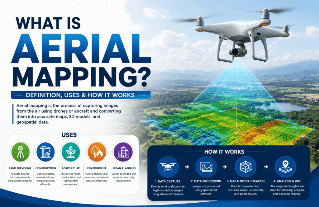
What Is Aerial Mapping Definition, Uses & How It Works
Aerial scanning has become a practical option for projects that require broad site coverage, difficult-terrain access, or repeatable spatial documentation. UAVs equipped with RGB cameras or LiDAR sensors can collect detailed information from above while reducing the need for survey crews to physically access every part of a site. For readers who want to understand the broader mapping process, this guide to what drone mapping is provides useful background.
Ground-based scanning remains important for indoor environments, close-range measurements, and applications that require controlled observation positions. The right method depends on the project’s accuracy requirements, site conditions, equipment, processing workflow, regulatory requirements, and total cost.
What Is Aerial Scanning?
Aerial scanning uses an unmanned aerial vehicle (UAV) equipped with a sensor to collect spatial information from above. Depending on the project, the system may use RGB imagery, LiDAR, thermal sensors, or multispectral cameras.
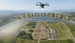
Photogrammetry uses overlapping photographs to reconstruct three-dimensional information. LiDAR uses laser pulses to measure distances and generate three-dimensional point clouds. If you want a broader explanation of the technology and its applications, this drone mapping guide explains how UAV-based mapping fits into professional geospatial workflows.
Aerial scanning can produce:
- Orthomosaic maps
- Point clouds
- Digital terrain models
- Digital surface models
- 3D models
- Contour information
- CAD-compatible data
- GIS datasets
The value of aerial scanning extends beyond aerial photography. A properly designed survey creates spatial data that can support surveying, construction, engineering, inspection, mapping, site documentation, and asset management.
When Is Aerial Scanning More Practical?
Aerial scanning becomes particularly useful when the physical characteristics of a site make conventional ground-based data collection inefficient.
Large Outdoor Areas
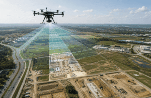
Large sites can require significant field time when survey personnel must physically cover the area. A UAV can collect imagery or LiDAR data across a broad site during a planned flight.
Construction sites, mines, quarries, industrial properties, agricultural land, transportation corridors, and large infrastructure projects can benefit from this approach.
The efficiency comes from collecting consistent spatial information across the site without requiring personnel to occupy every location.
Difficult or Hazardous Terrain
Steep slopes, unstable ground, stockpiles, flood-affected areas, and active construction zones can create challenges for ground-based surveying.
Aerial scanning allows the survey team to collect information remotely while the UAV covers areas that may be difficult or unsafe to reach directly.
This does not make UAV operations risk-free. Weather, obstacles, airspace restrictions, battery limitations, and site conditions still require appropriate planning.
Repeated Site Surveys
Projects that require regular documentation can also benefit from aerial acquisition.
Construction teams can use repeat surveys to document progress. Mining operations can compare stockpile conditions. Infrastructure teams can monitor changes across a site.
Consistency becomes important when datasets from multiple dates need to be compared. Similar flight planning, positioning, ground control, and processing methods can improve the reliability of those comparisons.
When the Overall Site Context Matters
Ground-based scanners collect detailed information around their observation positions. Aerial scanning provides a broader perspective across the site.
An aerial dataset can show relationships between terrain, structures, roads, drainage, vegetation, and other features. This broader context can support planning and GIS-based analysis.
When Are Ground-Based Methods More Practical?
Ground-based scanning provides detailed information around the scanner’s observation position, while aerial systems can cover larger outdoor areas. The differences become clearer when comparing drone mapping with land surveying, particularly in terms of coverage, accessibility, equipment, and measurement requirements.
Indoor Environments
UAVs generally do not provide the same practical advantages inside buildings. Terrestrial laser scanners, mobile mapping systems, total stations, and other ground-based instruments can provide better access and control.
Warehouses, industrial facilities, commercial buildings, mechanical rooms, and other enclosed spaces often require ground-based acquisition.
Close-Range Measurements
A terrestrial scanner can be positioned close to the object being measured. This approach can provide detailed geometry for structures, components, equipment, and other localized features.
For a small site or individual component, deploying a UAV may add unnecessary operational and processing requirements.
Controlled Measurement Positions
Some applications require measurements from specific observation locations or directions. Ground-based equipment can provide this controlled geometry more directly.
Areas Hidden From the Air
Vegetation, buildings, roofs, overhangs, and other obstructions can prevent an aerial sensor from seeing certain surfaces.
Ground-based scanning can complement aerial data by capturing areas that remain hidden from above.
For complex sites, combining aerial and terrestrial methods can provide better coverage than relying on either technology alone.
How Accurate Is Aerial Scanning?
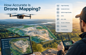
Aerial scanning accuracy depends on the complete survey workflow rather than the UAV alone.
Important factors include:
- Sensor quality and calibration
- Flight altitude
- Ground Sampling Distance (GSD)
- Image overlap
- GNSS positioning
- RTK or PPK corrections
- Ground Control Points
- Independent checkpoints
- Terrain characteristics
- Vegetation
- Lighting and weather
- Processing methodology
- Quality assurance
Resolution and accuracy are also different measurements. Detailed imagery does not automatically produce equally accurate spatial measurements.
A professional project should establish its required accuracy before data collection begins. The sensor, positioning method, flight plan, control strategy, processing workflow, and validation method can then be selected around that requirement.
The American Society for Photogrammetry and Remote Sensing (ASPRS) provides standards for assessing positional accuracy in digital geospatial data. The U.S. Geological Survey (USGS) also publishes technical resources covering UAS, remote sensing, photogrammetry, and geospatial applications.
What Equipment Does Aerial Scanning Require?
When photographs contain sufficient overlap and the mission follows an appropriate acquisition plan, photogrammetry software can use the imagery to reconstruct three-dimensional information. This process is explained in greater detail in this guide to drone photogrammetry. Equipment selection depends on the survey area, required accuracy, environmental conditions, and final deliverables.
UAV Platform
Multirotor UAVs are widely used because they can take off and land vertically and operate effectively over localized areas.
Fixed-wing platforms can be useful for certain large-area surveys because their flight characteristics allow efficient coverage over greater distances.
Platform selection should consider:
- Flight endurance
- Payload capacity
- Survey size
- Terrain
- Launch conditions
- Required sensor
- Weather conditions
RGB Cameras
RGB cameras support photogrammetric mapping and visual documentation.
When photographs contain sufficient overlap and the mission follows an appropriate acquisition plan, photogrammetry software can use the imagery to reconstruct three-dimensional information.
LiDAR Sensors
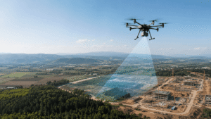
LiDAR measures distance using laser pulses and records the observations as a three-dimensional point cloud.
LiDAR can be particularly useful for terrain mapping and for some environments where vegetation makes image-based reconstruction more difficult.
Positioning Systems
GNSS provides positioning information for the UAV. RTK and PPK workflows can improve spatial control when properly configured.
Ground Control Points can provide additional geographic reference. Independent checkpoints can then help evaluate the positional accuracy of the final dataset.
New Jersey Drones can select UAV and sensor configurations according to the site’s physical conditions, required coverage, accuracy requirements, and intended data products rather than treating one equipment configuration as suitable for every project.
How Is Aerial Scanning Data Processed?
Raw aerial data must be processed before it becomes a usable surveying or engineering product.
For photogrammetry, software identifies common features across overlapping photographs. These observations help estimate camera positions and reconstruct three-dimensional information.The complete process involves more than capturing images. Mission planning, data acquisition, positioning, processing, and final quality control all influence the resulting dataset. A detailed explanation of how drone mapping works can help explain the relationship between these stages.
Depending on the project, processing can produce:
- Aligned imagery
- Sparse and dense point clouds
- Orthomosaics
- Digital surface models
- Digital terrain models
- 3D meshes
- Measurements
LiDAR follows a different processing workflow. Laser observations are converted into a georeferenced point cloud. The points can then be classified and filtered for applications such as terrain modeling.
The processed datasets can be brought into GIS, CAD, surveying, engineering, and 3D visualization workflows.
Quality control remains an essential part of processing. A visually detailed model does not automatically represent an accurate survey.
Is Aerial Scanning More Cost-Effective?
Aerial scanning can reduce total project costs, but it is not automatically cheaper than ground-based surveying.
A meaningful cost comparison should consider the complete workflow. Labor, equipment, mobilization, travel, site access, acquisition time, processing, quality control, regulatory requirements, and repeat surveys can all affect the final cost.
Consider two different projects.
A small indoor facility may be more efficiently surveyed with terrestrial scanning. A large outdoor property may require substantial ground coverage, making UAV acquisition more practical.
Accuracy requirements also influence cost. A project requiring RTK, PPK, ground control, independent checkpoints, LiDAR, or detailed processing requires more resources than basic aerial documentation.
The more useful question is therefore not “Is drone scanning cheaper?” but “Which method meets the project requirements with the appropriate level of field and processing effort?”
What Regulatory Requirements Affect Aerial Scanning?
Regulatory requirements should be considered before the survey begins. Rules vary between countries and can also depend on the aircraft, location, airspace, and type of operation.
A project may need to address:
- UAV registration
- Pilot or operator requirements
- Airspace restrictions
- Restricted areas
- Property or site permissions
- Privacy requirements
- Operating limitations
- Visual Line of Sight requirements
In the United States, the Federal Aviation Administration (FAA) regulates civil drone operations and provides requirements applicable to commercial UAV activities.
Operators should verify the rules that apply to the specific project location before planning the flight. Regulatory requirements can affect the schedule, operating area, equipment, staffing, and project cost.
For professional aerial scanning, regulatory compliance should be treated as part of project planning rather than as an issue to address immediately before launch.
Real-World Example: U.S. Geological Survey UAS Applications
The U.S. Geological Survey has used unmanned aircraft systems for mapping, environmental monitoring, scientific research, and remote-sensing applications.
USGS work demonstrates an important point about aerial scanning: the aircraft is only one part of the measurement system. Sensor selection, mission planning, positioning, data processing, and validation all influence the usefulness of the final dataset.
This approach becomes particularly valuable where conventional field collection would require extensive access across difficult terrain.
The broader lesson applies to commercial surveying as well. A UAV can reduce acquisition effort, but the resulting data still needs to meet the technical requirements of the intended application.
Source: U.S. Geological Survey — UAS research and applications
What Are the Main Advantages of Aerial Scanning?
Aerial scanning offers several practical advantages when project conditions match its strengths.
Large-Area Coverage
A UAV can collect spatial information across extensive outdoor areas without requiring personnel to walk through every section.
Difficult-Terrain Access
Aerial acquisition can reduce the need for personnel to enter steep, remote, unstable, or otherwise difficult terrain.
Repeatable Documentation
Repeat missions can provide comparable datasets for construction progress, site monitoring, volumetric analysis, and change detection.
Reduced Ground Exposure
Remote data collection can reduce personnel exposure to certain site hazards. Appropriate operational and site safety procedures remain necessary.
Multiple Data Products
One survey can support multiple outputs, including orthomosaics, point clouds, elevation models, 3D models, and GIS datasets.
Broader Site Understanding
The aerial perspective can reveal relationships between terrain, structures, roads, drainage, and other site features that may be difficult to interpret from individual ground positions.
How Can Aerial Scanning Improve Project Workflows?
The value of aerial scanning extends beyond data collection. A well-planned survey can provide a reusable spatial dataset that supports several stages of a project.
For example, construction teams can use the same aerial dataset for site documentation, progress comparison, volume calculations, and coordination. Engineers can use processed terrain information as part of design workflows. Asset managers can retain aerial records for future comparison.
This creates an important distinction between collecting data and creating usable project information.
The latter depends on how the dataset is processed, checked, organized, and delivered.
A professional workflow should therefore establish the required deliverables before the flight. If the final requirement is a survey-grade surface model, the acquisition strategy should reflect that requirement from the beginning.
What Is the Future of Aerial Scanning?
The future of aerial scanning is moving toward integrated workflows that combine UAV platforms, advanced sensors, automated processing, GIS, CAD, and three-dimensional visualization.
LiDAR and imaging systems continue to evolve, while onboard computing and automated flight technologies can improve data acquisition. Computer vision and machine-learning methods are also being applied to tasks such as object detection, point-cloud classification, and change analysis.
These technologies do not eliminate the need for professional oversight. Someone still needs to determine whether the data is suitable for the intended application and whether the resulting measurements satisfy the project specification.
Integration will become increasingly important. Aerial datasets can feed GIS platforms, CAD environments, 3D models, and digital-twin workflows.
The long-term value of aerial scanning will therefore depend not only on better UAV hardware, but also on reliable positioning, sensor calibration, data interoperability, processing, validation, and regulatory compliance.
When Should You Choose Aerial Scanning?
Aerial scanning is worth considering when:
- The project covers a large outdoor area.
- Terrain makes ground access difficult.
- Repeat surveys are required.
- Broad site context is important.
- Stockpile or terrain measurements are needed.
- 3D mapping forms part of the deliverable.
- Ground-based acquisition would require substantial field labor.
Ground-based methods may be more appropriate when:
- The project is indoors.
- Close-range detail is the priority.
- The survey covers a small area.
- Specific observation positions are required.
- Buildings or vegetation block important surfaces.
- Highly controlled local measurements are required.
A combined approach can be more effective for complex projects. UAV data can provide broad site coverage, while terrestrial equipment can capture detailed areas that aerial sensors cannot adequately observe.
FAQs
Is aerial scanning more accurate than conventional ground-based scanning?
Neither method is universally more accurate. Accuracy depends on the sensor, positioning, control, acquisition geometry, environment, processing, and project specification. Ground-based scanning often provides strong close-range detail, while properly controlled aerial surveys can produce accurate large-area spatial datasets.
How accurate can aerial scanning be?
Aerial scanning accuracy varies by project. Flight altitude, GSD, sensor calibration, image overlap, GNSS, RTK or PPK, ground control, terrain, processing, and validation all affect the result. Accuracy should be established according to the project’s requirements rather than based on a universal claim.
Can aerial scanning replace terrestrial laser scanning?
No. UAV and terrestrial systems have different strengths. UAVs work well for broad outdoor coverage, while terrestrial scanners are often better suited to indoor environments and close-range geometry. Complex projects can benefit from combining both technologies.
Is aerial scanning cheaper than ground surveying?
Aerial scanning can be more cost-effective for large or difficult sites, but there is no universal cost advantage. Labor, equipment, mobilization, processing, regulatory requirements, accuracy specifications, and site conditions all influence the total project cost.
What sensors are used for aerial scanning?
Common sensors include RGB cameras and LiDAR. RGB cameras support photogrammetry and visual mapping, while LiDAR produces laser-based point clouds. Multispectral and thermal sensors support specialized applications where spectral or temperature information is relevant.
Does aerial scanning require RTK or PPK?
Not every project requires RTK or PPK. These positioning technologies can improve spatial control for projects with higher accuracy requirements. The appropriate positioning strategy depends on the required deliverables, survey conditions, ground control, and accuracy specification.
What factors affect aerial scanning accuracy?
Sensor characteristics, flight altitude, GSD, image overlap, positioning, ground control, calibration, terrain, vegetation, lighting, weather, processing, and quality assurance can all affect accuracy. These factors should be considered during project planning rather than after data collection.
What are the main limitations of aerial scanning?
Weather, airspace restrictions, vegetation, physical obstructions, battery limitations, regulatory requirements, and difficult lighting can affect UAV surveys. Aerial scanning can also be less suitable for indoor environments and close-range measurements where ground-based equipment provides better access.
Can aerial and ground-based scanning be used together?
Yes. A UAV can provide broad site coverage while terrestrial equipment captures detailed geometry in selected areas. The datasets can be registered to a common coordinate system when the project requires both large-scale context and close-range detail.
What regulations apply to aerial scanning?
Regulations vary by country and operating environment. Requirements can include UAV registration, operator qualifications, airspace restrictions, site permissions, privacy considerations, and operational limitations. Operators should verify the requirements established by the relevant aviation authority before conducting the survey.
Conclusion
Aerial scanning becomes particularly practical when a project requires extensive outdoor coverage, difficult-terrain access, repeat documentation, or broad spatial context. UAV photogrammetry and LiDAR can produce valuable datasets for surveying, construction, engineering, inspection, mapping, and site documentation.
Conventional ground-based methods remain essential for indoor environments, close-range measurements, and applications requiring controlled local observations. In many projects, combining aerial and terrestrial scanning provides the best balance between coverage and detail.
The right technology should be selected according to the project’s accuracy requirements, site conditions, accessibility, regulatory constraints, equipment, processing workflow, and total cost. The UAV is only the data-collection platform; the quality of the final result depends on the complete measurement process.
For organizations evaluating UAV-based mapping or scanning, New Jersey Drones can provide an aerial approach based on the project’s site conditions, coverage requirements, sensor needs, and intended deliverables.
References
- Federal Aviation Administration (FAA). Unmanned Aircraft Systems.
https://www.faa.gov/uas - U.S. Geological Survey (USGS). UAS and Remote Sensing Research.
https://www.usgs.gov/ - American Society for Photogrammetry and Remote Sensing (ASPRS). Positional Accuracy Standards for Digital Geospatial Data.
https://www.asprs.org/ - National Institute of Standards and Technology (NIST). Measurement and Robotics Research.
https://www.nist.gov/