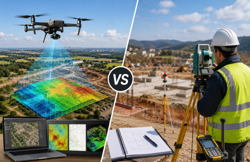
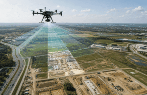
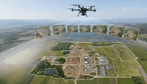
Visual comparison of drone mapping and traditional land surveying, highlighting aerial data collection, ground surveying methods, and modern geospatial technology used in construction, engineering, mining, and infrastructure projects.
When planning a construction project, land development, mining operation, agricultural survey, or environmental assessment, one question often comes up: Should you use drone mapping or traditional land surveying?
At first glance, both methods seem to accomplish the same goal. They collect spatial data, measure land, and help professionals make informed decisions. However, they work in very different ways and are designed for different types of projects.
Drone mapping uses unmanned aerial vehicles (UAVs) equipped with high-resolution cameras or LiDAR sensors to capture large amounts of aerial data in a short time. That data is then processed into products such as orthomosaic maps, 3D models, Digital Elevation Models (DEMs), and point clouds.
Traditional land surveying takes a different approach. Licensed surveyors use precision instruments like Total Stations, GNSS receivers, RTK GPS systems, and digital levels to collect highly accurate ground measurements. These measurements are essential for legal property boundaries, construction layouts, engineering control, and certified survey documents.
The choice isn’t about deciding which technology is “better.” Instead, it’s about understanding which method is best suited to your project’s objectives. In many modern projects, drone mapping and traditional surveying work together to deliver faster results without compromising accuracy.
In this guide, you’ll learn how both methods compare in terms of workflow, accuracy, speed, cost, equipment, applications, and legal considerations. By the end, you’ll have a clear understanding of when to use drone mapping, when traditional surveying is the better choice, and why many professionals combine both for the best results.
Quick Answer
Question
Answer
What is the biggest difference?
Drone mapping quickly captures aerial data across large areas, while land surveying focuses on highly accurate ground measurements for legal and engineering purposes.
Which is faster?
Drone mapping can survey hundreds of acres in a fraction of the time required for traditional field surveying.
Which is more accurate?
Both methods can achieve centimeter-level accuracy when using RTK, PPK, and Ground Control Points (GCPs). However, legal boundary surveys still require licensed land surveyors.
Which is more cost-effective?
Drone mapping usually reduces labor costs and project timelines for large sites, while traditional surveying remains essential for boundary surveys and construction staking.
Can drones replace land surveyors?
No. Drones are valuable data collection tools, but licensed surveyors are still responsible for legal surveys, certified measurements, and boundary verification.
What Is Drone Mapping?
Drone mapping is the process of using Unmanned Aerial Vehicles (UAVs) to capture aerial photographs or LiDAR data and convert that information into accurate geospatial products. Rather than taking a few images for visual reference, mapping drones collect hundreds or even thousands of overlapping images during a carefully planned flight. Specialized software then processes those images into detailed maps and 3D models that professionals can measure, analyze, and share.
Compared with traditional ground surveys, drone mapping allows large areas to be documented much more quickly while still producing highly detailed spatial data. It has become a preferred solution for industries that need frequent site updates, terrain analysis, or large-scale mapping.
Typical outputs from a drone mapping project include:
Orthomosaic maps
Digital Elevation Models (DEMs)
Digital Surface Models (DSMs)
Digital Terrain Models (DTMs)
Contour maps
3D point clouds
3D mesh models
Stockpile volume calculations
Cut-and-fill analysis
Surface measurements
Vegetation index maps (NDVI and NDRE)
GIS-ready datasets
These deliverables help engineers, surveyors, project managers, and environmental professionals make informed decisions using accurate geospatial information.
How Drone Mapping Works
Although the software handles much of the processing automatically, successful drone mapping follows a structured workflow. Every stage contributes to the quality and accuracy of the final results.
A typical project includes the following steps:
Plan the flight mission based on project requirements.
Capture overlapping aerial photographs or LiDAR scans.
Upload the collected data into photogrammetry software.
Process the imagery into geospatial products.
Verify accuracy using RTK, PPK, or Ground Control Points (GCPs).
Export the final datasets for use in GIS, CAD, BIM, or engineering software.
Careful planning, consistent image overlap, and proper quality checks are essential. Even small mistakes during data collection can affect the accuracy of the finished map.
Common Deliverables from Drone Mapping
One of the biggest advantages of drone mapping is the variety of datasets it can produce. The exact deliverables depend on the project’s objectives, but most mapping missions generate one or more of the following.
Orthomosaic Maps
An orthomosaic combines hundreds or thousands of aerial images into a single, high-resolution map. Because distortions are corrected during processing, users can accurately measure distances, areas, and locations directly from the map.
Digital Elevation Models (DEM)
A DEM represents the elevation of the bare ground, excluding trees, buildings, and other structures. Engineers commonly use these models for drainage studies, terrain analysis, road planning, and infrastructure design.
Digital Surface Models (DSM)
Unlike a DEM, a DSM includes everything visible on the surface, including vegetation, buildings, vehicles, and other objects. This makes it useful for urban planning, construction, and environmental analysis.
Digital Terrain Models (DTM)
A Digital Terrain Model provides a refined representation of the Earth’s surface by combining elevation data with additional terrain information. DTMs are widely used in civil engineering and land development projects.
Contour Maps
Contour maps display changes in elevation using lines that connect points of equal height. These maps help planners visualize slopes, drainage patterns, and terrain characteristics.
3D Point Clouds
Point clouds consist of millions of spatial data points that recreate real-world objects in three dimensions. They provide a highly detailed representation of terrain, buildings, and infrastructure.
3D Mesh Models
A 3D mesh model connects point cloud data into a realistic digital surface, making it easier to visualize buildings, landscapes, and complex structures.
Volume Measurements
Mining companies, construction firms, and quarry operators often use drone mapping to calculate stockpile volumes and estimate earthmoving quantities with greater efficiency.
Vegetation Index Maps
Multispectral drones can generate vegetation indices such as NDVI and NDRE, helping farmers monitor crop health, identify plant stress, and improve field management.
Technologies Used in Drone Mapping
Modern drone mapping combines several advanced technologies to produce accurate and reliable datasets. Each technology serves a specific purpose, and many projects use multiple solutions together.
Photogrammetry
Photogrammetry creates maps and 3D models by analyzing hundreds or thousands of overlapping photographs. By identifying common points across multiple images, the software reconstructs the landscape in remarkable detail.
Because it requires only a high-quality camera and mapping software, photogrammetry remains the most widely used drone mapping technique for construction, land development, mining, and surveying projects.
LiDAR
LiDAR, or Light Detection and Ranging, measures distances using laser pulses instead of photographs. Since laser beams can often penetrate vegetation, LiDAR is particularly effective for mapping forests, dense vegetation, and areas where bare-earth terrain models are required.
While LiDAR systems are generally more expensive than camera-based solutions, they provide exceptional accuracy in challenging environments.
RTK (Real-Time Kinematic)
RTK technology improves positional accuracy by receiving real-time correction data from a GNSS base station during the flight. This significantly reduces GPS errors and produces more precise geospatial datasets.
RTK drones are commonly used for engineering, infrastructure, and professional surveying projects where accuracy is critical.
PPK (Post-Processed Kinematic)
PPK applies positioning corrections after the flight rather than during data collection. It offers greater flexibility, especially in locations where maintaining a stable real-time correction signal is difficult.
Many professionals choose PPK for remote projects because it delivers consistent positioning accuracy without relying on a continuous connection to a base station.
Ground Control Points (GCPs)
Ground Control Points are clearly marked locations with precisely known coordinates. They improve the alignment of aerial imagery, reduce positioning errors, and provide an independent method for validating mapping accuracy.
Even with RTK and PPK technology, GCPs remain an important part of many high-precision mapping projects.
Industries That Rely on Drone Mapping
Drone mapping has become a valuable tool across a wide range of industries because it delivers accurate data quickly while reducing fieldwork and improving safety.
Construction
Construction teams use drone mapping to monitor project progress, calculate earthwork volumes, compare site conditions with design plans, and improve project documentation throughout the construction lifecycle.
Mining
Mining operations rely on drones for stockpile measurements, pit monitoring, terrain modeling, and volumetric calculations. Aerial surveys also improve worker safety by reducing the need to access hazardous areas.
Agriculture
Farmers use drone mapping to monitor crop health, detect irrigation problems, evaluate plant growth, and support precision agriculture practices that improve yields while reducing resource waste.
Infrastructure Inspection
Roads, bridges, railways, pipelines, transmission lines, and utility corridors can all be inspected more efficiently using drones. High-resolution aerial imagery allows engineers to identify issues without exposing workers to unnecessary risks.
Environmental Monitoring
Government agencies, researchers, and environmental consultants use drone mapping to monitor wetlands, forests, rivers, coastal erosion, flood zones, and wildlife habitats. Repeatable aerial surveys also make it easier to track environmental changes over time.
Why Drone Mapping Has Become So Popular
The growing demand for drone mapping isn’t simply driven by new technology. Organizations are adopting it because it solves real-world challenges more efficiently than many traditional data collection methods.
Faster Data Collection
A mapping drone can capture hundreds of acres in a single flight, allowing survey teams to complete projects much faster than manual field surveys.
Improved Safety
Drones reduce the need for personnel to enter hazardous locations such as active construction sites, mining pits, steep slopes, flood zones, or unstable terrain.
High-Resolution Data
Modern mapping drones capture extremely detailed imagery with centimeter-level Ground Sampling Distance (GSD), making it possible to create accurate maps and realistic 3D models.
Lower Operational Costs
For large projects, drone mapping often reduces labor requirements, minimizes equipment mobilization, and shortens project timelines. These efficiencies can significantly lower overall survey costs.
Better Decision-Making
Drone-generated orthomosaics, terrain models, and 3D visualizations give engineers, surveyors, and project managers a clear understanding of site conditions. This helps teams identify potential issues earlier, improve planning, and make more informed decisions throughout the project.
Internal Linking Opportunity: If you’re new to aerial mapping and want to understand the complete workflow, software options, accuracy factors, and real-world applications, continue with our Complete Drone Mapping Guide. It provides a comprehensive overview of everything you need to know before starting a drone mapping project.
What Is Land Surveying?
Land surveying is the science of accurately measuring and mapping the Earth’s surface. It provides the precise ground measurements needed to establish property boundaries, support engineering projects, guide construction, and create legally recognized land records.
Unlike drone mapping, which captures large amounts of aerial data in a relatively short time, traditional land surveying focuses on collecting highly accurate measurements directly on the ground. Surveyors use specialized instruments to determine exact positions, elevations, distances, and angles, ensuring that every measurement meets strict engineering and legal standards.
Because many surveying projects involve property ownership, public infrastructure, and regulatory compliance, they are typically carried out by licensed land surveyors who are qualified to certify the accuracy of their work.
Although drone technology has transformed the geospatial industry, traditional surveying remains the foundation for projects where legal precision and engineering-grade measurements are essential.
Primary Objectives of Land Surveying
Land surveying supports a wide range of engineering, construction, and legal activities. While the exact scope depends on the project, surveyors are commonly responsible for:
Establishing property boundaries
Preparing legal land records
Supporting construction layout and staking
Measuring elevations and terrain
Creating topographic surveys
Verifying engineering designs
Resolving boundary disputes
Providing survey control for mapping projects
Because these tasks often have legal implications, they require certified measurements and strict adherence to national surveying standards.
Equipment Used in Traditional Land Surveying
Professional surveyors rely on highly accurate instruments to collect dependable field measurements. Each piece of equipment plays a specific role in the surveying process.
Total Stations
A Total Station combines an electronic theodolite with an electronic distance meter (EDM). It measures horizontal angles, vertical angles, and distances with exceptional precision, making it one of the most widely used tools for construction layout and engineering surveys.
GNSS Receivers
Global Navigation Satellite System (GNSS) receivers determine precise geographic coordinates using satellite signals. They are commonly used to establish survey control points and collect accurate positioning data across large project sites.
RTK GPS Systems
Real-Time Kinematic (RTK) GPS systems improve positioning accuracy by receiving correction data from a nearby base station or network. RTK allows surveyors to achieve centimeter-level accuracy in real time, making it ideal for engineering and construction projects.
Digital Levels
Digital levels are used to determine differences in elevation between points. They play a vital role in road construction, drainage design, and infrastructure projects where accurate height measurements are required.
Data Collectors
Modern surveying instruments connect to handheld data collectors that store measurements digitally. These devices simplify fieldwork, reduce manual errors, and streamline data transfer to office software.
Laser Scanners
Laser scanners capture millions of measurements in a short period, creating highly detailed point clouds of buildings, infrastructure, and terrain. They are commonly used for complex engineering projects and heritage documentation.
Survey Tripods and Prisms
Tripods provide stable support for surveying instruments, while prisms reflect laser signals back to the Total Station for accurate distance measurements.
Together, these tools enable surveyors to produce reliable measurements that meet engineering specifications and legal requirements.
Drone Mapping vs Land Surveying: Complete Comparison
Although both technologies collect spatial data, they are designed for different purposes. Drone mapping is optimized for rapid aerial data collection over large areas, while traditional surveying focuses on precise ground measurements for engineering and legal applications.
The comparison below highlights where each method performs best.
Feature
Drone Mapping
Traditional Land Surveying
Primary Purpose
Large-area aerial mapping
Precise ground measurements
Coverage Area
Hundreds of acres per flight
Smaller areas measured point by point
Speed
Very fast
Slower fieldwork
Accuracy
Centimeter-level with RTK/PPK and GCPs
Survey-grade precision
Boundary Surveys
Not typically used for legal boundaries
Industry standard
Construction Layout
Supports planning and monitoring
Primary layout method
Equipment
Drone, camera, RTK/PPK, LiDAR
Total Station, GNSS receiver, RTK GPS
Labor Requirements
Smaller field crew
Larger field crew
Common Deliverables
Orthomosaics, DEMs, DSMs, 3D models
Boundary plans, construction layouts, legal survey documents
Best Industries
Construction, mining, agriculture, utilities
Engineering, legal surveying, infrastructure
Large Project Costs
Lower operational costs
Higher labor costs
Data Collection Method
Aerial
Ground-based
GIS Integration
Excellent
Excellent
Key Takeaway
Drone mapping and traditional land surveying are not competing technologies. They solve different problems. Drone mapping is ideal for capturing detailed aerial information quickly, while traditional surveying delivers the certified measurements required for engineering design, legal documentation, and construction layout.
How Drone Mapping and Land Surveying Work
Although both methods generate spatial data, their workflows are very different. Drone mapping emphasizes automation and large-scale aerial data collection, while traditional surveying relies on carefully measured ground observations.
Understanding these workflows makes it easier to choose the right approach for a specific project.
Drone Mapping Workflow
Drone mapping follows a structured digital process that transforms aerial imagery into accurate geospatial products.
Site Assessment and Mission Planning
Every successful mapping project begins with careful planning.
Before launching the drone, the operator evaluates the project site, checks weather conditions, reviews local airspace restrictions, and defines flight settings such as altitude, image overlap, flight speed, and Ground Sampling Distance (GSD).
Taking the time to plan properly helps ensure complete image coverage and minimizes the risk of missing data.
Data Collection
Once the mission begins, the drone follows a pre-programmed flight path and automatically captures hundreds or even thousands of overlapping images.
Depending on the project, the aircraft may carry different payloads, including:
RGB camera
LiDAR sensor
Multispectral camera
Thermal camera
Most mapping missions use approximately 75-85% forward overlap and 65-80% side overlap to provide enough image redundancy for accurate photogrammetry processing.
Data Processing
After the flight, the captured data is imported into specialized mapping software.
The software automatically performs several processing steps, including:
Aligning aerial images
Creating a sparse point cloud
Building a dense point cloud
Generating a Digital Surface Model (DSM)
Creating a Digital Elevation Model (DEM)
Producing an orthomosaic map
Building a 3D mesh model
This workflow converts thousands of photographs into accurate geospatial datasets that can be used in GIS, CAD, and engineering software.
Quality Assurance
Professional mapping projects always include a quality control stage before deliverables are released.
Survey teams typically verify:
Horizontal accuracy
Vertical accuracy
Ground Control Point accuracy
RTK or PPK corrections
Coordinate systems
Processing errors
Complete image coverage
Only after these checks are complete are the final datasets delivered to the client.
Traditional Land Survey Workflow
Traditional surveying follows a more hands-on process because measurements are collected directly from the ground rather than from the air.
Although it requires more fieldwork, this approach delivers the precision needed for legal and engineering applications.
Project Planning
The survey begins by reviewing the project requirements, legal records, existing control points, engineering drawings, and site conditions.
This planning stage determines the survey method, required equipment, and measurement accuracy needed for the project.
Establish Survey Control
Surveyors establish permanent or temporary control points using GNSS receivers or Total Stations.
These control points serve as reference locations for every measurement collected during the survey and help maintain consistency across the entire project.
Ground Measurements
With the control network in place, surveyors begin collecting detailed field measurements.
Common equipment includes:
Total Stations
RTK GPS systems
GNSS receivers
Digital levels
Unlike drone mapping, which captures an entire site during a single flight, traditional surveying records each point individually to achieve maximum precision.
Data Processing and Deliverables
After fieldwork is complete, the measurements are imported into CAD and GIS software for processing.
Depending on the project, surveyors may produce:
Boundary maps
Topographic surveys
Construction layout plans
Engineering drawings
Legal survey documents
Site control reports
These deliverables become the foundation for construction, land development, infrastructure design, and property documentation.
Key Takeaway
Both workflows produce valuable geospatial information, but they are built around different objectives. Drone mapping prioritizes speed, efficiency, and comprehensive aerial coverage, while traditional land surveying focuses on precision, legal compliance, and engineering-grade measurements. In many modern projects, combining both approaches delivers the most accurate and cost-effective results.
Accuracy Comparison
One of the first questions clients ask is, “Which method is more accurate?”
The answer isn’t as simple as choosing one technology over the other. Accuracy depends on how the project is planned, the equipment being used, the conditions on-site, and how the collected data is processed.
Drone mapping can deliver centimeter-level accuracy when the mission is carefully planned and supported with technologies such as RTK, PPK, and Ground Control Points (GCPs). It is an excellent choice for construction monitoring, topographic mapping, mining, agriculture, and many engineering projects where accurate spatial data is essential.
Traditional land surveying, however, remains the preferred approach whenever legally certified measurements are required. Since surveyors collect measurements directly on the ground using precision instruments, it continues to be the industry standard for property boundaries, construction staking, and engineering control.
Rather than asking which method is more accurate, it’s more useful to ask which method is best suited for your project’s objectives.
What Affects Drone Mapping Accuracy?
The quality of a drone mapping project depends on several factors working together. Even advanced drones cannot compensate for poor planning or weak data collection practices.
Some of the biggest factors include:
Flight altitude
Camera quality and sensor performance
Front and side image overlap
RTK corrections
PPK processing
Ground Control Point placement
Weather conditions
GNSS signal quality
Photogrammetry software
Pilot and processing experience
A well-planned mission with good overlap and accurate positioning will usually produce far better results than a rushed flight using expensive equipment.
What Affects Traditional Survey Accuracy?
Traditional surveying is equally dependent on following proven field procedures.
Survey-grade accuracy relies on:
Properly calibrated instruments
A reliable survey control network
Clear line of sight between equipment
Experienced survey professionals
Stable environmental conditions
Correct field measurement techniques
Because measurements are collected directly on the ground and verified throughout the survey, traditional surveying continues to provide the highest level of confidence for legal documentation and engineering projects.
RTK vs PPK vs Ground Control Points (GCPs)
Many newcomers assume that buying an RTK drone removes the need for Ground Control Points. In practice, professional survey teams often use these technologies together because each one serves a different purpose.
RTK (Real-Time Kinematic)
RTK improves positioning while the drone is flying by receiving real-time correction data from a nearby GNSS base station or network.
Its main benefits include:
Higher positioning accuracy during flight
Faster field workflow
Fewer Ground Control Points required
Reduced processing time
For many commercial mapping projects, RTK provides an excellent balance between efficiency and accuracy.
PPK (Post-Processed Kinematic)
Instead of applying corrections during the flight, PPK processes positioning data afterward.
This approach offers several advantages:
Works well where real-time correction signals are unreliable
Provides greater flexibility in remote locations
Produces consistent positioning results
Offers an additional layer of quality control
PPK is often preferred for projects in challenging environments where maintaining a stable RTK connection isn’t practical.
Ground Control Points (GCPs)
Ground Control Points remain an important part of professional surveying, even when RTK or PPK is available.
They help by:
Independently verifying mapping accuracy
Reducing systematic positioning errors
Improving vertical accuracy
Strengthening quality assurance
Providing confidence in the final deliverables
For projects that demand the highest level of precision, many professionals combine RTK, PPK, and strategically placed GCPs. This hybrid approach delivers reliable, survey-grade results while reducing the risk of costly errors.
Equipment Comparison
Although both methods collect spatial data, the tools they rely on are quite different because their goals are different.
Drone mapping is designed to gather large amounts of aerial data quickly, while traditional surveying focuses on collecting highly precise measurements directly from the ground.
Drone Mapping Equipment
Traditional Survey Equipment
Mapping Drone
Total Station
RTK Drone
GNSS Receiver
RGB Camera
RTK GPS
LiDAR Scanner
Digital Level
Multispectral Camera
Survey Prism
Flight Planning Software
Data Collector
Photogrammetry Software
CAD Software
GIS Software
GIS Software
Each tool plays a specific role in the overall workflow.
Drone equipment is optimized for rapid aerial data capture and digital mapping, while traditional surveying instruments are built for precision measurement, layout, and legal documentation.
Instead of replacing one another, these technologies are increasingly being used together to improve both efficiency and accuracy.
Cost Comparison
Project cost isn’t determined by equipment alone. Labor requirements, project size, field time, travel, and processing all influence the overall budget.
For large sites, drone mapping is often the more economical option because it can collect extensive data in a short amount of time with a smaller field crew.
Organizations frequently reduce costs through:
Less field labor
Fewer site visits
Shorter project timelines
Reduced equipment mobilization
Improved operational safety
Traditional surveying may require more personnel and longer fieldwork, especially on expansive sites. However, it remains the most practical investment for projects involving legal boundaries, construction staking, or engineering control where certified measurements are essential.
Ultimately, the most cost-effective solution depends on the project’s objectives rather than the technology itself.
Speed Comparison
When project deadlines are tight, speed becomes a major consideration.
Drone mapping has a clear advantage for covering large areas because a single automated flight can collect thousands of measurements in a relatively short time. Traditional surveying, on the other hand, gathers data point by point, which naturally requires more field time.
Here’s a general comparison:
Project Size
Drone Mapping
Traditional Surveying
10 Acres
Less than 1 hour for field capture
Several hours to a full day
100 Acres
A few hours
Multiple days
Large Infrastructure Corridor
Multiple automated flights over a short period
Several days or even weeks, depending on terrain and crew size
While drones significantly reduce data collection time, processing the imagery and validating the results are still essential parts of the workflow.
Traditional surveying remains the preferred choice whenever certified ground measurements or legal documentation are required.
For many organizations, combining both methods delivers the best balance of speed, accuracy, and reliability.
Best Applications of Drone Mapping
Drone mapping has become a valuable tool across many industries because it combines speed, accuracy, and detailed aerial data collection. Instead of spending days gathering measurements on the ground, organizations can capture large areas in a few flights and generate maps, 3D models, and analytical reports that support better decision-making.
Below are some of the industries where drone mapping delivers the greatest value.
Construction & Infrastructure
Construction sites change quickly, making regular progress tracking essential. Drone mapping gives project managers an up-to-date view of the entire site without disrupting ongoing work.
It is commonly used to:
Monitor construction progress
Compare completed work with design plans
Measure earthworks
Document site conditions
Improve communication between project teams
Typical deliverables include:
Orthomosaic maps
Digital Terrain Models (DTMs)
Cut-and-fill reports
Volume calculations
Progress reports
3D site models
By collecting consistent data throughout the project, teams can identify potential issues earlier, reduce costly rework, and keep stakeholders informed.
Mining & Quarrying
Mining operations often cover large and difficult terrain, making traditional data collection both time-consuming and hazardous.
Drone mapping enables mining companies to collect accurate site information without sending personnel into high-risk areas.
Common applications include:
Stockpile volume calculations
Open-pit monitoring
Terrain analysis
Haul road planning
Site expansion planning
Typical deliverables are:
Stockpile volume reports
Contour maps
Digital Elevation Models (DEMs)
3D mine models
Progress reports
With frequent aerial surveys, mining teams can improve planning, monitor production, and maintain safer operations.
Precision Agriculture
Modern farming increasingly relies on data to improve crop performance and reduce unnecessary costs. Drone mapping gives farmers a clear picture of field conditions, allowing them to respond before small problems become major ones.
Common applications include:
Crop health monitoring
Irrigation analysis
Plant stress detection
Field scouting
Precision fertilizer planning
Drone mapping can generate:
NDVI maps
NDRE maps
Crop health reports
Irrigation analysis
Plant count maps
Having access to accurate field data helps farmers optimize water usage, reduce fertilizer waste, and improve overall productivity.
Environmental Monitoring
Environmental agencies, conservation groups, and consulting firms use drone mapping to monitor natural resources with greater efficiency and less environmental disturbance.
Common projects include:
Flood assessment
Coastal erosion studies
Wetland monitoring
Forest management
Wildlife habitat analysis
River and watershed monitoring
Because drone surveys can be repeated using the same flight plan, organizations can accurately compare environmental changes over time.
Utilities & Energy
Inspecting utility infrastructure often involves hazardous locations and difficult terrain. Drone mapping allows inspections to be completed safely while minimizing service disruptions.
Utility companies commonly use drones for:
Power line inspections
Pipeline corridor mapping
Solar farm monitoring
Wind turbine inspections
Substation documentation
Typical outputs include:
Corridor maps
Infrastructure inspection reports
Thermal imagery
Vegetation encroachment analysis
3D infrastructure models
These datasets help maintenance teams identify issues sooner and plan repairs more efficiently.
Urban Planning & Smart Cities
Cities are increasingly using drone mapping to support planning, infrastructure development, and long-term asset management.
Drone-generated data assists with:
Road planning
Land development
Utility planning
Flood modeling
Zoning analysis
Digital twin creation
Accurate aerial datasets help planners evaluate existing conditions, assess future development opportunities, and make informed decisions backed by current spatial information.
Best Applications of Traditional Land Surveying
Although drone technology has transformed how spatial data is collected, traditional land surveying remains essential for projects requiring legal accuracy and engineering precision.
There are many situations where certified ground measurements are not only preferred but legally required.
Property Boundary Surveys
Determining property boundaries remains one of the primary responsibilities of licensed land surveyors.
Boundary surveys are used to:
Identify property corners
Verify boundary markers
Locate easements
Detect encroachments
Resolve ownership disputes
While drone imagery can provide valuable supporting information, legal boundary determinations generally require certified surveying procedures and professional oversight.
Construction Layout (Stakeout)
Before construction begins, surveyors establish the precise locations of key structural elements to ensure the project follows the approved engineering plans.
Construction layout typically includes:
Building corners
Foundations
Roads
Bridges
Utilities
Pipelines
Accurate stakeout work helps reduce construction errors and keeps projects aligned with design specifications.
Engineering Surveys
Large infrastructure projects depend on highly accurate ground measurements before construction begins.
Engineering surveys support projects such as:
Highways
Airports
Railways
Bridges
Dams
Water distribution systems
These surveys provide the reliable control data engineers need for design, planning, and construction.
Cadastral Surveys
Cadastral surveys establish land ownership for legal documentation, taxation, and government records.
These surveys must comply with strict national and regional surveying standards and are performed by qualified professionals.
Utility & Infrastructure Layout
Surveyors also establish the exact locations of underground and above-ground utilities before construction begins.
This includes:
Water lines
Sewer systems
Gas pipelines
Electrical networks
Fiber-optic infrastructure
Accurate positioning helps prevent costly mistakes during construction and ensures compliance with engineering requirements.
Why Modern Surveyors Combine Both Methods
Today’s surveying professionals rarely view drone mapping and traditional surveying as competing technologies.
Instead, they combine the strengths of both to create a faster, more efficient, and highly accurate workflow.
A typical hybrid workflow looks like this:
Establish Survey Control
A licensed surveyor begins by setting accurate control points using GNSS receivers or Total Stations.
Plan the Drone Mission
The mapping mission is designed by defining:
Flight altitude
Image overlap
Ground Sampling Distance (GSD)
Flight path
Project objectives
Capture Aerial Data
The drone collects high-resolution imagery or LiDAR data across the entire project area.
Process the Data
Photogrammetry software converts the collected data into:
Orthomosaic maps
Digital Elevation Models (DEMs)
Digital Surface Models (DSMs)
Point clouds
3D models
Validate Accuracy
Surveyors verify the final outputs using:
RTK corrections
PPK processing
Ground Control Points (GCPs)
Quality assurance procedures
Deliver Engineering-Ready Data
The completed datasets are integrated into GIS, CAD, and BIM platforms for design, analysis, construction planning, and long-term asset management.
This hybrid workflow combines the speed of drone mapping with the precision of traditional surveying, giving engineers, planners, and project managers reliable data without sacrificing quality.
Advantages of Drone Mapping
Drone mapping has become the preferred solution for many large-scale projects because it delivers detailed spatial data quickly, safely, and efficiently.
Some of its biggest advantages include:
Faster Data Collection
A single flight can capture hundreds of acres in a relatively short time, dramatically reducing fieldwork compared with traditional methods.
Improved Safety
Survey teams can collect information without entering hazardous locations such as:
Active construction sites
Open-pit mines
Steep slopes
Highways
Disaster zones
Lower Project Costs
By reducing labor requirements, minimizing site visits, and shortening project timelines, drone mapping often lowers the overall cost of large-area surveys.
High-Resolution Deliverables
Modern mapping drones produce:
Orthomosaic maps
DEMs
DSMs
Point clouds
3D models
These datasets provide detailed information for planning, engineering, and analysis.
Better Project Documentation
Each flight creates a permanent visual record of site conditions, making it easier to monitor progress, compare historical data, and communicate updates with clients and stakeholders.
Limitations of Drone Mapping
Like any technology, drone mapping has limitations. Understanding them helps organizations choose the right solution for each project.
Some common limitations include:
Weather Dependency
Strong winds, heavy rain, fog, and poor visibility can delay flights and reduce image quality.
Limited Battery Life
Most mapping drones require multiple battery changes when covering large project areas.
Regulatory Requirements
Drone operations must comply with local aviation rules, restricted airspace regulations, and privacy laws.
Dense Vegetation
Standard photogrammetry may struggle to capture ground elevations beneath dense tree cover.
In these situations, LiDAR often provides better results.
Processing Requirements
Capturing aerial images is only one part of the workflow.
Producing accurate deliverables also requires:
Powerful computer hardware
Specialized software
Experienced data processing
Legal Restrictions
Although drone mapping supports engineering and planning, legal boundary surveys generally remain the responsibility of licensed land surveyors.
Advantages of Traditional Land Surveying
Traditional surveying continues to play an essential role in projects that demand certified measurements and legal documentation.
Its primary advantages include:
Legally recognized boundary surveys
Highly accurate ground measurements
Reliable construction staking
Strong regulatory compliance
Precise engineering control networks
Trusted data for infrastructure development
For projects involving property ownership, legal disputes, construction layout, or engineering control, traditional land surveying remains the industry standard.
Key Takeaway
Drone mapping and traditional land surveying each have distinct strengths. Drone mapping is ideal for collecting detailed aerial data quickly across large areas, while traditional surveying provides the legal accuracy and engineering precision required for boundary surveys and construction projects.
Rather than replacing one another, these methods work best together. By combining drone technology with conventional surveying techniques, organizations can improve efficiency, maintain survey-grade accuracy, and deliver more reliable results across a wide range of geospatial projects.
Common Myths About Drone Mapping and Land Surveying
There are plenty of misconceptions about drone mapping and traditional land surveying. While both technologies are used to collect spatial data, they’re often misunderstood or compared unfairly.
Let’s separate the myths from the facts.
Drones Will Replace Land Surveyors
One of the most common myths is that drones will eventually eliminate the need for professional land surveyors.
The reality is very different.
Drones are outstanding tools for collecting aerial data quickly and efficiently, but they don’t replace the expertise of licensed surveyors. Surveyors establish legal property boundaries, create certified survey documents, verify measurements, and provide engineering control that drones alone cannot legally deliver in many jurisdictions.
Reality: Drone mapping makes surveyors more productive. It doesn’t replace the knowledge, responsibility, or legal authority of licensed professionals.
Drone Mapping Is Always More Accurate
Many people assume that collecting thousands of aerial images automatically produces more accurate results.
Accuracy doesn’t depend on the number of photographs. It depends on the quality of the entire workflow.
Several factors influence mapping accuracy, including:
Flight planning
Camera quality
RTK or PPK positioning
Ground Control Points (GCPs)
Image overlap
Weather conditions
Processing software
Operator experience
A poorly planned drone mission can produce unreliable data, while a professionally executed survey can achieve exceptional accuracy.
Reality: The technology alone doesn’t determine accuracy. Good planning, proper equipment, and experienced operators make the difference.
RTK Eliminates the Need for Ground Control Points
RTK drones have significantly improved positioning accuracy, leading some people to believe that Ground Control Points are no longer necessary.
In practice, many professional surveying firms still use GCPs because they provide an independent way to verify mapping accuracy.
Ground Control Points help:
Validate horizontal and vertical accuracy
Reduce systematic errors
Strengthen quality assurance
Increase confidence in the final deliverables
Reality: RTK improves positioning, but GCPs remain an important part of many high-accuracy mapping projects.
Traditional Land Surveying Is Outdated
With the rise of drone technology, some people assume traditional surveying is becoming obsolete.
That’s far from the truth.
Ground-based surveying continues to play a critical role in:
Property boundary surveys
Construction staking
Utility layout
Engineering control
Government infrastructure projects
Legal documentation
Many projects simply cannot move forward without certified survey data collected by licensed professionals.
Reality: Traditional surveying remains the foundation of legal and engineering work, while drones expand what survey teams can accomplish.
LiDAR Is Always Better Than Photogrammetry
LiDAR is a powerful technology, but it isn’t automatically the best solution for every project.
Photogrammetry performs exceptionally well when capturing detailed imagery of open terrain, construction sites, stockpiles, and infrastructure.
LiDAR becomes the better choice when projects involve:
Dense forests
Heavy vegetation
Bare-earth terrain models
Complex natural environments
Each technology has strengths, and choosing the right one depends on the project requirements rather than assuming one is universally superior.
Reality: LiDAR and photogrammetry complement each other. The best option depends on your goals, terrain, budget, and the type of data you need.
(FAQs)
What is the difference between drone mapping and land surveying?
Drone mapping uses UAVs to capture aerial imagery and create products such as orthomosaic maps, 3D models, and elevation data. Traditional land surveying relies on ground-based instruments to establish precise measurements for property boundaries, engineering projects, and construction layouts. Both methods often work together rather than replacing one another.
Can drone mapping replace traditional land surveying?
No. Drone mapping improves the speed and efficiency of collecting spatial data, but licensed land surveyors are still required for legal boundary surveys, certified measurements, and many engineering applications.
Is drone mapping accurate enough for construction projects?
Yes. When combined with proper flight planning, RTK or PPK positioning, Ground Control Points, and high-quality processing, drone mapping can achieve centimeter-level accuracy suitable for many construction, mining, and infrastructure projects.
Which is faster: drone mapping or traditional surveying?
Drone mapping is generally much faster for large sites because it captures extensive aerial data during automated flights. Traditional surveying collects measurements point by point, making it more time-consuming on expansive projects.
Which method is more cost-effective?
For large-area mapping, drone mapping often reduces labor costs, field time, and site visits. Traditional surveying remains the better investment for projects requiring legal documentation, construction staking, or certified engineering measurements.
Do RTK drones still require Ground Control Points?
RTK technology improves positioning accuracy and can reduce the number of Ground Control Points needed. However, many professionals still use GCPs to verify accuracy, improve quality assurance, and strengthen confidence in the final dataset.
Which industries benefit the most from drone mapping?
Drone mapping is widely used in construction, mining, agriculture, utilities, infrastructure inspection, forestry, environmental monitoring, renewable energy, and urban planning because it provides fast, accurate, and detailed geospatial data.
When should LiDAR be used instead of photogrammetry?
LiDAR is usually the better choice for mapping dense vegetation, forests, or projects that require accurate bare-earth terrain models. Photogrammetry is often more cost-effective for open areas where high-resolution imagery and 3D models are the primary goals.
Can GIS integrate drone mapping and survey data?
Yes. Modern GIS platforms can combine drone imagery, LiDAR point clouds, GNSS measurements, CAD drawings, and traditional survey data into a unified geospatial workflow for mapping, analysis, and decision-making.
What software is commonly used for drone mapping?
Some of the most widely used drone mapping platforms include Pix4D, Agisoft Metashape, DJI Terra, Trimble Business Center, ArcGIS Pro, QGIS, Global Mapper, and AutoCAD Civil 3D. The right software depends on your workflow, project requirements, and the deliverables you need.
Conclusion
Drone mapping and traditional land surveying are often presented as competing technologies, but in practice, they solve different problems and are most effective when used together.
Drone mapping offers a fast and efficient way to capture detailed aerial data across large areas, making it ideal for applications such as construction monitoring, mining, agriculture, environmental studies, and infrastructure inspections. Traditional land surveying, on the other hand, provides the precision, legal certainty, and engineering control required for property boundaries, construction staking, and certified measurements.
As geospatial technology continues to evolve, more organizations are adopting a hybrid approach that combines the strengths of both methods. Using drones for rapid data collection and traditional surveying for verification and control allows teams to improve efficiency without compromising accuracy.
If you’re planning a mapping or surveying project, the best choice isn’t about selecting one technology over the other. It’s about understanding your project’s goals and using the right combination of tools to achieve reliable, high-quality results.