How Accurate Is Drone Mapping?
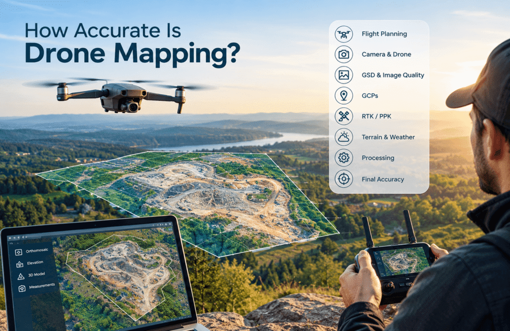
Drone mapping provides detailed aerial information for measuring and understanding land and project sites.
TL;DR
- Drone mapping can be highly accurate when the project is planned and carried out properly.
- There is no single accuracy number that applies to every drone mapping project.
- The final result depends on the drone, camera, flight height, image quality, positioning, ground references, terrain, weather and processing.
- A smaller GSD can show more ground detail, but it does not automatically mean the map is more accurate.
- Ground Control Points (GCPs) can help connect the map to known locations on the ground.
- RTK and PPK can provide more precise positioning information in suitable workflows.
- The right level of accuracy depends on what the map will be used for.
- For some engineering, legal or professional surveying work, additional survey methods may still be required.
How Accurate Is Drone Mapping?
Drone mapping can be highly accurate, but the actual level of accuracy depends on how the entire project is planned and carried out. The drone and camera matter, but so do flight height, image quality, positioning, ground references, weather, terrain and the way the photographs are processed.
The important thing to understand is that “accurate” does not mean the same thing for every project.
Someone may need a general aerial map to understand a property. A construction company may need measurements to monitor a site. An engineer may need reliable information for a much more demanding project. A landowner may simply want a clear view of the land.
These projects all use drone mapping, but they do not necessarily require the same level of accuracy.
Expert Note: Accuracy should be treated as a project requirement, not simply as a specification of the drone itself.
Key Takeaway: The accuracy of a drone map depends more on the complete mapping process than on the drone alone.
What Does Accuracy Mean in Drone Mapping?
In simple terms, accuracy means how closely the information on the map matches the real world.
Imagine a drone map showing the corner of a building. The question is not simply whether the building looks clear in the image. The real question is:
How close is that mapped building corner to its actual location on the ground?
The same idea applies to measurements.
Suppose you use a drone map to measure the distance between two points. Accuracy means asking:
How close is that measurement to the actual distance in the real world?
This is an important distinction because a map can look extremely detailed without automatically being accurate enough for every purpose.
Image quality, image resolution and GSD are related to how much detail you can see. They do not, by themselves, prove how accurately that information is positioned on the ground.
For example, a photograph may clearly show a small object, but that does not automatically mean the object’s exact location has been mapped correctly.
That is why professional drone mapping looks at the complete process rather than judging accuracy from appearance alone.
Expert Note: A sharp, detailed image is useful, but visual quality alone does not prove that a map is accurate.
Key Takeaway: Accuracy is about how closely mapped locations and measurements represent the real world—not simply how good the map looks.
Is There One Standard Accuracy for Drone Mapping?
No. There is no single accuracy standard that applies to every drone mapping project.
The level of accuracy you need depends on the purpose of the project and how the final information will be used.
Several things can change the accuracy requirement, including:
- The purpose of the mapping
- The size of the area
- The type of terrain
- The drone and camera being used
- Flight height
- Image quality
- Positioning information
- Ground control
- Required measurements
- Client requirements
- Professional or legal requirements
For example, a property owner who wants a general aerial view does not necessarily need the same level of accuracy as a construction company using drone data to support detailed site work.
The same applies to land mapping. A map used for general planning may have different requirements from information used for engineering or property-related work.
This is why it can be misleading to say something like, “Drone mapping is accurate to X centimeters” without explaining the project and the process behind the result.
Expert Note: Avoid treating one accuracy number as the universal standard for all drone mapping.
Key Takeaway: The better question is not “How accurate is a drone?” but “How accurate does this project need to be?”
What Factors Affect Drone Mapping Accuracy?
Several parts of a drone mapping project can affect the final result. A good drone helps, but it is only one part of the process.
Drone and Camera
The drone and camera are the starting point.
A good camera can capture clear photographs with enough detail for the mapping project. Camera quality, sensor size, lens quality, image resolution and the stability of the drone can all affect the photographs collected during the flight.
However, buying a better drone does not automatically produce a more accurate map.
A high-end drone flown poorly can produce a worse result than a less expensive drone used with careful planning and good conditions.
The camera also needs to be suitable for the job. If important ground features are difficult to see in the photographs, the final map may not contain enough useful information.
Expert Note: A high-quality drone does not automatically guarantee a high-quality map. The way it is used matters just as much.
Flight Height
Flight height has a direct relationship with the amount of ground detail captured in each photograph.
In general:
Higher flight → larger GSD → less ground detail
Lower flight → smaller GSD → more ground detail
GSD, or Ground Sampling Distance, simply describes how much real-world ground is represented by each pixel in an image.
A lower GSD generally means the photographs contain more visible ground detail. But that does not mean you should always fly as low as possible.
The right flight height depends on the size of the area, the details you need to capture, safety considerations and the purpose of the project.
For a deeper explanation, see What Is GSD in Drone Mapping?.
Key Takeaway: Choose flight height based on the needs of the project rather than simply trying to fly as low as possible.
Image Overlap
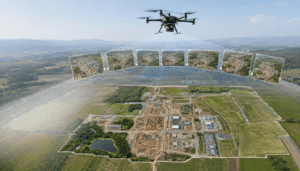
A drone mapping project normally uses many photographs rather than one large photograph.
These photographs need enough shared visual information so they can be connected when the final map is created.
Think about taking photographs of a long road. Each image should show part of the area already captured in the previous image. This gives the mapping process enough information to understand how the photographs fit together.
If there is not enough shared information between images, parts of the project may become difficult to connect correctly.
However, good overlap alone does not guarantee an accurate map. It is one part of good flight planning.
Expert Note: Image overlap supports a reliable mapping process, but overlap by itself cannot guarantee accuracy.
Weather and Lighting
Weather can have a bigger effect on mapping than beginners often expect.
Strong wind can make it harder to keep the drone stable. Rain can affect the flight and image quality. Changing sunlight can create shadows that make some ground features difficult to identify.
Other problems can include:
- Strong shadows
- Haze
- Poor visibility
- Changing light
- Rain
- Strong wind
A site that looks perfect from the ground may not produce useful mapping photographs under poor conditions.
Key Takeaway: Good mapping starts with usable photographs, and good photographs start with suitable flying conditions.
Terrain
The shape of the land also matters.
Flat ground is generally easier to map than an area with major changes in elevation. Slopes, uneven ground, vegetation and other features can make the project more challenging.
For example, a large flat field may be relatively straightforward. A site with steep slopes, trees and different ground levels may require more careful planning.
Terrain should therefore be considered before the drone takes off.
Positioning
The drone also needs reliable information about where it is during the flight.
Standard GPS/GNSS positioning can provide location information. More advanced options such as RTK and PPK can provide more precise positioning information when the appropriate equipment and setup are available.
You do not need to think of these as complicated technologies. Their basic purpose in mapping is to improve the location information associated with the photographs.
However, better positioning does not remove the need to plan the project properly or check the final result.
Ground Control Points
Ground Control Points, commonly called GCPs, are known locations on the ground that can be used as references when creating and checking a map.
Think of them as fixed points whose real-world locations are already known.
They can help connect the drone imagery to the actual ground and can be especially useful when a project has higher accuracy requirements.
GCPs are not simply about placing as many points as possible. Their location, measurement quality and distribution across the site all matter.
For more information, see What Are Ground Control Points (GCPs) in Drone Mapping?.
Processing
The work does not end when the drone lands.
The photographs and positioning information need to be processed to create the final map.
The quality of that processing can affect the result. Problems in the photographs, missing information, incorrect settings or mistakes during processing can affect the final output even if the flight itself went well.
That is why accuracy should be considered from the beginning of the project through to the final quality check.
Does GSD Affect Drone Mapping Accuracy?
GSD affects the amount of ground detail visible in drone imagery, but GSD and accuracy are not the same thing.
This is one of the most common points of confusion for people who are new to drone mapping.
GSD, or Ground Sampling Distance, tells you how much real-world ground is represented by one pixel in an image.
In simple terms:
GSD = ground detail
Accuracy asks a different question:
How closely does the mapped information match its real-world position or measurement?
For example, imagine two drone maps of the same property. One has a smaller GSD and shows smaller ground features more clearly.
That can be very useful.
But clearer detail does not automatically mean that every feature on the map is positioned more accurately.
This is why the following statement should be avoided:
“A 2 cm GSD means 2 cm accuracy.”
GSD describes image detail. It does not promise the same level of overall mapping accuracy.
Accuracy can also be affected by flight planning, camera quality, positioning, ground control, terrain, image quality and processing.
If you want to understand the difference in more detail, read What Is GSD in Drone Mapping?.
Expert Note: A smaller GSD can give you more visible ground detail, but it does not automatically provide better overall accuracy.
Key Takeaway: GSD tells you about image detail; accuracy tells you how closely the final mapped information matches reality.
Do GCPs Improve Drone Mapping Accuracy?
GCPs can improve the reliability of a drone mapping project by providing known ground references.
The basic idea is straightforward.
The drone collects photographs that contain visual information.
GCPs provide known locations on the ground.
The mapping process brings these pieces of information together to create the final result.
In simple terms:
Drone imagery → visual information
GCPs → known ground reference
Processing → final mapping result
The quality of the GCPs matters. Their measurements need to be reliable, and their placement should make sense for the project.
It can also be useful to have independent checkpoints. These are measured ground locations that are kept separate from the points used to control the map. They can then be used to check how well the final result matches known locations.
More GCPs do not automatically mean a better map.
If the points are poorly measured or badly distributed, simply adding more of them may not solve the problem.
Expert Note: More GCPs do not automatically produce a more accurate map. Their placement, measurement quality and purpose matter.
Key Takeaway: Well-planned ground control is more valuable than simply using a large number of ground points.
For a detailed explanation, see What Are Ground Control Points (GCPs) in Drone Mapping?.
Is RTK or PPK Drone Mapping More Accurate?
RTK and PPK are two ways of improving the positioning information associated with drone flights.
RTK can provide more precise positioning information while the drone is operating, provided the required setup and corrections are available.
PPK uses positioning information that is processed after the flight.
Their basic roles can be understood like this:
| Method | Basic Role |
|---|---|
| Standard positioning | Provides normal location information |
| RTK | Provides more precise positioning during operation |
| PPK | Processes positioning information after the flight |
| GCPs | Provides known ground references |
It is important not to treat these options as interchangeable.
RTK and PPK focus on positioning information. GCPs provide known references on the ground. They can work together depending on the project.
It is also incorrect to assume that RTK automatically eliminates the need for GCPs in every situation.
Some projects may be completed with less reliance on traditional GCP workflows when RTK or PPK is used appropriately. Other projects may still benefit from ground references and independent checks.
The right choice depends on the accuracy requirement, equipment, site and intended use of the final map.
Expert Note: RTK and PPK can reduce reliance on traditional GCP workflows in some projects, but they do not make every quality-control step unnecessary.
Key Takeaway: RTK, PPK and GCPs address different parts of the mapping process and should be selected according to the project.
What Is the Difference Between Relative and Absolute Accuracy?
There are two useful ways to think about mapping accuracy: relative accuracy and absolute accuracy.
Relative Accuracy
Relative accuracy is about how well features relate to each other within the mapped area.
For example, imagine a site with two buildings.
If the buildings appear in the correct relationship to each other, the map may have good internal consistency.
Absolute Accuracy
Absolute accuracy is about how closely those features match their actual real-world positions.
A map could show two buildings in the correct relationship to each other but still be shifted slightly from their true locations.
This distinction becomes especially important when the map is being used for measurements, construction or survey-related work.
The fact that everything looks consistent does not automatically prove that the entire map is correctly positioned in the real world.
Expert Note: A map can have very good internal consistency while still having an overall position error.
Key Takeaway: Relative accuracy describes how features fit together; absolute accuracy describes how closely they match their real-world locations.
How Accurate Is Drone Mapping for Different Projects?
The answer changes depending on what the drone map is being used for.
Construction Mapping
Construction teams can use drone mapping for:
- Site progress
- Earthwork
- Stockpile measurements
- Site documentation
- Planning
- General project monitoring
For a construction project, the required accuracy depends on how the information will be used.
A progress image may have different requirements from measurements that will influence important construction decisions.
Expert Note: Construction projects that require precise control should establish their accuracy requirements before the drone flight begins.
Agriculture
Drone mapping can help with:
- Field boundaries
- Area calculations
- Crop monitoring
- General field documentation
For agriculture, the usefulness of the map may depend more on the specific task than on achieving one universal accuracy level.
Real Estate
Real estate professionals and property owners may use aerial mapping for:
- Property overviews
- Land documentation
- Development visualization
- Site presentation
A general property overview may not require the same level of accuracy as a professional project involving detailed measurements or legal boundaries.
Mining and Quarrying
Drone mapping can be useful for:
- Stockpile measurements
- Surface monitoring
- Site changes
- General site documentation
Because these projects can involve large areas and changing surfaces, careful flight planning and consistent data collection are important.
Land Mapping
Land mapping can support:
- General site mapping
- Terrain information
- Development planning
- Property documentation
Again, the required accuracy depends on how the information will ultimately be used.
Survey and Engineering
Surveying and engineering projects can have specific accuracy requirements. Some applications may also have professional or legal requirements that drone mapping alone does not satisfy.
For these projects, the mapping workflow should be designed around the actual requirement rather than assuming that a particular drone or camera automatically meets it.
Key Takeaway: The required accuracy depends on the decision the drone map will support.
Can Drone Mapping Replace a Land Survey?
Not automatically.
Drone mapping can be extremely useful for surveying-related work, but that does not mean it replaces a professional land survey in every situation.
Drone mapping can:
- Support surveying work
- Provide aerial information
- Cover large areas efficiently
- Help document a site
- Support measurements in appropriate workflows
- Help with planning and monitoring
However, professional land surveying may still be required for things such as:
- Legal property boundaries
- Certain engineering work
- Construction control
- Regulatory purposes
- Other professional applications
The important point is that drone mapping and traditional land surveying do not have to compete with each other.
In many cases, they can work together.
A drone can provide a broad view of a site and useful measurements, while a professional survey can provide the information required for specific legal, engineering or property purposes.
Requirements can also vary depending on location and intended use, particularly in the USA, UK and Canada.
Expert Note: Drone mapping should not be presented as universally better, cheaper or more accurate than traditional surveying.
Key Takeaway: Drone mapping and land surveying can complement each other, but they are not interchangeable for every project.
What Can Make a Drone Map Less Accurate?
Even a capable drone can produce a poor mapping result when the overall process is not handled properly.
Common problems include:
- Poor flight planning
- Flying too high for the required level of detail
- Not enough image overlap
- Blurry photographs
- Strong wind
- Poor lighting
- Moving objects
- Dense vegetation
- Uneven terrain
- Poor GCP placement
- Incorrect ground measurements
- Weak positioning information
- Processing problems
- Failing to check the final map
For example, a flight may appear successful because the drone completed the planned route. But if several photographs are blurry or important parts of the site were not captured properly, the final map may still have problems.
Likewise, having a high-quality camera does not solve problems caused by poor planning or difficult weather.
Accuracy is therefore a process, not a feature that can simply be switched on.
Expert Note: A mapping project can fail because of the workflow even when the drone itself is capable of producing excellent imagery.
Key Takeaway: Most mapping problems cannot be solved simply by buying a better drone.
How Can You Improve Drone Mapping Accuracy?
The best way to improve accuracy is to think about the project before the drone leaves the ground.
Before the Flight
Start by defining what the final map needs to accomplish.
Consider:
- What accuracy does the project require?
- What equipment is appropriate?
- What flight height should be used?
- What GSD is suitable?
- Are GCPs needed?
- What is the terrain like?
- Is the weather suitable?
- Will the entire area be captured properly?
This preparation can prevent many problems later.
During the Flight
Once the flight begins:
- Follow the planned route
- Maintain suitable image overlap
- Monitor image quality
- Avoid poor weather when possible
- Make sure important areas are captured
- Watch for problems that could affect the photographs
The goal is to collect consistent, usable imagery rather than simply completing the flight.
After the Flight
The work continues after landing.
You should:
- Review the photographs
- Remove or address obvious image problems
- Process the imagery correctly
- Add GCPs when required
- Use checkpoints when appropriate
- Inspect the final map
- Check important measurements
- Look for unusual distortions or problems
Expert Note: Accuracy is planned before the drone takes off.
Key Takeaway: A professional mapping result comes from the complete workflow—not just the aircraft.
How Do You Check the Accuracy of a Drone Map?
A drone map should not be considered accurate simply because the mapping software successfully created an output.
The final result should be checked against information that can be trusted.
Possible checks include:
- Comparing mapped points with known ground locations
- Using independent checkpoints
- Comparing measurements with known values
- Inspecting the final map
- Looking for unusual distortions
- Checking consistency across the site
Once the photographs have been processed, the final result may include an orthomosaic map, which combines aerial images into a single map-like view of the area. Understanding how an orthomosaic is created can also help you understand what the final drone mapping output represents.
What Is a Checkpoint?
A checkpoint is a measured location on the ground that is kept separate from the points used to control the map.
Its purpose is simple: to provide an independent check of the final result.
This gives you a way to compare the mapped location with a known real-world location.
The exact checking method will depend on the project and the level of confidence required.
The important thing is not to assume that a successful processing result automatically means the map has been proven accurate.
Expert Note: Processing a map and proving its accuracy are two different things.
Key Takeaway: A reliable mapping workflow includes independent checking, not just map creation.
What Accuracy Should You Expect From Your Drone Mapping Project?
Instead of asking for one universal accuracy number, start by defining what you actually need from the project.
Ask yourself:
- What am I mapping?
- How large is the area?
- What details need to be visible?
- Do I need measurements?
- How precise do those measurements need to be?
- Will the map support construction or engineering work?
- Does the project involve legal property information?
- Would GCPs, RTK or PPK be appropriate?
These questions help determine the right approach.
For example, a landowner creating a general map of a property may have very different requirements from an engineering team working on a construction project.
The important thing is to define the expected result before collecting the data.
Expert Note: The required accuracy should be established before data collection, not after the map has already been created.
Key Takeaway: Define the required result first, then choose the flight, camera and positioning approach to match it.
Drone Mapping Accuracy vs GSD vs GCPs
These terms are connected, but each one describes something different.
| Concept | What It Tells You |
|---|---|
| GSD | How much real-world ground each image pixel represents |
| GCP | Provides a known ground reference |
| RTK | Helps provide precise positioning during the operation |
| PPK | Processes positioning information after the flight |
| Accuracy | How closely the final mapped result matches reality |
| Checkpoint | Helps independently evaluate the final result |
It is easy to mix these ideas together, especially when starting with drone mapping.
GSD is mainly about the amount of detail captured in the imagery. GCPs provide known locations on the ground. RTK and PPK help with positioning information. Checkpoints can help evaluate the finished result.
None of these should be treated as a replacement for the entire mapping process.
Expert Note: GSD, GCPs, RTK, PPK, checkpoints and accuracy are related, but they are not interchangeable.
Key Takeaway: Good drone mapping comes from combining the right level of image detail, positioning, ground references and quality checking for the project’s needs.
FAQs
How accurate is drone mapping?
Drone mapping can be highly accurate when the project is properly planned and carried out. The final accuracy depends on the equipment, flight planning, image quality, positioning, ground control, terrain, weather, processing and the purpose of the project.
There is no single accuracy number that applies to every drone map.
Is drone mapping accurate enough for surveying?
It can be accurate enough for many surveying-related applications, but it depends on the specific project.
The required accuracy, equipment, ground control, positioning and professional requirements all need to be considered. Some surveying work may still require a professional land survey or additional survey methods.
Does a smaller GSD mean better accuracy?
No. A smaller GSD generally means more visible ground detail, but it does not automatically mean better overall mapping accuracy.
Accuracy also depends on positioning, image quality, flight planning, ground references, terrain and processing.
Do GCPs improve drone mapping accuracy?
GCPs can improve the reliability of a mapping project by providing known ground references.
Their effectiveness depends on their measurement quality, placement, distribution and the requirements of the project. Simply adding more GCPs does not automatically make a map more accurate.
Is RTK drone mapping more accurate?
RTK can provide more precise positioning information in suitable mapping workflows.
However, RTK does not automatically guarantee a specific level of overall map accuracy, and it does not necessarily eliminate the need for ground references or quality checks.
Can drone mapping replace a land survey?
Not in every situation.
Drone mapping can support surveying, measurements, planning and site documentation, but professional land surveys may still be required for legal property boundaries, certain engineering work and other applications with specific professional requirements.
What affects drone mapping accuracy?
Many factors can affect accuracy, including the drone and camera, flight height, GSD, image overlap, weather, lighting, terrain, positioning, GCPs, image quality and processing.
The entire workflow matters.
How do you check drone mapping accuracy?
You can compare mapped locations with known ground locations, use independent checkpoints, compare measurements with known values and inspect the final map for unusual problems.
A completed map is not automatically an accurate map simply because the processing software finished successfully.
What is the difference between GSD and accuracy?
GSD describes the amount of ground detail represented by each image pixel, while accuracy describes how closely the mapped information matches its real-world position or measurement.
They are related, but they are not the same thing.
What accuracy should I expect from a drone map?
The expected accuracy should be based on the purpose of your project rather than on a universal drone accuracy number.
Before the flight, determine what measurements or information you need, how precise they need to be and whether the project involves construction, engineering, surveying or legal property information.
Conclusion
Drone mapping can be highly accurate, but accuracy does not come from the drone alone.
The final result depends on the complete process: the camera, flight planning, GSD, image quality, positioning, ground references, RTK or PPK when appropriate, processing and final quality checks.
That is why there is no single accuracy number that can honestly describe every drone mapping project.
The best approach is to start with the purpose of the map. Decide what information you need, how precise it needs to be and how the final result will be used. From there, the equipment, flight plan and mapping process can be selected to match those requirements.
For general mapping, construction, agriculture, real estate, mining and land planning, drone mapping can provide valuable information. For projects involving strict engineering, legal or professional surveying requirements, additional survey methods may still be necessary.
In the end, good drone mapping is not simply about getting a drone into the air. It is about planning the right project, collecting useful information and checking the final result.
For a broader understanding of the subject, continue with the Drone Mapping Guide.