What Is GSD in Drone Mapping? A Simple Guide for Beginners
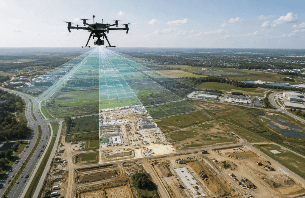
What Is GSD in Drone Mapping
When you look at a drone map, you may notice that some maps show very small details clearly, while others give you a broader view of the land. One of the main things that helps describe this level of detail is GSD, which stands for Ground Sampling Distance.
The name may sound complicated, but the basic idea is quite simple.
GSD tells you how much real ground is represented by one pixel in a drone photograph. For example, if a drone image has a GSD of 2 cm per pixel, each pixel represents about 2 centimeters of ground.
This matters because the GSD you choose can affect how much detail you can see in the final map.
A smaller GSD generally gives you more visible ground detail, while a larger GSD gives you less detail but can make it easier to cover larger areas efficiently.
So, what is GSD in drone mapping, and how do you know what GSD you need?
Let’s break it down step by step.
What Is GSD in Drone Mapping?
GSD, or Ground Sampling Distance, describes how much real-world ground is represented by one pixel in a drone image. A smaller GSD means each pixel represents a smaller piece of ground, which generally allows the image to show finer details.
For example:
- 1 cm/pixel: One pixel represents about 1 cm of ground.
- 2 cm/pixel: One pixel represents about 2 cm of ground.
- 5 cm/pixel: One pixel represents about 5 cm of ground.
- 10 cm/pixel: One pixel represents about 10 cm of ground.
The important thing to remember is that a smaller number usually means more visible detail.
Imagine looking at a construction site from above. If every pixel represents a very small piece of the ground, you may be able to see smaller features more clearly. If every pixel represents a larger area, those small features may not be as easy to identify.
GSD is therefore one way of understanding the level of ground detail captured by drone photographs.
If you are new to drone mapping, it is helpful to think of GSD as a simple connection between the photograph and the real ground below it.
For a broader introduction to how drones are used to create maps, see our Drone Mapping Guide.
GSD Explained With a Simple Example
Let’s make GSD even easier to understand.
Imagine that you are mapping the same piece of land twice.
In the first project, your imagery has a GSD of 1 cm/pixel.
In the second project, the imagery has a GSD of 5 cm/pixel.
The first project generally gives you more visible detail because each pixel represents a much smaller part of the ground.
With a 1 cm GSD, a pixel represents roughly a 1 cm by 1 cm area on the ground.
With a 5 cm GSD, a pixel represents roughly a 5 cm by 5 cm area.
That difference can become important when you are trying to identify smaller features.
A simple way to think about it
Think about looking at a photograph made from many tiny squares.
If each square represents only a very small part of the ground, the photograph can show smaller details.
If each square represents a larger part of the ground, some of those smaller details may disappear.
This is why GSD is often discussed when people talk about the level of detail in drone mapping.
However, GSD is not exactly the same thing as the resolution of a normal screen or photograph. It specifically tells you how much real ground is represented by each pixel in the drone image.
Simple GSD comparison
| GSD | What it generally means |
|---|---|
| 1 cm/pixel | Very detailed ground imagery |
| 2 cm/pixel | High-detail imagery |
| 5 cm/pixel | Moderate level of detail |
| 10 cm/pixel | Lower detail over a larger area |
These are simple examples rather than fixed standards. The right choice depends on what you are trying to accomplish with the mapping project.
Why Does GSD Matter in Drone Mapping?
GSD matters because not every drone mapping project needs the same amount of detail.
Imagine two completely different projects.
One person wants to map a large agricultural field to understand the overall condition of the land. Another person wants to document a relatively small construction site where smaller surface features are important.
They may not need the same level of detail.
A larger area can often be mapped more efficiently when extremely fine detail is not necessary. On the other hand, a project that depends on seeing smaller features may benefit from more detailed imagery.
GSD can affect several practical parts of a mapping project, including:
- How clearly small features appear
- How much detail can be seen in the imagery
- How useful the photographs are for the intended purpose
- How much land can be covered efficiently
- How many photographs may be needed
- How much computer processing may be involved
This does not mean that the smallest possible GSD is always the best choice.
In fact, choosing unnecessarily detailed imagery can make a project more demanding without providing much additional value.
For example, if you are documenting a very large field and only need a general view of the land, you may not need extremely detailed imagery.
The better question is not:
“What is the smallest GSD I can get?”
Instead, ask:
“How much detail does my project actually need?”
That question will help you choose a more practical approach.
Smaller GSD vs. Larger GSD
The easiest way to understand GSD is to compare smaller and larger values.
Smaller GSD
A smaller GSD means each pixel represents a smaller area of the ground.
This generally means:
- More visible ground detail
- Better ability to see smaller features
- Often a lower flight height
- Potentially more photographs
- Potentially more work when processing the imagery
For projects where small details matter, this can be useful.
Larger GSD
A larger GSD means each pixel represents a larger area of the ground.
This generally means:
- Less fine detail
- Larger ground coverage
- Potentially more efficient mapping of large areas
- Less need for extremely detailed imagery
A larger GSD can be perfectly suitable when the project does not require very small features to be visible.
Side-by-side comparison
| Smaller GSD | Larger GSD |
|---|---|
| More visible detail | Less visible detail |
| Smaller ground area per pixel | Larger ground area per pixel |
| Often associated with lower flight heights | Often associated with higher flight heights |
| May require more imagery | May require less imagery |
| Useful when smaller features matter | Useful for broader coverage |
The key point is simple:
Smaller is not automatically better.
The best GSD is the one that gives you enough detail for the job without creating unnecessary work.
How Does Flight Height Affect GSD?
Flight height has a major effect on GSD.
In simple terms, when a drone flies higher above the ground, each pixel generally represents a larger area of ground. This produces a larger GSD.
When the drone flies lower, each pixel generally represents a smaller area of ground, resulting in a smaller GSD.
So the basic relationship looks like this:
Lower flight height → smaller GSD → more ground detail
Higher flight height → larger GSD → less ground detail
For example, imagine you are mapping the same area with the same drone and camera.
If you fly relatively low, the camera is closer to the ground. The photographs can represent smaller areas of ground in each pixel.
If you fly higher, the camera is farther from the ground. Each pixel generally covers a larger area.
However, flight height is not the only thing that determines GSD.
The camera also matters.
The camera’s ability to capture detail, the lens being used, the size of the camera sensor and other parts of the setup can all influence the final result.
Terrain matters too.
If you are mapping a flat field, the distance between the drone and the ground may remain fairly consistent.
If you are mapping an area with hills, slopes, buildings or other changes in height, different parts of the site may be at different distances from the drone.
This is why you should not think of GSD as simply “how high the drone flies.”
It is the result of how the camera captures the ground from a particular distance and setup.
What Factors Affect GSD?
Several things can influence the GSD you get from a drone mapping project.
1. Flight Height
The higher the drone is above the ground, the larger the area represented by each pixel generally becomes.
Flying lower can produce a smaller GSD when conditions and local operating requirements allow it.
2. Camera Resolution
The camera records the ground using pixels.
A camera capable of capturing more image detail can influence the GSD you can achieve from a particular flight setup.
But having a high-resolution camera does not automatically mean your final map will be perfect.
The whole mapping process still matters.
3. Camera Sensor
The camera sensor is the part of the camera that captures light and creates the image.
Different sensors have different characteristics, so the camera setup can affect how much ground is captured and how much detail can be recorded.
You do not need to understand the technical details of sensors to understand GSD.
The simple point is:
Different cameras can produce different results even when the drone flies at a similar height.
4. Lens
The lens affects how much of the ground the camera can see.
Different lenses provide different views, which can affect the relationship between the camera and the ground in the photographs.
5. Drone and Camera Setup
The drone, camera, lens and flight plan work together.
Changing one part of the setup can affect the final imagery.
This is why you should not assume that a flight height that worked well with one drone will produce exactly the same GSD with another setup.
6. Terrain
Uneven terrain can make GSD less consistent across a project.
A drone flying over a flat area has a more consistent distance from the ground.
Over hills, slopes or other uneven surfaces, that distance can change.
7. Image Quality
Even if your planned GSD looks good on paper, blurry or poorly captured photographs can reduce the amount of useful detail in the final result.
Movement, focus problems, difficult lighting and other image-quality issues can all affect the usefulness of the imagery.
GSD vs. Accuracy: Are They the Same Thing?
No. GSD and mapping accuracy are not the same thing.
This is one of the most important points for anyone learning drone mapping.
GSD tells you approximately how much ground each pixel represents.
Accuracy tells you how closely the final map represents the actual location or measurement of something on the ground.
Those are two different ideas.
For example, imagine that a drone project has a GSD of 2 cm/pixel.
It would be incorrect to automatically say:
“The map is accurate to 2 cm.”
That conclusion does not follow from the GSD alone.
A smaller GSD can give you more visible detail, but many other things can affect the accuracy of the final map.
These can include:
- How the flight was planned
- Camera quality
- Image quality
- Position information
- Ground reference information
- Processing methods
- Terrain
- Weather and lighting
- Quality checks
So you could have very detailed imagery but still have problems with the overall location or measurements if other parts of the project were not handled properly.
Think of it this way:
GSD tells you about image detail.
Accuracy tells you about how closely the mapped information matches the real world.
They are related, but they are not interchangeable.
This distinction is especially important for construction, surveying and other projects where measurements matter.
What GSD Should You Use for Drone Mapping?
There is no single GSD that is perfect for every drone mapping project.
The right choice depends on what you need to see, measure or document.
General Site Mapping
If your goal is to create a useful overview of a site, you may not need extremely fine detail.
A moderate level of detail can provide a good balance between image quality and coverage.
Construction Mapping
Construction sites can contain smaller features that may be important to document.
A smaller or moderate GSD may be useful when the project requires more visible site detail.
The exact choice depends on the purpose of the mapping.
Agriculture
Agricultural areas can be very large.
If you are mainly interested in broad field information, you may not need the same level of detail as a small construction project.
A larger GSD may sometimes be sufficient, depending on what you are trying to identify.
Real Estate
For property mapping, the required detail depends on the goal.
A general property overview may not require extremely fine imagery.
If the mapping needs to show smaller site features, a different approach may be more appropriate.
Land and Survey Work
Land projects can have very different requirements.
If the information will be used for measurements or professional survey work, the required level of detail and overall accuracy should be considered together rather than choosing GSD alone.
Large Areas
When mapping a large area, extremely small GSD values can create a huge amount of imagery.
If you do not need that level of detail, choosing a larger GSD may make the project more practical.
The most important rule is:
Choose GSD based on what you need to see and measure, not simply because the smallest number sounds better.
GSD Examples for Different Drone Mapping Projects
The following table gives a general way to think about GSD for different projects.
| Project | Possible GSD Approach | Why |
|---|---|---|
| Large agricultural field | Moderate or larger GSD | Efficient coverage of a large area |
| Construction site | Smaller or moderate GSD | More site detail may be useful |
| Property mapping | Moderate GSD | Useful balance for site documentation |
| Stockpile monitoring | Smaller or moderate GSD | Surface detail may be important |
| General land documentation | Moderate GSD | Balance between coverage and detail |
| Detailed inspection | Smaller GSD | Smaller features may matter |
These are not fixed industry standards.
A construction project, for example, may have completely different requirements from another construction project.
The same applies to agriculture, property mapping and land documentation.
Always begin with the purpose of the project.
How Do You Calculate GSD?
You do not need to be good at mathematics to understand the basic idea behind GSD.
GSD can be estimated using several pieces of information, including:
- The drone’s height above the ground
- The camera sensor
- The size of the image
- The camera lens
In simple terms, GSD depends on how far the camera is from the ground and how the camera captures that ground in the photograph.
A common calculation uses the relationship between flight height, sensor size, image size and lens focal length.
The exact calculation can look intimidating at first, but the concept is straightforward.
If the camera moves farther away from the ground while the rest of the setup stays the same, each pixel generally represents a larger piece of ground.
If the camera moves closer to the ground, each pixel generally represents a smaller piece of ground.
Many drone mapping applications can also estimate the expected GSD during flight planning.
For beginners, the important thing is not memorizing a formula.
It is understanding what the number means.
If your flight plan shows 2 cm/pixel, think:
“Each pixel represents about 2 cm of ground.”
That simple interpretation is often more useful than trying to memorize a complicated calculation.
How to Improve GSD in a Drone Mapping Project
If you need more detailed imagery, there are several practical things you can consider.
1. Adjust Flight Height
Reducing the flight height can produce a smaller GSD when appropriate.
However, the drone should always be operated safely and according to the rules that apply to the location.
2. Use a Suitable Camera
The camera plays an important role in the level of detail you can capture.
Choose equipment that matches the requirements of the project rather than simply buying the most expensive camera.
3. Plan the Flight Carefully
A good flight plan helps ensure that the area is properly photographed.
The drone should capture enough overlapping images so the mapping software has sufficient information to work with.
4. Avoid Blurry Images
A small GSD is not very useful if the photographs are blurry.
Stable flying, suitable camera settings and good capture conditions can help produce clearer imagery.
5. Consider Lighting
Good lighting can make photographs easier to use.
Very difficult lighting conditions can affect image quality and make it harder to capture clear details.
6. Match GSD to the Project
Do not automatically aim for the smallest GSD possible.
If the project does not require very fine detail, a larger GSD may save time and reduce the amount of imagery that needs to be processed.
7. Check the Final Map
A planned GSD is not the same as a guarantee of a high-quality final map.
Always look at the finished result and make sure it contains the detail you actually need.
Common GSD Mistakes Beginners Make
GSD can seem simple once you understand it, but beginners often make a few common mistakes.
Mistake 1: Thinking Smaller GSD Always Means Better Mapping
A smaller GSD generally means more visible detail, but that does not automatically make it the best option for every project.
Mistake 2: Confusing GSD With Accuracy
A 2 cm GSD does not automatically mean the map is accurate to 2 cm.
Mistake 3: Choosing GSD Without Considering the Project
The right GSD depends on what you need to see and measure.
Mistake 4: Ignoring the Camera and Lens
Flight height is important, but the camera setup also matters.
Mistake 5: Flying Too High for a Detail-Heavy Project
If smaller features are important, flying too high may result in imagery that does not show enough detail.
Mistake 6: Ignoring Image Quality
Blurry photographs can reduce the usefulness of detailed imagery.
Mistake 7: Treating a Planned Number as a Guarantee
The GSD shown in a flight plan does not guarantee that the final map will meet every project requirement.
Mistake 8: Using the Same GSD for Every Project
A large farm, construction site, property and detailed inspection may all have different needs.
GSD, Image Resolution and Mapping Quality
These three ideas are often confused, so let’s keep them simple.
GSD
GSD tells you how much real ground is represented by each pixel.
For example, 2 cm/pixel means one pixel represents approximately 2 cm of ground.
Image Resolution
Image resolution refers to the number of pixels available in an image.
A camera may capture a very large image with many pixels.
But having more pixels does not automatically mean the final map will be more accurate or useful.
Mapping Quality
Mapping quality is the bigger picture.
It can depend on:
- GSD
- Image clarity
- Camera quality
- Flight planning
- Image overlap
- Position information
- Processing
- Ground conditions
- Overall quality control
So a high-resolution camera alone is not enough.
Likewise, a very small GSD alone does not guarantee an excellent map.
A good drone mapping project depends on how all these pieces work together.
What GSD Is Best for Beginners?
There is no single perfect GSD for someone who is just starting with drone mapping.
Instead of choosing a number first, start by asking a few basic questions:
- What am I mapping?
- How large is the area?
- What details do I need to see?
- Do I need to make measurements?
- How much time do I have for processing?
- What drone and camera do I already have?
For example, a beginner mapping a large field for general documentation may have very different needs from someone mapping a small construction site.
The goal should be to collect enough detail for the job.
You do not need to make the project unnecessarily complicated just to achieve the smallest possible GSD.
A useful beginner rule is:
Don’t start by asking, “What is the smallest GSD I can get?”
Start by asking:
“What level of detail does my project actually need?”
That approach will help you make better decisions as you gain experience.
GSD and Different Types of Drone Mapping
GSD is especially important when drone mapping is based on photographs.
If you are learning about different mapping methods, it is useful to understand that not all drone data works in exactly the same way.
Photogrammetry
Photogrammetry uses photographs captured by a drone to create mapping products.
Because photographs are made up of pixels, GSD is particularly relevant here.
The GSD helps describe how much ground is represented by each pixel in the imagery.
Orthomosaic Maps
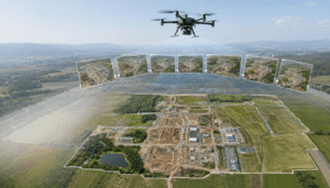
An orthomosaic is a large map created by combining many drone photographs into one image.
GSD helps describe the level of ground detail represented in that imagery.
If you want to learn more about this type of map, see our guide:
What Is an Orthomosaic Map? A Beginner’s Guide
3D Mapping
Drone photographs can also be used to create three-dimensional models of sites and objects.
The amount of visible image detail can affect the information available when creating these models.
LiDAR
LiDAR works differently from ordinary photographic mapping.
It uses laser measurements rather than relying on image pixels in the same way as a normal drone photograph.
Because of this, GSD should not be treated as the same concept for LiDAR data.
If you are comparing mapping methods, this distinction is important.
For a broader explanation of photogrammetry, LiDAR and other methods, see:
Types of Drone Mapping: Photogrammetry, LiDAR & More
FAQs
What does GSD mean in drone mapping?
GSD stands for Ground Sampling Distance. In drone mapping, it describes how much real-world ground is represented by one pixel in a drone image. A smaller GSD generally means more visible ground detail, while a larger GSD generally means less detail.
What is a good GSD for drone mapping?
A good GSD depends on the purpose of the mapping project. A project that requires small details may benefit from a smaller GSD, while a large-area project may work well with a larger GSD. There is no single value that is right for every project.
Is a smaller GSD better?
A smaller GSD generally provides more visible ground detail, but it is not automatically better for every project. Smaller GSD can require lower flights, more photographs and more processing. The right choice depends on what you need to see and measure.
How does altitude affect GSD?
Flying higher generally produces a larger GSD, while flying lower generally produces a smaller GSD. This is because the camera is farther from or closer to the ground. However, the camera, lens and other parts of the setup also affect the final GSD.
Is GSD the same as mapping accuracy?
No. GSD and mapping accuracy are different things. GSD describes the amount of ground represented by each pixel, while accuracy describes how closely the mapped information represents the actual location or measurement on the ground.
What GSD is suitable for construction mapping?
Construction mapping may benefit from a smaller or moderate GSD when smaller site features need to be visible. The appropriate value depends on the size of the site, the details being documented and whether measurements are required.
What GSD is suitable for agriculture?
Agricultural mapping can sometimes use a moderate or larger GSD when the main goal is covering a large area. However, the required detail depends on what you are trying to monitor or analyze in the field.
How do you calculate GSD?
GSD can be estimated using the drone’s height above the ground, camera sensor information, image size and lens characteristics. The basic idea is that the distance between the camera and ground and the way the camera captures the ground determine how much ground each pixel represents.
Does camera resolution affect GSD?
Yes, the camera setup can affect the GSD that a drone mapping project can achieve. Camera resolution, sensor characteristics and lens choice all play a role. However, a high-resolution camera does not automatically guarantee a high-quality or accurate map.
What is the difference between GSD and image resolution?
GSD describes how much real ground each pixel represents, while image resolution describes how many pixels an image contains. They are related, but they are not the same measurement. A high-resolution image does not automatically guarantee better mapping results.
Conclusion
GSD is simply a way to describe how much real ground is represented by each pixel in a drone image.
A smaller GSD generally means that each pixel represents a smaller piece of ground, allowing the imagery to show finer details. A larger GSD generally means less fine detail but can make it more practical to cover large areas.
Flight height can have a major effect on GSD, but it is not the only factor. The camera, lens, terrain and image quality also matter.
Most importantly, GSD is not the same as mapping accuracy. A smaller GSD can provide more visual detail, but it does not automatically guarantee more accurate measurements.
The best GSD is the one that fits the purpose of your project.
Instead of always chasing the smallest number, think about what you actually need to see, document or measure.
Once you understand that, choosing the right GSD becomes much easier.
For a complete overview of drone mapping, its methods, uses and workflow, continue with our Drone Mapping Guide.