DEM vs DSM vs DTM: What’s the Difference?
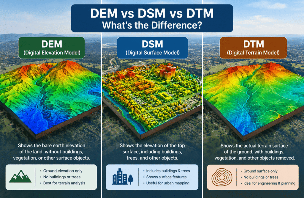
DEM vs DSM vs DTM What’s the Difference
DEM, DSM, and DTM are three terms you will often see when learning about drone mapping and elevation data. They can look similar at first, but they do not always describe the same thing.
The easiest way to remember them is:
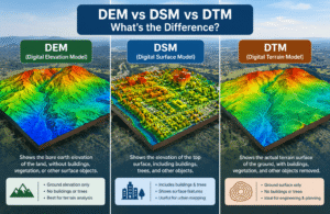
- DSM shows the surface, including buildings, trees, and other objects.
- DTM focuses on the bare ground and terrain.
- DEM is a broader term for an elevation model, and its exact meaning can depend on the software, data provider, or project.
Understanding this difference matters because choosing the wrong elevation model can lead to incorrect measurements, poor planning, or confusion when working with drone mapping data.
If you are new to drone mapping, our complete Drone Mapping Guide is a useful place to start.
TL;DR
| Model | What it represents | Common uses |
|---|---|---|
| DSM | The visible surface, including buildings, trees, and other objects | Construction, vegetation, site planning, roof and surface analysis |
| DTM | The bare ground and natural terrain | Drainage, grading, earthwork, terrain analysis |
| DEM | A general term for elevation data or an elevation model | Terrain and elevation analysis, depending on the source |
The most important difference is simple:
DSM = surface
DTM = ground
DEM = general elevation model term
What Is an Elevation Model?
An elevation model is a digital representation of the height of land or objects across an area.
Instead of looking at a flat map, you can use elevation information to understand how high or low different parts of a site are.
For example, an elevation model can help show:
- hills and valleys
- slopes
- raised areas
- low points
- buildings
- trees
- changes in terrain
- drainage patterns
Drone mapping can collect the imagery needed to create detailed elevation products. If you want to understand the overall process first, see How Does Drone Mapping Work?.
The important point is that not every elevation model represents the same type of surface. That is where DSM, DTM, and DEM become different.
What Is a DSM?
DSM stands for Digital Surface Model.
A DSM represents the top surface of an area.
That means it can include not only the ground, but also objects sitting on the ground.
Depending on the project, a DSM may show:
- buildings
- trees
- vegetation
- vehicles
- structures
- stockpiles
- the natural ground
Imagine flying a drone over a construction site. The drone captures the site from above, and the resulting DSM can show the ground together with buildings, equipment, piles of material, and other visible features.
When Is a DSM Useful?
DSM data is useful when you need to understand what is physically present on the surface.
Common applications include:
- construction progress
- building and roof analysis
- vegetation studies
- solar planning
- site visualization
- stockpile measurements
- surface height analysis
For a broader look at mapping methods, see Types of Drone Mapping: Photogrammetry, LiDAR & More.
Simple Example
Think of a forest.
A DSM can represent the top of the trees because the trees are part of the surface being measured.
That makes a DSM different from a model that tries to show only the ground underneath those trees.
What Is a DTM?
DTM stands for Digital Terrain Model.
A DTM is intended to represent the ground or terrain without surface objects such as trees and buildings.
This makes it particularly useful when the main question is:
“What does the actual ground look like?”
A DTM can help show:
- slopes
- hills
- valleys
- ridges
- low areas
- ground elevation
- terrain changes
When Is a DTM Useful?
DTMs are commonly useful for projects involving the shape and behavior of the ground.
Examples include:
- drainage planning
- grading
- road planning
- earthwork
- terrain analysis
- flood-related studies
- site development
For projects where elevation needs to support land or construction decisions, understanding the difference between drone mapping and traditional surveying can also help. See Drone Mapping vs Land Surveying.
Simple Example
Go back to the forest example.
A DTM attempts to represent the ground underneath the trees rather than the tops of the trees.
So:
DSM → tree canopy
DTM → ground beneath the trees
What Is a DEM?
DEM stands for Digital Elevation Model.
This is where things become slightly confusing.
Unlike DSM and DTM, DEM does not always have one universally consistent meaning.
Different mapping companies, software platforms, government agencies, and data providers may use “DEM” differently.
In some contexts, DEM is used as a general term for an elevation model. In others, it may refer specifically to terrain or ground elevation.
That means you should always check how the data provider defines the term before using it for a project.
Why Does This Matter?
Suppose someone gives you a file labeled “DEM.”
The name alone may not tell you exactly what is represented.
You may need to know:
- Does it include buildings?
- Does it include trees?
- Is it showing bare earth?
- What data was used to create it?
- What processing was applied?
- What level of accuracy is expected?
This is one reason it is better to look at the actual data description instead of assuming that every DEM means exactly the same thing.
DEM vs DSM vs DTM: Simple Comparison
The easiest way to compare them is to focus on what each model is trying to represent.
| Feature | DEM | DSM | DTM |
|---|---|---|---|
| General elevation model | Yes | No | No |
| Represents surface objects | Depends on definition | Yes | Generally no |
| Represents bare ground | Depends on definition | Not the main purpose | Yes |
| Buildings included | Depends on data | Usually | Usually removed |
| Trees included | Depends on data | Usually | Usually removed |
| Terrain analysis | Yes, depending on model | Sometimes | Yes |
| Surface analysis | Depends on model | Yes | Limited |
The key is not simply remembering three abbreviations.
The key is understanding what the data actually represents.
What Is the Main Difference Between DSM and DTM?
The main difference is what happens to objects above the ground.
A DSM includes the visible surface, while a DTM focuses on the underlying terrain.
For example, imagine a building standing on a flat piece of land.
A DSM can show the height of the building because the roof is part of the surface.
A DTM is intended to show the ground beneath the building.
The same idea applies to trees.
A DSM can represent the tree canopy, while a DTM attempts to represent the terrain underneath it.
A Simple Way to Remember It
If your question is:
“What is on top of the ground?”
Think DSM.
If your question is:
“What does the ground itself look like?”
Think DTM.
Is a DEM the Same as a DSM or DTM?
Not necessarily.
DEM is often used as a broader term for elevation data, while DSM and DTM describe more specific types of elevation representation.
However, terminology is not perfectly consistent across the industry.
One software platform may use DEM to describe a terrain model, while another may use the term more generally.
So if you receive a DEM from a mapping provider, check the documentation before assuming it is either a DSM or DTM.
Expert Note: The label of a file is not always enough to understand its contents. For professional work, always check the dataset description, processing method, coordinate information, and stated accuracy.
How Are DEM, DSM and DTM Created From Drone Mapping?
Drone mapping usually begins with aerial images collected across an area.
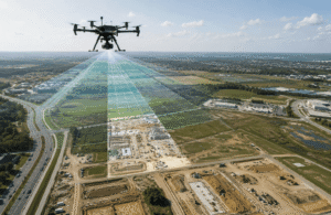
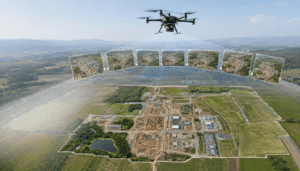
The drone captures overlapping photographs while following a planned flight path. Those images can then be processed to create a detailed representation of the mapped area.
Depending on the project and processing method, the resulting data can be used to create different elevation products.
The overall workflow can include:
- Planning the drone flight
- Capturing overlapping images
- Processing the images
- Building a detailed 3D representation
- Generating elevation information
- Producing the required map or model
If you want a beginner-friendly explanation of this process, read What Is Drone Photogrammetry?.
The exact result depends on the equipment, flight conditions, image quality, processing method, terrain, and project requirements.
Can a Drone Create Both a DSM and DTM?
Yes, a drone mapping project can produce both.
However, creating a useful DTM can be more challenging when vegetation, buildings, or other objects hide the ground.
A DSM can represent the visible surface relatively directly.
A DTM requires the above-ground features to be identified and removed or otherwise handled so the underlying terrain can be represented.
This is one reason the project goal should be clear before the flight is planned.
If the project needs ground information, the team should plan the mapping process accordingly rather than simply collecting images and deciding what to do with them afterward.
What Is a DSM Used For?
A DSM is useful when the height of surface features matters.
Construction
Construction teams can use surface information to understand site conditions and monitor changes over time.
Vegetation
A DSM can help represent the height and distribution of vegetation.
Buildings and Roofs
Because buildings are part of the visible surface, DSM data can be useful for understanding building height and roof-related features.
Stockpiles
Surface elevation can help calculate the volume of materials such as soil, gravel, or other stockpiled materials.
Solar Planning
Surface height and nearby structures can help when evaluating a site for solar-related planning.
For a broader understanding of drone mapping applications, you can also read What Is Drone Mapping?.
What Is a DTM Used For?
A DTM is more useful when the ground itself is the main concern.
Drainage
Understanding high and low areas can help with drainage planning.
Grading
A ground-focused elevation model can help teams understand how a site slopes and where material may need to be moved.
Road Planning
Terrain information can support early planning for roads and access routes.
Earthwork
Ground elevation data can help estimate changes to a site and support earthwork planning.
Terrain Analysis
DTMs are useful when the goal is to study slopes, terrain shape, and changes in ground elevation.
DEM vs DSM vs DTM for Different Industries
Different industries may need different types of elevation information.
| Industry | Commonly useful model | Why |
|---|---|---|
| Construction | DSM + DTM | Surface and ground information |
| Agriculture | DSM + DTM | Vegetation and terrain |
| Forestry | DSM + DTM | Canopy and ground |
| Road planning | DTM | Terrain and ground elevation |
| Drainage | DTM | Slopes and low areas |
| Solar planning | DSM | Surface and surrounding structures |
| Stockpile measurement | DSM | Surface height and volume |
| General elevation analysis | DEM | Depends on how DEM is defined |
These are not strict rules. The right model depends on what the project needs to measure or understand.
How Accurate Are DEM, DSM and DTM Products?
There is no single accuracy number that applies to every DEM, DSM, or DTM.
Accuracy can vary depending on factors such as:
- drone and camera
- flight height
- image quality
- ground conditions
- terrain
- vegetation
- weather
- processing
- control points
- project design
This is important because a highly detailed model is not automatically a highly accurate model.
For example, a map may contain a large amount of visual detail but still have elevation errors if the project was poorly planned or controlled.
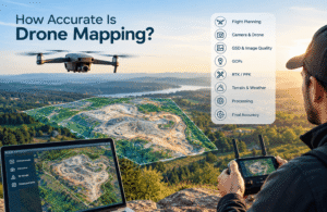
If accuracy is important to your project, see How Accurate Is Drone Mapping?.
Ground Control Points can also play an important role in improving the positioning of mapping data. Learn more in What Are Ground Control Points (GCPs) in Drone Mapping?.
Does GSD Affect DEM, DSM and DTM?
Yes, the level of ground detail captured by the drone can affect the resulting elevation products.
GSD, or Ground Sampling Distance, describes the approximate ground size represented by each image pixel.
A smaller GSD generally means more ground detail is captured in the imagery.
But GSD should not be treated as the same thing as final elevation accuracy.
Other factors still matter, including:
- camera quality
- flight planning
- terrain
- image overlap
- processing
- control points
- site conditions
For a deeper explanation, see What Is GSD in Drone Mapping?.
Common Beginner Mistakes
When people first work with elevation models, a few mistakes appear frequently.
1. Assuming DEM Always Means DTM
This is probably the biggest source of confusion.
DEM can be used differently depending on the source.
2. Treating DSM and DTM as the Same
They answer different questions.
A DSM represents the surface, while a DTM focuses on the ground.
3. Choosing a Model Without Knowing the Project Goal
Before selecting a model, ask what you actually need to measure.
If you need building and tree heights, a DSM may be useful.
If you need ground slope or drainage information, a DTM may be more appropriate.
4. Assuming More Detail Means More Accuracy
A detailed-looking model is not automatically accurate.
Accuracy depends on the complete mapping process.
5. Ignoring Data Documentation
Always check what a provider means by DEM, DSM, or DTM before using the data for important decisions.
DEM vs DSM vs DTM:
If you are unsure which model you need, start with the question your project is trying to answer.
Need the visible surface?
Choose a DSM.
Useful for:
- buildings
- trees
- roofs
- surface features
- stockpiles
Need the bare ground?
Choose a DTM.
Useful for:
- terrain
- slopes
- drainage
- grading
- earthwork
Received a file called DEM?
Check the provider’s definition first.
Do not automatically assume that the DEM is a DSM or DTM.
Need both surface and ground information?
A project may benefit from both DSM and DTM.
For example, a construction project may need the DSM to understand existing structures and surface features while using the DTM to study the underlying terrain.
Practical Example: A Construction Site
Imagine a construction company asks New Jersey Drones to map a large development site.
The project team may want to know:
- Where is the highest ground?
- Where are the low areas?
- How steep is the site?
- How much material is in a stockpile?
- What structures are already present?
- How has the site changed since the previous survey?
A single elevation product may not answer every question.
A DSM can help represent the visible surface, including structures and stockpiles.
A DTM can provide a better view of the underlying terrain.
This is why the best approach is usually to start with the project question, not the model name.
How Does an Orthomosaic Fit Into This?
An orthomosaic and an elevation model are related, but they are not the same product.
An orthomosaic is a corrected aerial image that can be used as a detailed map of the area.
Elevation models add height information.
So, a drone mapping project may produce both:
- an orthomosaic for visual and location-based analysis
- a DSM for surface elevation
- a DTM for ground terrain
If you want to understand orthomosaics separately, read What Is an Orthomosaic Map? A Beginner’s Guide.
Expert Note
The most important thing to remember is that DEM, DSM, and DTM are labels for elevation-related data, but the labels alone do not always tell the whole story.
This is especially true for DEM.
Before using an elevation dataset, confirm:
- what surface it represents
- whether buildings and trees are included
- how it was created
- what level of accuracy is reported
- what coordinate system is being used
- whether it meets the needs of your project
For professional mapping work, understanding the data is more important than simply knowing the abbreviations.
Key Takeaway
The difference between DEM, DSM, and DTM becomes much easier once you focus on the surface being represented.
DSM shows the surface.
DTM focuses on the ground.
DEM is a broader elevation term whose meaning can vary by source.
If you are planning a drone mapping project, do not choose an elevation model simply because its name sounds appropriate. Start by deciding what you need to measure, then select the data that answers that specific question.
For a complete introduction to the subject, visit the Drone Mapping Guide.
FAQs
What is the difference between DEM, DSM, and DTM?
DSM represents the visible surface, including objects such as buildings and trees. DTM focuses on the bare ground and terrain. DEM is a broader term for elevation data and can mean different things depending on the source.
Is a DEM the same as a DTM?
Not always. Some providers use DEM as a general term for elevation data, while others may use it for terrain or ground elevation. Always check the provider’s definition.
Is a DSM the same as a DEM?
Not necessarily. A DSM is specifically a surface model, while DEM can be used more broadly.
What is a DSM used for?
DSM data is useful for studying surface features such as buildings, trees, roofs, vegetation, and stockpiles.
What is a DTM used for?
DTMs are commonly used when the shape and elevation of the ground are important, including drainage, grading, terrain analysis, and earthwork planning.
Can drones create DSM and DTM data?
Yes. Drone mapping can produce elevation data that is used to create DSMs and, when the ground can be properly identified, DTMs.
Does GSD affect elevation models?
GSD affects the amount of ground detail captured in the imagery, but it is not the same thing as final elevation accuracy. Other parts of the mapping process also affect the result.
Which is better, DSM or DTM?
Neither is automatically better. A DSM is better when surface features matter, while a DTM is more appropriate when the underlying ground and terrain are the main concern.
What should I check before using a DEM?
Check exactly what the provider means by DEM, what features are included, how the data was created, and what accuracy information is provided.
Conclusion
DEM, DSM, and DTM can seem confusing because the terms are often used interchangeably in everyday mapping discussions.
But the basic idea is straightforward:
DSM = what is on the surface.
DTM = what the ground looks like.
DEM = a general elevation-model term that needs context.
Once you understand this distinction, it becomes much easier to choose the right elevation data for construction, agriculture, land development, drainage, forestry, and other drone mapping projects.
And when working with data from a mapping provider, always look beyond the file name. The definition, processing method, and project requirements matter just as much as the label.